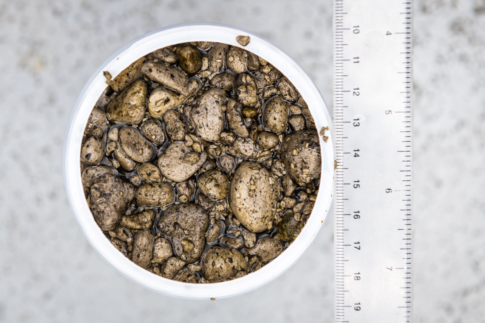
Pumice: derived from the Latin word pumex meaning “foam.” In French it is known as “the foam of the sea.” During a volcanic eruption, molten lava – which has a high water and gas content – is suddenly depressurised and cooled rapidly. The dissolved gases are exsolved when depressurized and then frozen in the lava that becomes igneous rock when cooled. Thus, pumice is a rock full of gas bubbles, causing it to float.
10 Million Cubic Meters of Pumice
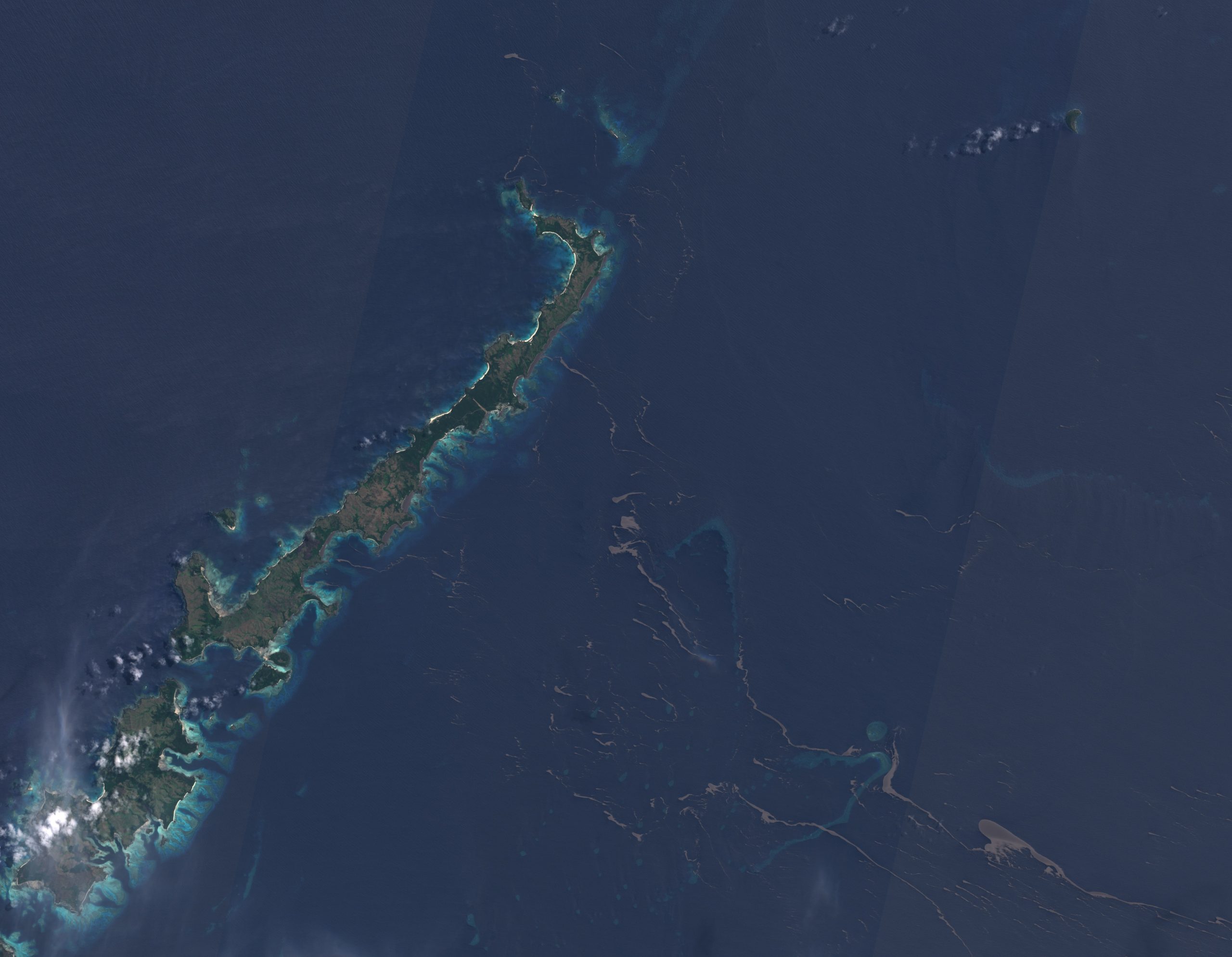
The question is: why are we suddenly talking about pumice and how does this relate to #AirToSea? Well, earlier this year (August 2019), there was an underwater volcanic eruption near Tonga. This event created over 10 million cubic meters of pumice, which formed a giant raft in the south pacific. Measuring some 150 km sq, larger than Manhattan, it was an incredible feature which was visible from space.
Very quickly, however, it broke up due to wind and wave action and began drifting westward. This eruption, and the feature it created, was very much in the back of our scientists’ minds at the beginning of this cruise, and, just as Trichodesium, is the subject of the project’s key question – if you have something on the surface which might modify the heating and exchange of gases in the ocean, what wider impacts does this have? At what scales does this happen and how would you measure/quantify this? How can we be sure that what we are seeing in the satellite image is pumice or Trichodesmium? How different is this from a wispy cloud?
First Signs of the Lost Raft
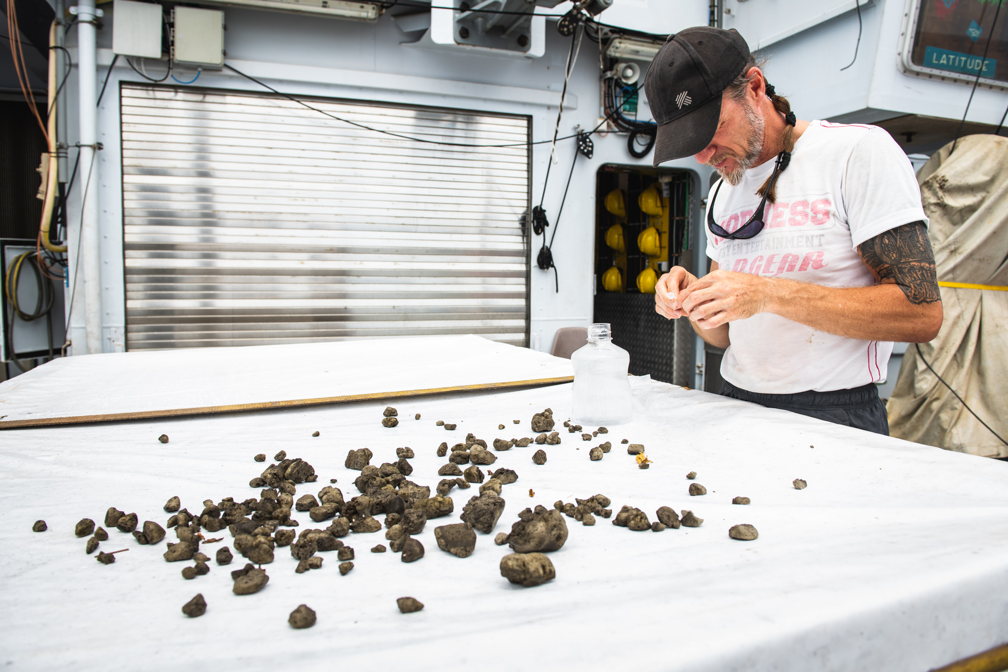
Within the last 48 hours, guided by the UAVs (Unmanned Aerial Vehicles), the team managed to track down what they believe to be the remnants of the pumice raft. Having broken up on reefs and islands, the hypothesis is that much of the pumice had accumulated on the beaches of the atolls in this part of the world, before being washed back out to sea by winds and currents pushing from the right direction. Spotted from the ‘flight deck’ on December 8th, the first few pieces of rock were seen floating past R/V Falkor. At the beginning of the cruise, nobody knew if this pumice was even still out there – now, the team are using all of the tools at their disposal to find more of this material, map it and study it.

In terms of this project’s objectives, this latest discovery marks a huge achievement. The aim was to come to this part of the world to search for features (Trichodesmium slicks and pumice), locate them precisely using the UAVs, use the real-time data to guide the sampling equipment, and then measure, monitor and map in incredibly high resolution. With two weeks still left, the #AirToSea team is already achieving some of these ambitious goals – using state-of-the-art technology to improve our understanding of the ocean and to map its surface in extraordinary detail, and pushing the boundaries of oceanographic research in the process.