Do you know the color of the ocean? Most would say ‘blue,’ and certainly from space that is generally the case. However, the ocean has a palate far more extensive than many would think. Its color varies hugely depending on where and how you look at it.
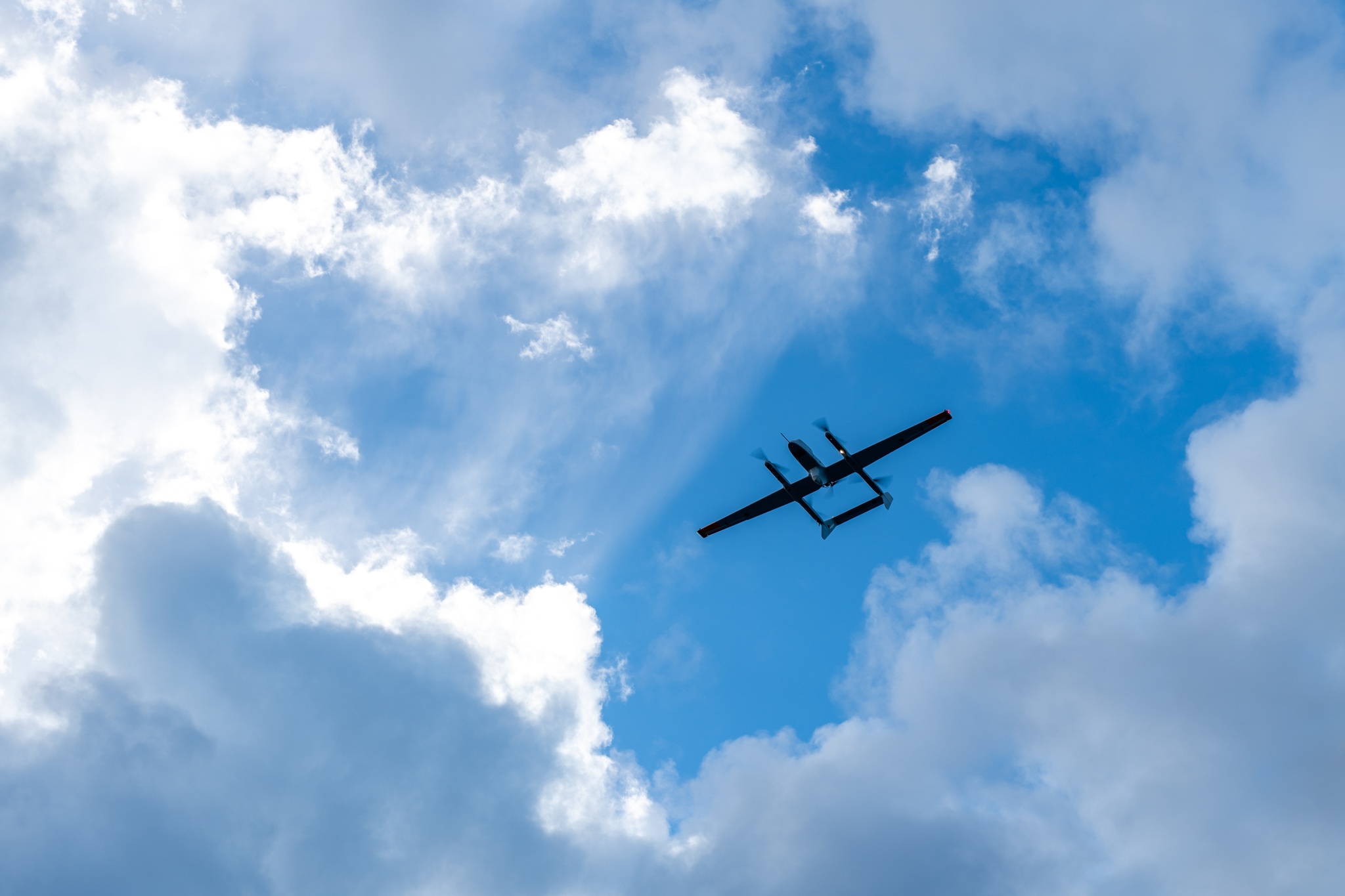
Asking the question of ocean surface color can reveal what is on the surface, and with this information, researchers can study how that particular surface interacts with the atmosphere. And so it makes sense that the oceanography department at Lamont-Doherty Earth Observatory (LDEO) is very interested in mapping ocean color, especially on the novel and cutting-edge platform of Unmanned Aerial Vehicles (UAVs)!
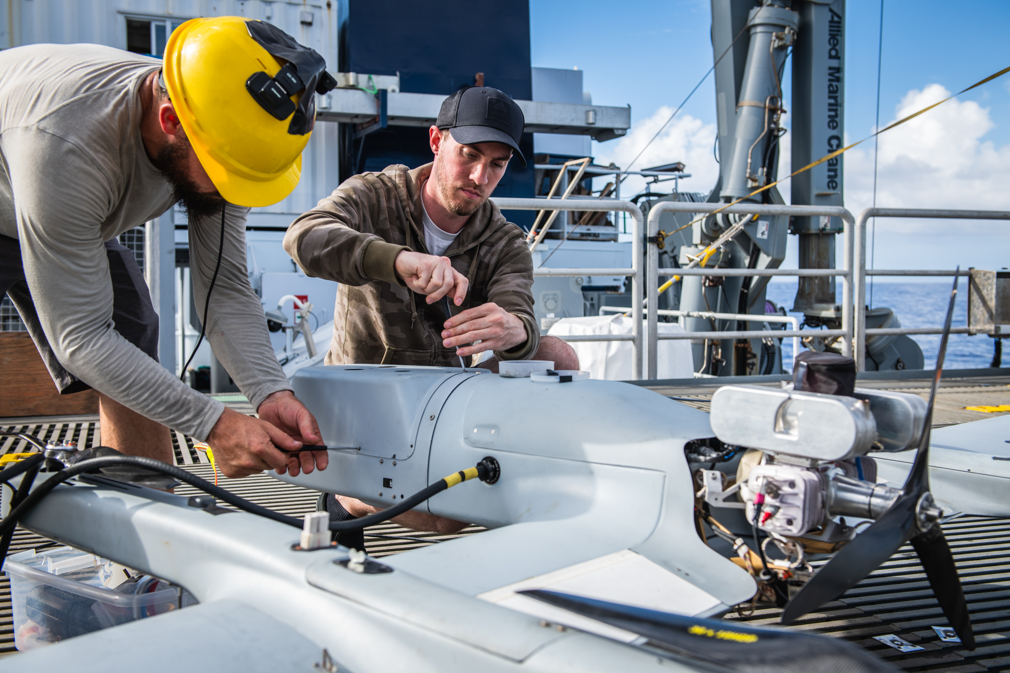
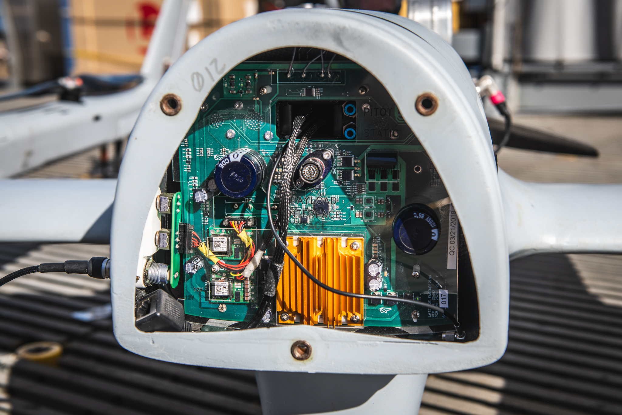
The LDEO science payloads, which fit into the nose cones of the UAVs, are broadly divided into two categories: remote sensing and in situ. In situ generally refers to non-light sensing instruments, like ones that measure air temperature, pressure, humidity, and wind. Remote sensing instruments, on the other hand, sample their data from a removed distance by taking advantage of modern light sensing technology, and so “remote sensing” really just means measuring the light from a distant location.
How We Measure Light
Modern humanity has harnessed the properties of light and its material interactions to give us everything from the telescope to the ground-breaking gravitational wave observatories LIGO and VIRGO. In the late 1600s, Isaac Newton was the first to separate composite light into its constituent parts, or colors with a material that came to be known as a prism. Many materials have prism abilities, the most familiar probably being when water droplets fall, forming a rainbow. The modern age has honed light-manipulating properties significantly since Newton’s time, and there is now a huge variety of light sensing tools that have come out of that research.
Light sensors generally operate by recording the volume of received light within a given amount of exposure time. You can think of the volume of light in a couple ways: One way is sound volume—more volume simply means more sound, and it is the same with light. Another way to think about light volume is in terms of a liquid volume, such as fluid ounces. Just like when you use a liquid-measuring cup, and the marks on the side tell you when you have filed ¼-cup, ½-cup, and so on, light sensors have “light-measuring cups” that tell you the light volume for a particular cup’s wavelength.
No matter how you think of it, I am using the term “light volume” to simply mean “how much light,” and since light behaves like a particle (known as the photon), it is perfectly physically reasonable to think of light as being measured in cups! You may heard that a commercial camera records RGB wavelengths—that is because cameras have red cups, blue cups, and green cups to measure the light volume at each of those three wavelengths.
A spectrometer is just another instrument with light cups, but it can have many hundreds of cup types instead of just three, allowing it to measure many hundreds of different wavelengths! And that is really all there is to it: cameras and spectrometers measure light in the exact same way, but primarily differ in the number of different light cups.
Using Physics for Ocean Research
Many of us know the concept of “conservation of energy,” the law that basically says that the total going in is the same as the total coming out. In fact, science has shown that the only possible difference that can exist between the in and the out is the form of the energy. You already know Einstein’s most famous equation E = mc2, and it is a prime example of energy conservation! It says that matter can be converted to light (and vice versa), so that the particular amount of matter you convert (call it 5 grams) always gives you the same number of photons (5 grams * c2). Light and matter are just two sides of the same coin, and that coin is energy!
Energy conservation is fundamentally how physical oceanographers study the ocean. They measure all forms of energy in the air, all forms of energy in the water, and how those energies give or take from each other in an attempt to determine where the overall net flow of energy. If you measure everything going in and everything coming out, then by energy conservation, you can know the net energy flow.
This net energy exchange at the air-sea boundary is what we use to make weather, climate, and ocean forecasting models ever-more accurate. These models are paramount to continued tracking and planning for the short-term (weather) and the long-term (climate). Note that climate and weather are completely distinct from one other. Weather operates on scales of days, whereas climate operates on scales of centuries or millennia. Understanding both is very important, so that we can avoid catastrophes like runaway greenhouse effect (as on the surface of Venus) or even the lack of any greenhouse gases at all (global ice age).