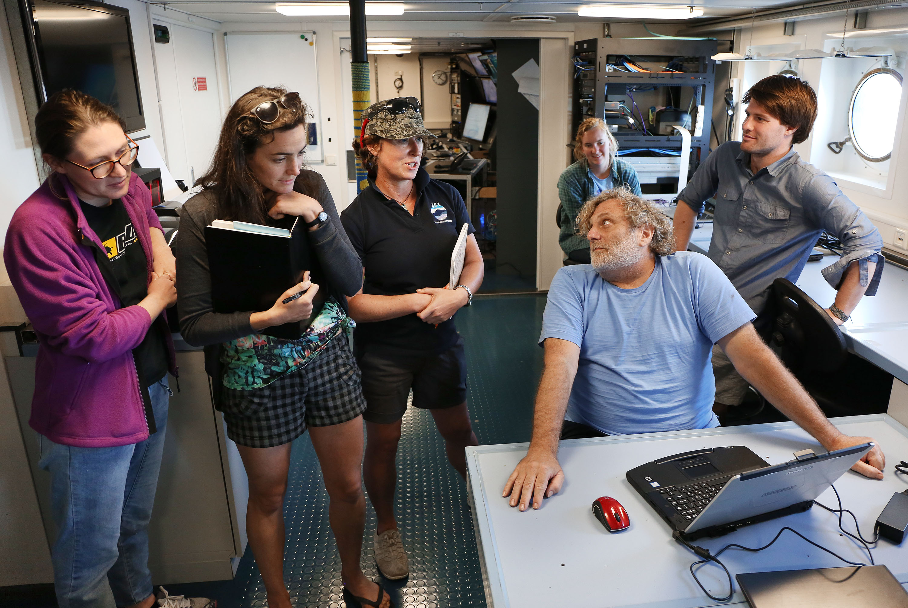
The acronym STEM is commonly used in education, standing for programs that feature Science, Technology, Engineering, and Mathematics. All of these studies are often grouped together: as an engineer, sometimes I apply the science and maths to get technology, while other times I use the science, maths, and technology to design or calculate something new. I use all these together, but it is a rare day when I am in a room with scientist, mathematician, and tech colleagues working towards a mutual objective. Today I am sitting on the R/V Falkor with scientists from various fields, working with techs and engineers to create detailed maps of the seafloor: we all have the same goal.
I am a Student Opportunities Participant, working on a PhD in civil and environmental engineering at UC Davis. Beside me is my fellow Student Opportunities Participant Mardi McNeil, a PhD student in marine geoscience from Queensland University of Technology. One of the key reasons we are both here is because we want to improve our seafloor mapping skills. In both our fields, we want to be able to use sonar to classify the sea floor.
Sound Under the Waves
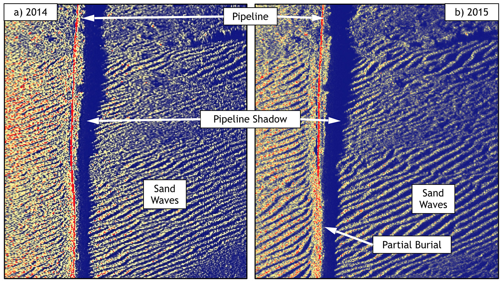
To create a map of the seafloor we use sound. We send sound at a known velocity towards the seafloor, and it bounces off whatever it touches first – usually the bottom. knowing the time the sound takes to return to our transducer, we can calculate what the distance is between us and the object it reflected from. If we send enough points of sound towards the seafloor, we can work out its shape: we call this bathymetry.
In addition to revealing the shape of the seafloor, our sonars can also give us a good idea of what it is made of: we call this classification. Different objects absorb sound at different rates. For example, a concrete room will have much more echo than a carpeted and draped movie theatre. This means that different amounts of sound will be returned to the transducer from the original signal. We call this backscatter. We can match the backscatter to known mediums to identify them. Alternately, we know harder surfaces return more backscatter – this can help us tell the difference between bottom types such as hard rocks as opposed to sand.
Building Information
As an engineer dealing with seabed structures I am interested in how the environment around my structure will change – this will affect its longevity. I need to understand the physical processes to know what to design for. To understand the physical processes, I want information about the seafloor and how it changes over time, i.e. I want these maps. Also, before I can design a structure I need to know what the seabed is made of and what shape it is. More information leads to better, safer design which is more resilient to the dynamic environment these structures are situated in.
Scientists like Mardi are also interested in what the seabed is made of and its shape. Seafloor mapping allows us to assess the complexity and scale of natural seabed structures, such as reef-like algal bioherms, which provide habitat for marine life. Understanding the location and scale of this important marine habitat will help us to better manage and conserve the ocean as a whole.
Science and engineering often use the same data. It is exciting to be spending time with scientists who are also interested in seabed structures even if their focus-areas are natural while mine are made by humans. For the best ongoing management of both natural and human structures, we can work together to collect the best data possible with ever improving technology.