Coral reefs are like libraries for geologists. All that colourful living biota is just a thin veneer on the surface – most of the reef lies beneath this exterior living layer. Reef geologists collect samples of dead coral skeletal material and use these to “read” the story of environmental and oceanic conditions in the geological past.
As a Student Opportunities Participant with Schmidt Ocean Institute, I have joined this expedition from Queensland University of Technology in Brisbane, Australia. I am a PhD candidate in Marine Geoscience, working on the geology and geomorphology of Halimeda algal reef-like bioherms in the Great Barrier Reef. Like Dr. Ken Rubin’s science team from University of Hawaii, my research group is also working on the timing and evolution of reef growth through past ice ages to today, in relation to environmental and sea level change. Sea-level change over geological time-scales is complex and regionally variable, so it is important that research groups from different parts of the world work on unravelling sea level secrets, then collaborate and share their findings.
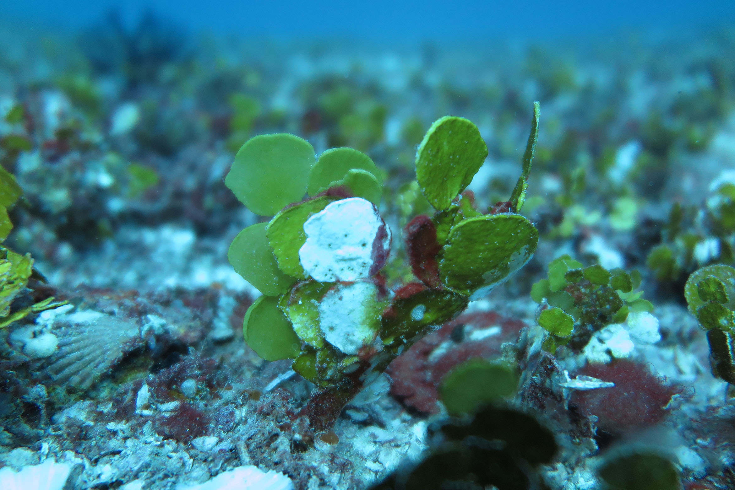
For my PhD project back in Australia, I am utilising some of the same tools and techniques which Dr. Rubin’s team are using on this expedition. Halimeda is a calcareous green alga common in tropical and sub-tropical reef environments. It grows attached to the sea floor and is a major carbonate sediment producer because of its calcified skeleton. In fact, in the northern Great Barrier Reef, Halimeda algae has constructed kilometre-scale 20m thick sequences of reef-like mounds, or “bioherms,” since the end of the last ice age when sea level rose and flooded the Australian continental shelf, which is now the Great Barrier Reef.
A Targeted Approach
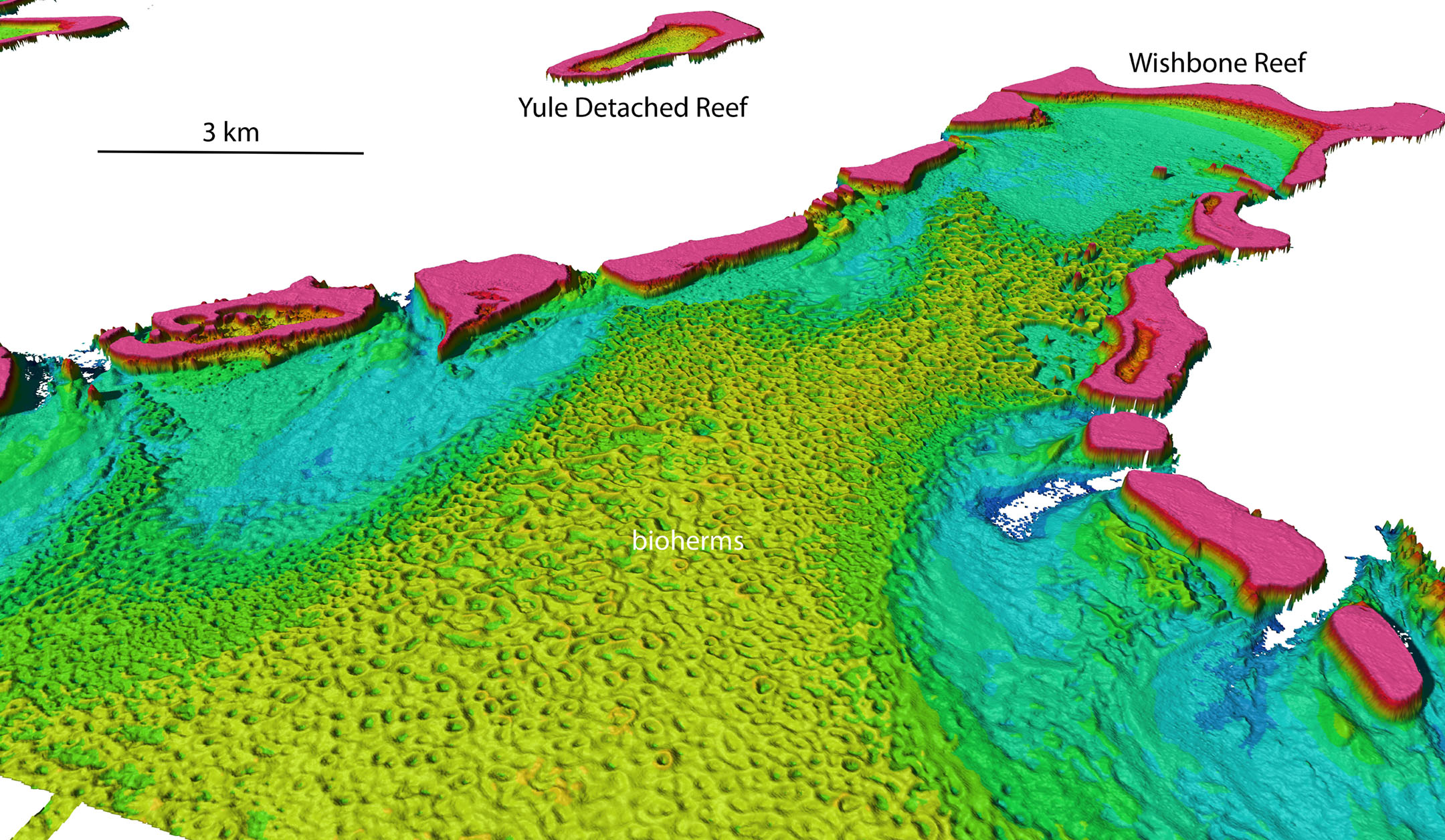
The first phase of my project involved mapping the spatial distribution and morphology (shapes and patterns) of these Halimeda bioherms, using multi-beam echosounder seafloor bathymetry. This is the same technique that Dr. Rubin’s team are using on the R/V Falkor to map the Hawaiian drowned coral reefs. Without these 3D images of the seafloor we would have no idea of the true complexity of these features and how they have evolved over time.
The next phase of my project will involve using an AUV (autonomous underwater vehicle) and a small ROV (remotely operated vehicle) to provide higher resolution 3D stereoscopic video imagery across the Halimeda bioherms. Although my equipment is much smaller – and much less expensive – than AUV REMUS and ROV SuBastian being used on this cruise, the concept and goals are the same. Capturing very high resolution bathymetry and video imagery of the seafloor will allow me to make better decisions about where to focus efforts on future surveys, and where to take samples for later laboratory analysis.

Tech and Teamwork
These new technologies are exciting because they provide us with the tools to explore the undersea environment in ways not previously possible. We can collect more data more efficiently than ever before, which allows us to test hypotheses and answer complex scientific questions. On this expedition I am surrounded by a talented team of marine geologists, oceanographers, engineers, and marine technicians who are all experts in their respective fields. In my own project so far I have worked with data which has already been cleaned and processed, so this expedition will provide me with more experience and skills in the necessary workflow to go from raw data to final output, which can then be analysed and worked on in GIS (geographic information system) software.