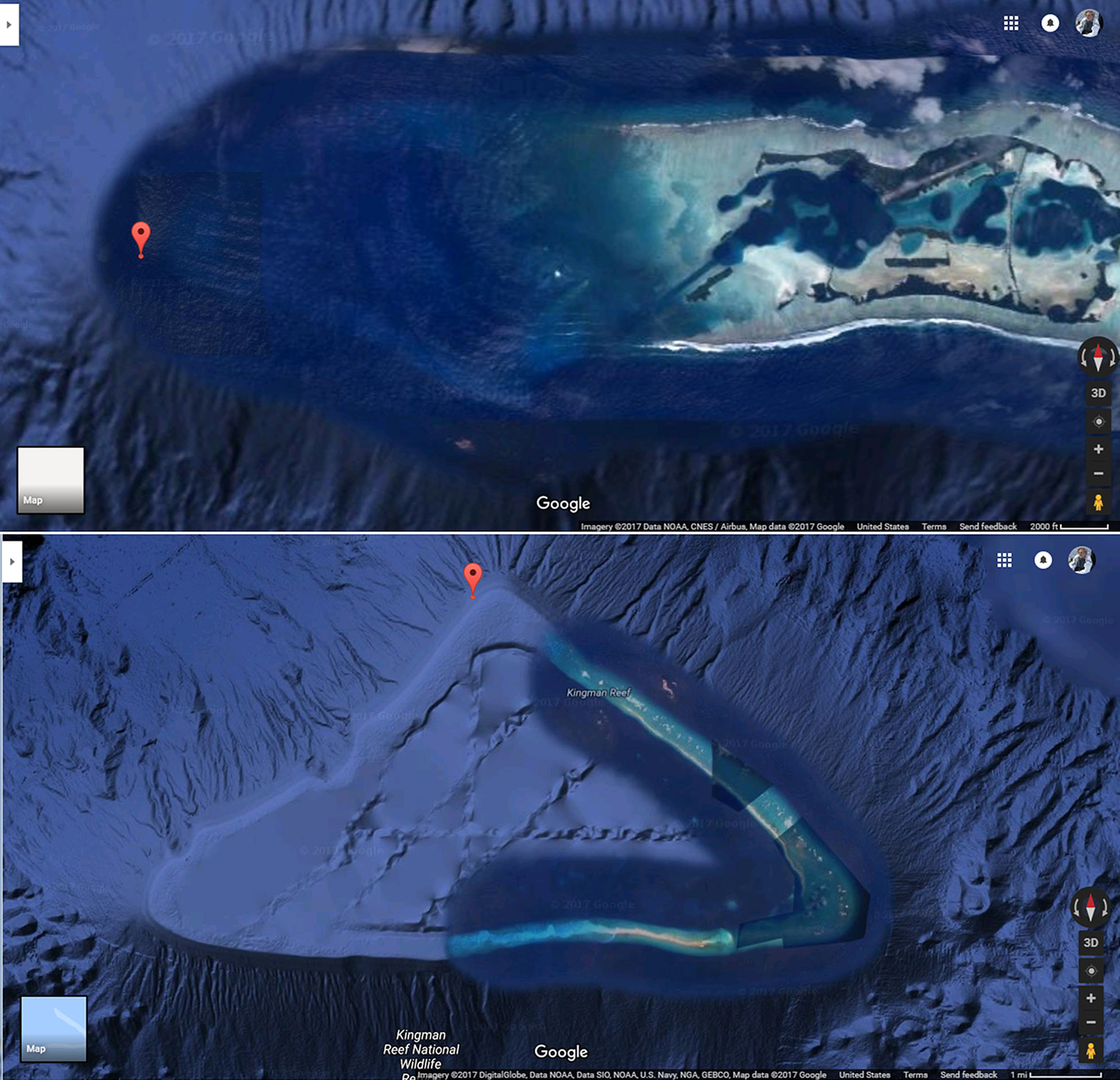
Research Vessel Falkor is on a mission, steaming full ahead for a tiny spec of land in the central Pacific Ocean called Palmyra Island. We do not know what we will find in the shallow seas there, but we have got to go. It is not just another point on the map – it is a place with huge potential to help us solve a puzzle about how sea level rose after the last ice age and where (geographically) the ice melt that drove the sea level rise originated. Palmyra (and its sister land mass called Kingman Reef) were not picked at random. Rather, they are positioned roughly halfway between Hawaii and Tahiti, two places where previous work tells different stories about the timing and amount of sea level change over the past 20,000 years. Palmyra may hold the key to understanding this difference, and how that impacts our forecasts of future sea level change. So we are on our way.

Off to Explore
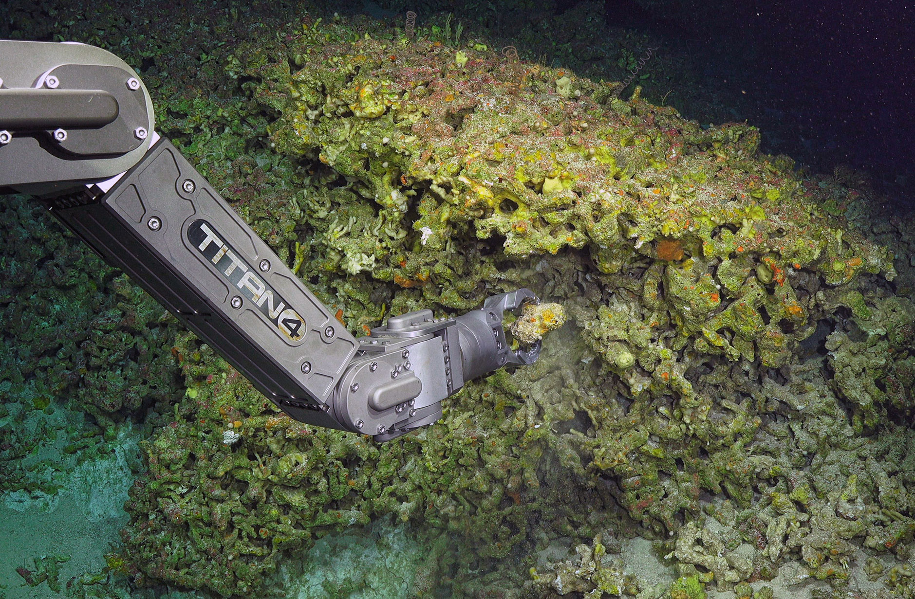
ROV SuBastian has been happily diving in Hawaii for much of the past week. It was not easy to make the choice to leave there, since sea conditions are perfect right now, operations are relatively easy, and I know what I will find diving in there. After all, my research group has been working at Penguin Bank in Hawaii for a decade. During that time we have discovered a fantastic site with a huge, intact, Ice Age coral reef, now drowned beneath 100+ meters of sea water. We know even more about Penguin Bank now, having completed Leg 1 of the “Sea Level Secrets” expedition. During that part of this Schmidt Ocean Institute cruise, we made very detailed autonomous underwater vehicle (AUV) maps of nearly 50 km2 of seabed, plus another 100 km2 that we mapped with the Falkor’s excellent hull-mounted sonar system. These data provide excellent context for the 12 prior submersible dives I have conducted here since 2006 (10 with the manned submersible Pisces IV and V), and two with the in-development ROV Lu’ukai, all operated by SOEST’s Hawaii Undersea Research Lab at the University of Hawaii). This prior work was the main basis of the proposal to Schmidt Ocean Institute to conduct the Sea Level Secrets research.
As Leg 2 of our “Sea Level Secrets” got underway, the team returned to Penguin Bank with SuBastian for a shakedown and familiarization dive, a dive to test a new photo mosaic system for the ROV, as well as detailed mapping and sampling at Master Frodo’s Mound (a particularly good spot we named on the ancient coral reef). The work has been excellent. The site is comfortable for me, and I knew we could stay and do some really “next-level stuff” by dive-mapping a lot more of the bank in detail, helping to characterize a world-class deglacial reef site.
Taking the Chance
But instead, we decided to head off into the unknown – to visit a site 1000 miles away that we have never seen before – in order to look for similar drowned coral reefs that we are not sure actually exist. Many marine scientists are explorers at heart, and this is the best sort of exploration: one motivated by a compelling reason to go! Importantly, Schmidt Ocean Institute supports this exploration. They believe enough in the scientific rationale to fund a voyage of discovery. Let’s face it: it is unlikely that the Palmyra field research would be supported by the US National Science Foundation: The project is not “safe” enough for them. Schmidt Ocean Institute also supported the intense planning effort for this visit, which included a lengthy permitting process to visit a nature reserve in a US National Monument and a plan for special operations and minimal impact sampling (thanks to Allison, Stefan, Eric and others for their help with that!). The final stages of our planning involved lengthy discussions with the Falkor’s captain and ROV manager about safely operating the ship and ROV so close to small, low-lying islands, and constant watching of the weather to find a safe window for the trip (many Pacific cyclones track through the area).
Now, all the scientific and logistical planning is behind us. The ship is making way to Palmyra. There is energy on the ship as the science party and crew alike anticipate this visit. They have seen the photos on Goggle Images and read the entry on Wikipedia, which make this small speck of land in the middle of the ocean all the more intriguing. We are now two days into a three and a half day transit, and preparation activities have slowed enough for me to write this blog post. I am hoping for a successful visit and that the captain lets me place the next pin on ship’s map of sites visited!