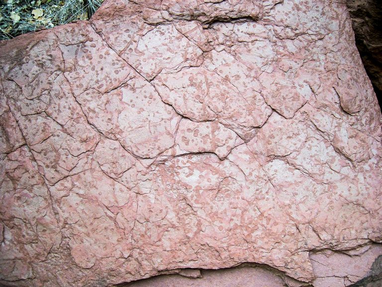
Although a Marine Geologist, Jonathan Tree was far from the ocean in 2005, exploring deserts near Canyonlands National Park in Utah. He was searching for geological clues and samples when he came across a dark red rock with an unusual texture of mud cracks. Upon a closer look, he realized the rock had preserved rain drops from a day nearly 300 million years ago. This graphic and poetic look at our planet’s distant past touched him so much that to this day, this is his favorite find.
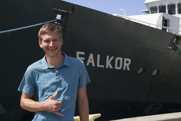
This passion and enthusiasm becomes evident every time Jonathan is invited to explain why the coming multibeam survey is interesting. Soon, Falkor will arrive to one of the most remote areas of Earth to conduct a four-day scan of a seafloor segment within the newly expanded area of the Johnston Atoll Unit in the Pacific Remote Islands Marine National Monument.
Multibeam mapping is the next best thing to actually walking a terrain and analyzing it with bare hands or direct observation with an ROV. Since walking on the seafloor at depth of 1000 meters is impossible at the moment, Jonathan will have to rely on the remarkable accuracy of Falkor’s sonar. To understand the difference in detail between imagery from a satellite in space and sonar from a ship, let’s use a metaphor: Imagine a chair covered by a blanket. The rough shape of the chair can be perceived, but until the blanket is removed, it is impossible to see the chair’s details, material, or markings. The satellite imagery that is available today is like the chair covered by the blanket: some features are there and Jonathan can make educated guesses. Falkor’s multibeam will remove the blanket and reveal the landscape in extreme detail.
For the first time in this part of the ocean, Jonathan will observe the seafloor’s features and rock types in great detail and use these revelations to begin threading stories in his geological mind – stories involving the formation of our own living planet.
Listen Carefully
Geology was not always Jonathan’s first focus. He began his career by studying Biology, but after a course on Historical Geology taught by Robert Fillmore of Western State Colorado University that introduced him to all of the creativity bottled inside the field of Geology, he decided to make it his primary interest.
Creativity might not be the first thing to come to mind when thinking about rocks, but Jonathan knows that the details revealed by bathymetric surveys such as volcanoes on top of other volcanoes, landslides, faults, or substrate can be arranged in chronological order, in effect writing history. As more details come in, clues are pieced together: “mapping the geology makes us analyze the data and put the story together,” he explains, “The anticipation of what the next line of bathymetry will show is like turning a page in a book, the story continues to unfold.” It really does take a creative and perceptive mind to listen to the rocks and to translate the information they have to tell.
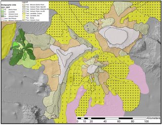
Stepping Stone
Two years ago when sailing on Falkor, Jonathan began deciphering the massive amount of data collected on that expedition to produce a new level of detail in the geological story and geological maps of the entire Hawaiian Ridge. This year, that project will come to fruition. The maps will show the different rock types of the ocean’s floor and where the boundaries between these materials lie, ultimately offering possible descriptions of how they were formed. Today, Jonathan is attempting to add a new piece of information to the tapestry of our planet’s geological history by mapping a section of the Johnston Atoll unit. For the very first time, this part of our planet’s seafloor will be described.
For him, the best possible outcome would be to find some features so compelling that they inspire further exploration. “If we can find something so interesting, something we never knew was there and someone then goes back to it to continue studying it, then we will have contributed to building on the science and knowledge,” he says. In a comparison befitting a Marine Geologist, Jonathan aspires to turn this research into a stepping stone for future marine scientists.