Search Results for
Log Post: Finish Line
The expedition ended with a marathon dive through a portion of the Olympic Coast National Marine Sanctuary and the successful completion of a long day’s hunt. The target was Tully Canyon, on the U.S. side of the borderline, and it’s considered an important pathway for lower oxygen water offshore to make its way inshore. As … Continued
Log Post: Early Departure
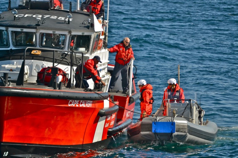
The most notable event today wasn’t a dive, but rather a hastily arranged rendezvous with the Coast Guard. Last Monday there was a terrible helicopter crash in the Arctic Circle. While returning to the Amundsen, a Canadian icebreaker and research ship, the helicopter went down, killing three people—the ship’s captain, the pilot, and a scientist. There … Continued
Log Post: Glimpse of the Future?
It was strange. All of a sudden, working across the canyon at 800 meters, a cloud of sediment had engulfed the ROPOS ROV. You couldn’t see much of anything. But the cloud didn’t seem to be flowing down the canyon, as you would expect if sediment on a slope had given way somewhere. Instead, the … Continued
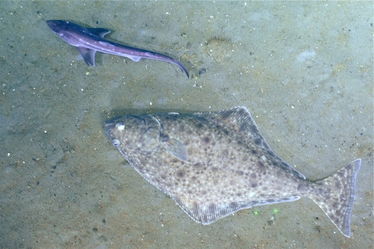
Log Post: Deep-sea Dining
It’s not fish we’re looking for, but tonight we found them anyway. As soon as we saw the bottom at about 300 meters, there were halibut, a sea skate, and a dogfish. Then, before long, we saw the first of 3 giant Pacific octopi, curled up on the side of a rock and apparently unbothered … Continued
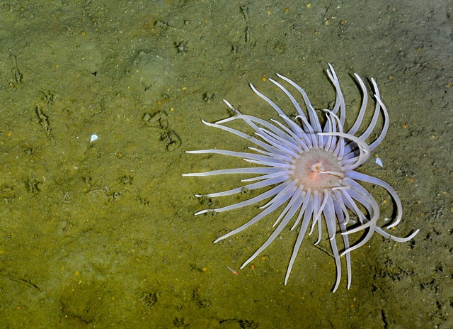
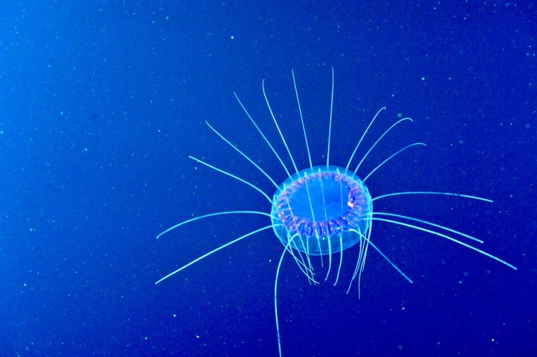
Log Post: Being There
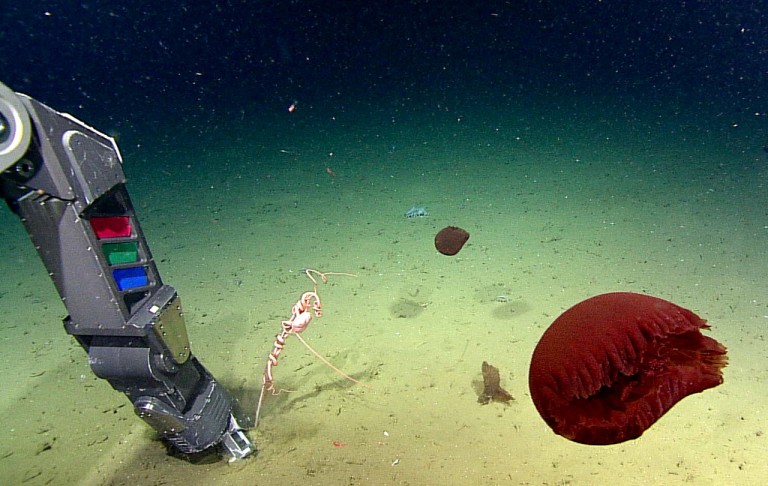
Today, on the expedition’s deepest dive at 2,000 meters, ROPOS ventured through an area quite different from others we’ve explored. Toward the end, the team collected a coveted sample of what may be a new species of sea anemone, and that would prove a stark reminder of why it’s important to see an animal in … Continued
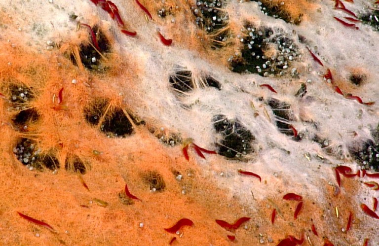
Log Post: Worms on Ice and Feeding Booths
Kim Juniper spotted something strange out of the corner of his eye on the ROV monitor yesterday—even though he was distracted at the time by a phone call. The chance discovery would prove one of the more interesting targets of today’s explorations, and may even have yielded a new species. But that was just one … Continued
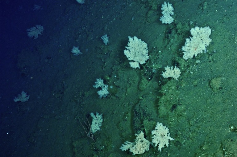
Log Post: Wallyland and the Coral Gardens
Today was a mix of mechanical achievements and pure exploration—in one case unplanned—that led to the discovery of two surprisingly large deep coral habitats. After the launch and long drive to the bottom, the day’s first task was to attach another oxygen sensor, this one at the NEPTUNE observatory’s only instrument package along the deepest … Continued
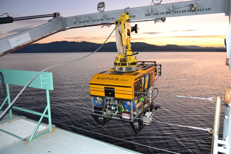
Log Post: Visiting NEPTUNE
“OK, let’s fly.” That was Keith Shepherd, general manager for the ROPOS ROV. It was time to quickly back the vehicle away from the large instrument package 1,250 meters below us. The pilot had just pulled a cord that released buoys intended to take the package up for recovery. Nothing happened for what seemed too … Continued