The first leg of the Papahānaumokuākea Marine National Monument mapping project ran from March 7th to April 11th. Please click on the Cruise Log and Map buttons to the upper left. To learn more about the research, please visit the project page.

Final Cruise Report
Download the Revealing Papahanaucoolmokuakea Cruise Report for expeditions FK140307 & FK140502.
Data Products Resulting from this Cruise
The resulting shipboard dataset is being stored at the Rolling Deck to Repository and is now available.
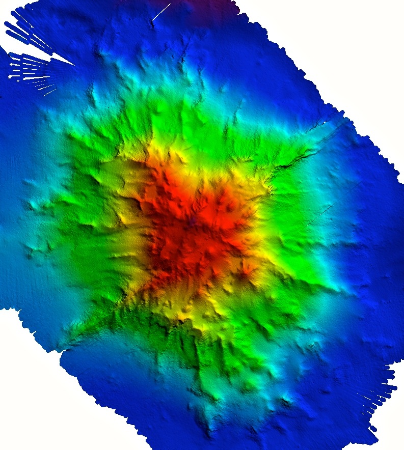
The resulting bathymetric dataset from the multibeam mapping the Papahanaumokuakea Marine National Monument in the Northwestern Hawaiian Islands using R/V Falkor’s Kongsberg EM302 and EM710 is being stored at the NOAA National Center for Environmental Information (NCEI). You can view all Falkor datasets by using the Filter Surveys button in the left sidebar.
Leg One Data: March 7 – April 11, 2014
Cruise data is also be available through the following organizations
• Google Earth
• National Geoscience Data Center (NGDC)
• NOAA Pacific Hydrographic Navigational Charts
• NOAA Pacific Islands Benthic Habitat Mapping Center
• Monterey Bay Aquarium Research Institute
• University of Hawaii School of Ocean and Earth Science and Technology (SOEST)
• Papahanaumokuakea National Marine Monument website
Publications, Meeting Presentations, and Research Seminars based on this Cruise
Kelly, Chris. 2014. 72 Days on the Falkor: New Maps and New Insights on the Seamounts and Banks in the Papahanaumokuakea Marine National Monument. Seminar Presentation for the Hawaii Institute of Marine Biology, University of Hawaii, 3 September 2014.
Shapiro, M. 2015. Rediscovering the Northwest Hawaiian Ridge. Invited presentation at the Hawaiian Volcano Observatory Kilauea Volcano. Volcano, HI.
Smith J.R., C. Kelley, B. Boston, B. Dechnik, S. Habel, L. Harrison, J. Leonard, F. Lichowski, D. Luers, J.E. Miller, R. Orange, M.A. Patterson, B. Shiro, J. Taylor, H. Togia, J.P. Tree, J. Tucker, D. Wagner, N. Wright, New R/V Falkor Multibeam Data from the Papahānaumokuākea Marine National Monument in the Northwestern Hawaiian Islands, abstract OS34A-06, 2014 AGU Fall Meeting.
Tree, J. P., Ito, G., Garcia, M. O., Wessel, P., Shiro, B., Boston, B., Togia, H., Kelley, C., Smith, J. R., Spatial distribution, density structure, and relationship of intrusive and extrusive volcanics of seamounts along the Northwest Hawaiian Ridge, 2014, Abstract ID DI43A-4359. Presented at 2014 Fall Meeting, AGU, San Francisco, Calif., Dec. 15-19.
Cruise Related Media
VOS2-16 Onboard the Falkor: Mapping the Northwest Hawaiian Islands Voice of the Sea TV November 1 & December 20, 2015