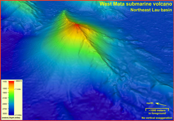
West Mata is a Restless Volcano. West Mata Seamount is one of only two submarine volcanoes in the world where an active eruption has been directly observed on the seafloor. An expedition in November 2008 discovered evidence that West Mata was actively erupting while exploring the water column in the area for hydrothermal plumes – but the expedition did not have an ROV to confirm it.
About 6 months later in May 2009, a follow-up “rapid response” expedition returned to the site with an ROV and recorded spectacular video of lava erupting from several vents near the summit of the seamount.
The next visit with an ROV was in 2012, and by that time the summit eruption had stopped, a pit crater had formed, and many hydrothermal vent animal species had begun to colonize the more stable landscape. However, that moment of calm would not last.
Evidence for Recent Eruptions
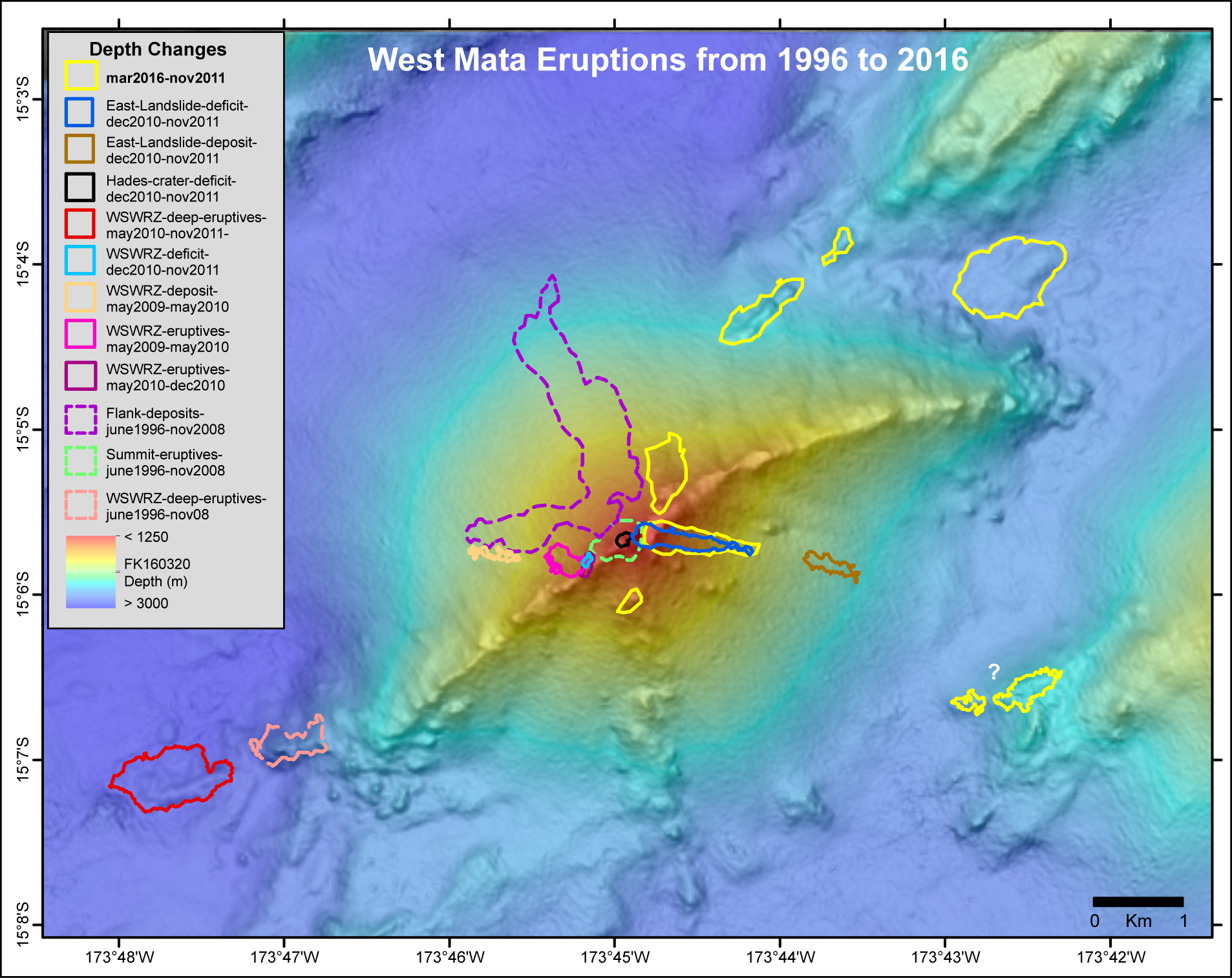
In most places in the ocean you just need to map the seafloor once, and then you can assume that it does not change. But at active volcanoes it is valuable to re-map the seafloor at every opportunity because comparing one survey to another can reveal depth changes due to eruptions or landslides. Volcanoes are dynamic landscapes.
Since 2008, West Mata has been re-surveyed 7 times and amazingly, there have been significant depth changes between most of those surveys caused by eruptions at the summit or on the flanking rift zones. This shows that despite West Mata not being active during the ROV dives in 2012, it has remained very active and has kept erupting intermittently over the last decade.
Before we set off for this year’s expedition, we had the opportunity to compare the most recent bathymetric survey, which was collected by R/V Falkor in February 2016 during the Virtual Vents cruise to the previous survey in 2011/2012. This comparison showed at least four new eruption sites in the 2012-2016 time interval, including two sites low on the NE flank and two near the summit, one of which is marked by a new volcanic cone that is 90 meters (nearly 300 feet) tall!
New Sites to Explore
None of these recent eruption sites have been visited on the seafloor and we hope to explore and sample as many of them as possible during this expedition. We will be using the ship’s CTD to see if any of them are hydrothermally active (new lava flows can take several years to cool) and we will be using AUV Sentry to collect high-resolution bathymetry of the eruption sites to use during ROV SuBastian dives during the next cruise leg.
The activity of submarine volcanoes is usually hidden from our view, so West Mata represents an extraordinary opportunity to learn about the interactions between the earth and the deep ocean that can have important impacts on ocean geochemistry and marine ecosystems. And with West Mata’s frequent activity, there is always a chance that we will be lucky enough to catch it in the act again.