The windshield wipers are working frantically as we drive towards the ship for the first time. A tropical storm is approaching Guam and this rain is the leading edge.
Upon reaching the port, the storm is upgraded to a typhoon and we’re told by the coast guard that we’ll have to depart a day earlier than expected to avoid the worst of it.
If we don’t leave soon, the chance of big waves smashing the ship into the pier are significant; a risk no one wants to take. Our time for loading and mobilization is cut short, but everyone is in port early for such eventualities. All hands are on deck to get ready.
We plan to head north from Guam to let the worst of the storm pass to the south of us, then loop back east and then southwest back to Guam by the end of the weekend. In the meantime, we will get acclimatized, run our safety drills and test out key equipment. On day minus one, we’re already seeing how adaptability is a key skill when conducting scientific research in the open ocean.
First Stop
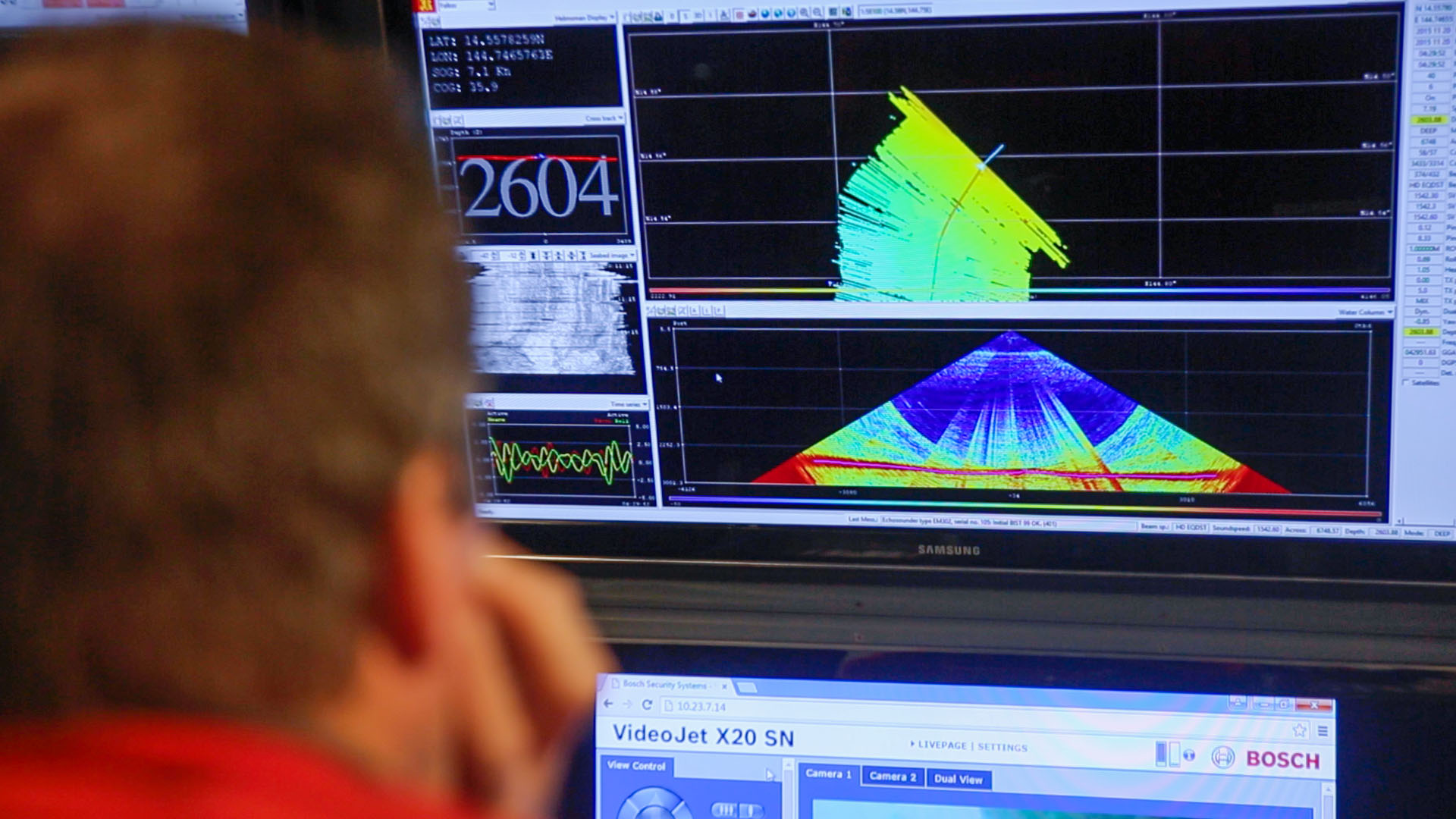
It gives us an unexpected opportunity to head to our first site, Northwest Rota, a submarine volcano 100 km north of Guam. Chief scientist Joe Resing and his team first visited the area in 2004 and discovered the volcano was erupting. It was erupting each year they visited until it stopped in 2010. This provides a good opportunity to test our multibeam sonar mapping system. We’ll compare this data with previous surveys from the area, to see if the structure of the seabed has changed. This would only happen if there had been further significant volcanic activity.
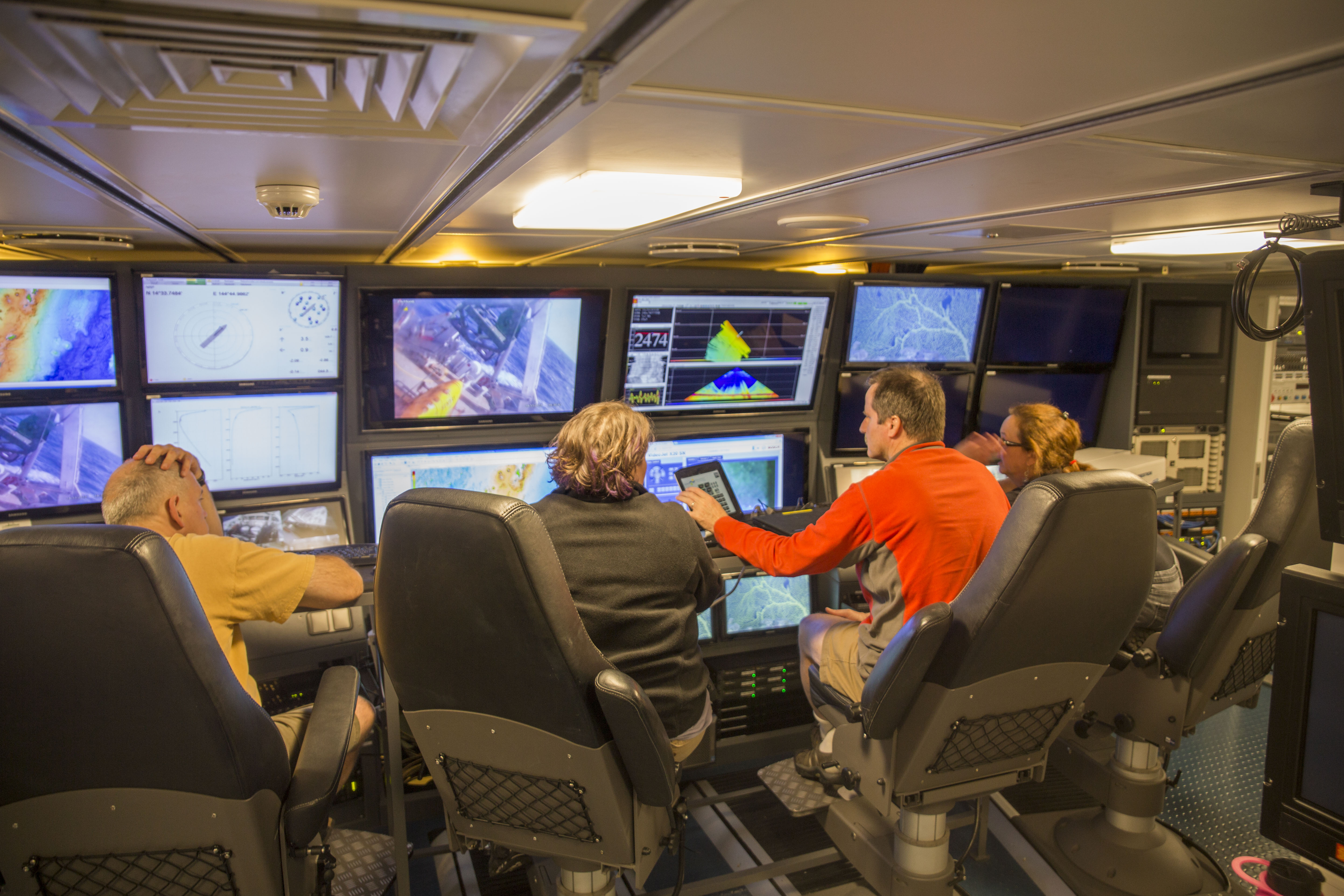
Many of us gather round the science control room as we pass the seamount, looking for bubbles on the display, a surefire indicator of volcanic activity. No bubbles this time though, it looks like the volcano is still at peace. The equipment and the monitors seem to be working well though. The science team looks at home in the pilot style seats. I’m reminded of the Star Trek crew in full flow, everyone concentrating on their role, in front of an ocean of futuristic data screens and live-feed cameras.
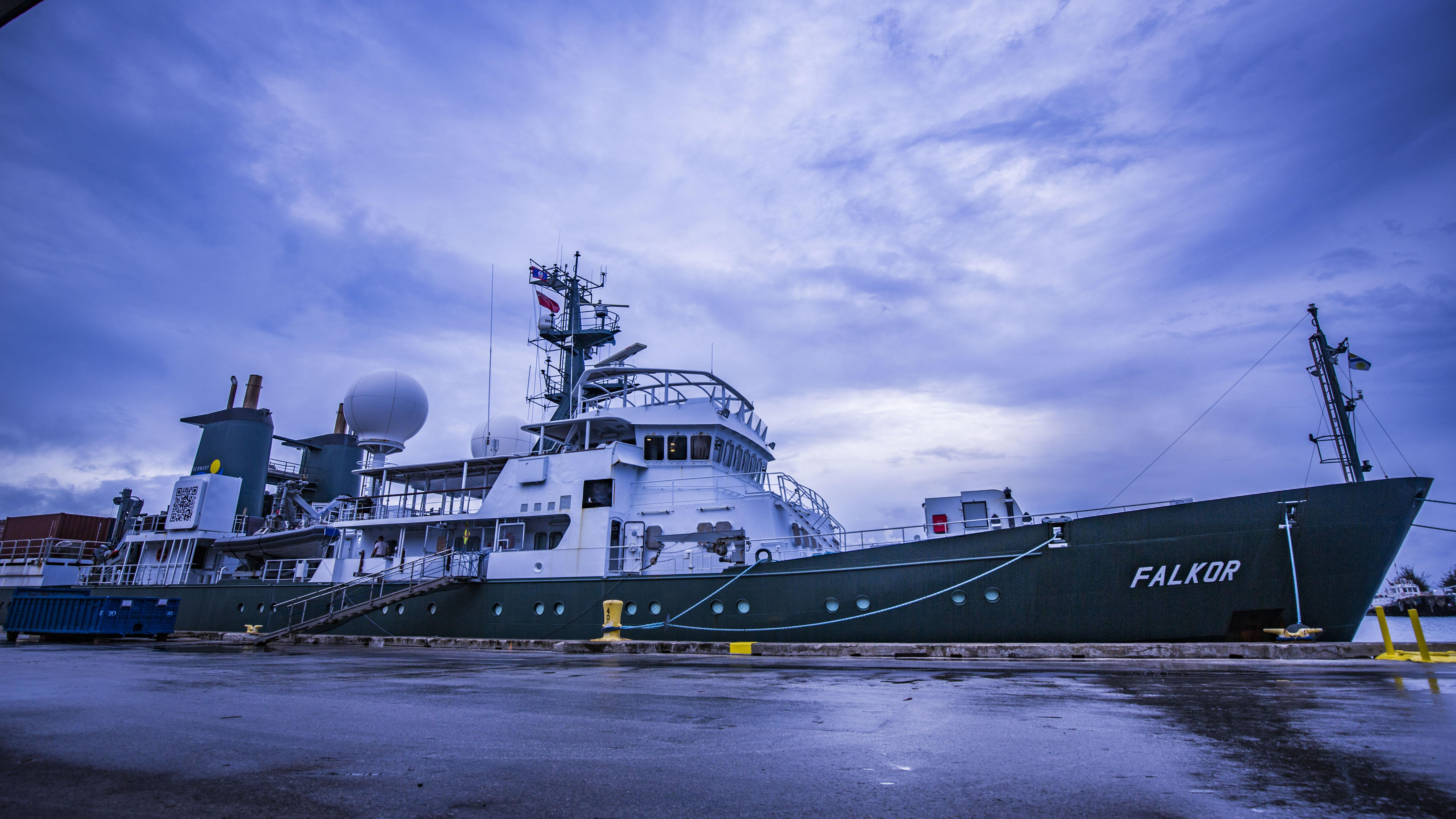
Preparing R/V Falkor for deployment under Guam’s stormy skies. Photo credit: SOI/Thom Hoffman
Physically Adapting
Another test of our ability to adapt comes in the winds and seas that have been kicked up by the typhoon. Some people take to sea life like ducks to water, others take a little longer to adjust. Seasickness happens when your brain fails to comprehend the difference in movement between objects around you and the rocking movement that you are experiencing. The body seems to react like you’ve been poisoned, your brain deciding it is time to be sick and get rid of any toxic agent that might be doing you harm. Thanks brain, very helpful…
Certainly the choppy waves on the outskirts of a typhoon are not the easiest conditions to start life on a ship. Cue debate as to whether pitching (where the ship rocks forward and back), or rolling (where she goes from side to side) is worse for seasickness. Everyone shares their theories and advice about which position in the boat to take, as well as which medicines, and what food and drink to consume (or not) to tackle the beast. Welcome to life onboard. The best cure for seasickness – like jetlag and heartbreak – seems to be time, and by morning everyone seems to be getting brighter.
Setting Course
Captain Heiko shows us an informative map visualization of the typhoon – represented by a big round, angry red circle – and the ship – a much smaller blue circle. I am happy watching the the vessel steer clear as the storm moves off to the west, comfortably south of our location.
Soon it will be time to head back to Guam, pick up the remaining equipment that we did not get a chance to load while in port, and start our mission to the back-arc. We can expect plenty more adaptation during the rest of the cruise, but the crew and scientists seem well practiced to face whatever comes next.