In a previous blog, we talked about the recent Hollywood blockbuster San Andreas, and went on to describe the events that would likely occur if a large tsunami-generating earthquake took place in the Mentawai gap. Unlike the movies, in reality we do not have a big action star to save the day.
We are on our own when it comes to disaster mitigation, so the best way to prepare is improving our understanding of underwater earthquakes and their relationship with tsunamis. Applying that knowledge to the development of early warning systems is part of the strategy.
Tsunami early warning system
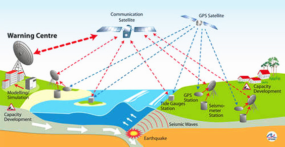
The 2004 Indian Ocean earthquake and tsunami took the world by surprise. In the aftermath, the international community came together to design an effective early warning system for this region: GITEWS (German Indonesian Tsunami Early Warning System) was born. Designed and installed during the course of several years, it was handed over to the Indonesian government to run and maintain from 2010 onwards.
How does it work? How can we know if a tsunami is approaching the coast? Over 300 sensors have been installed across Indonesia including seismometers, GPS stations, tide gauge stations and buoys. A warning center located in Jakarta runs non-stop, receiving data from all sensors. In the event of an earthquake, the early warning station receives multiple signals via satellite.
The data would then enable the staff at the station to determine:
– The location and strength of the quake,
– The rupture that caused the seismic vibrations and if there has been vertical movement in the sea floor, large enough to cause a tsunami,
– Tsunami detection through tide gauges and buoys with GPS signals that are able to detect changes in sea level.
The system is designed in such a way that the data can be received, processed and applied on a decision in under 5 minutes post-earthquake. The experts are then capable of choosing whether to issue a tsunami warning, and if so, which are the most critical places to warn.
R/V Falkor‘s contribution
Bathymetry has a huge effect on the propagation and height of tsunami waves. Computer programs are used to model flooding scenarios, and accurate bathymetry is key to producing reliable forecasts. The large amounts of high-resolution bathymetric data being collecting onboard of R/V Falkor will certainly improve the results of such inundation maps.
Knowledge, information and education
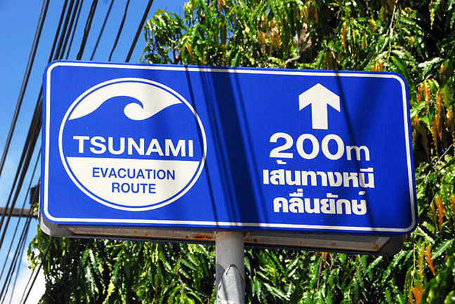
It has been calculated that in the event of a tsunami generating earthquake in the Mentawai gap, the first wave would reach the islands in 5-10 minutes and mainland Sumatra in 20-30 minutes. Even with an effective warning system in place, the window for reaction is very narrow. This is one of the reasons why education and outreach can be a vital component in tsunami defense.
As the MEGATERA expedition nears its completion, the experts onboard prepare to process the data and are confident that its application will add true value to the quality of life of coastal communities in Sumatra.