The sea surface microlayer is but a tiny slice of the ocean – only the top millimeter at most; however, this thin boundary serves as a mediator of air-sea gas exchange, controlling all transfers between the atmosphere and the ocean. It is the link between all processes that meet at the sea surface, and a huge part of marine biogeochemical cycles and air-sea interactions. Therefore, this tiny microlayer plays an influential role in regulating the entire planet’s climate. For something so small and easily overlooked, the surface microlayer is a key element in many important environmental actions.
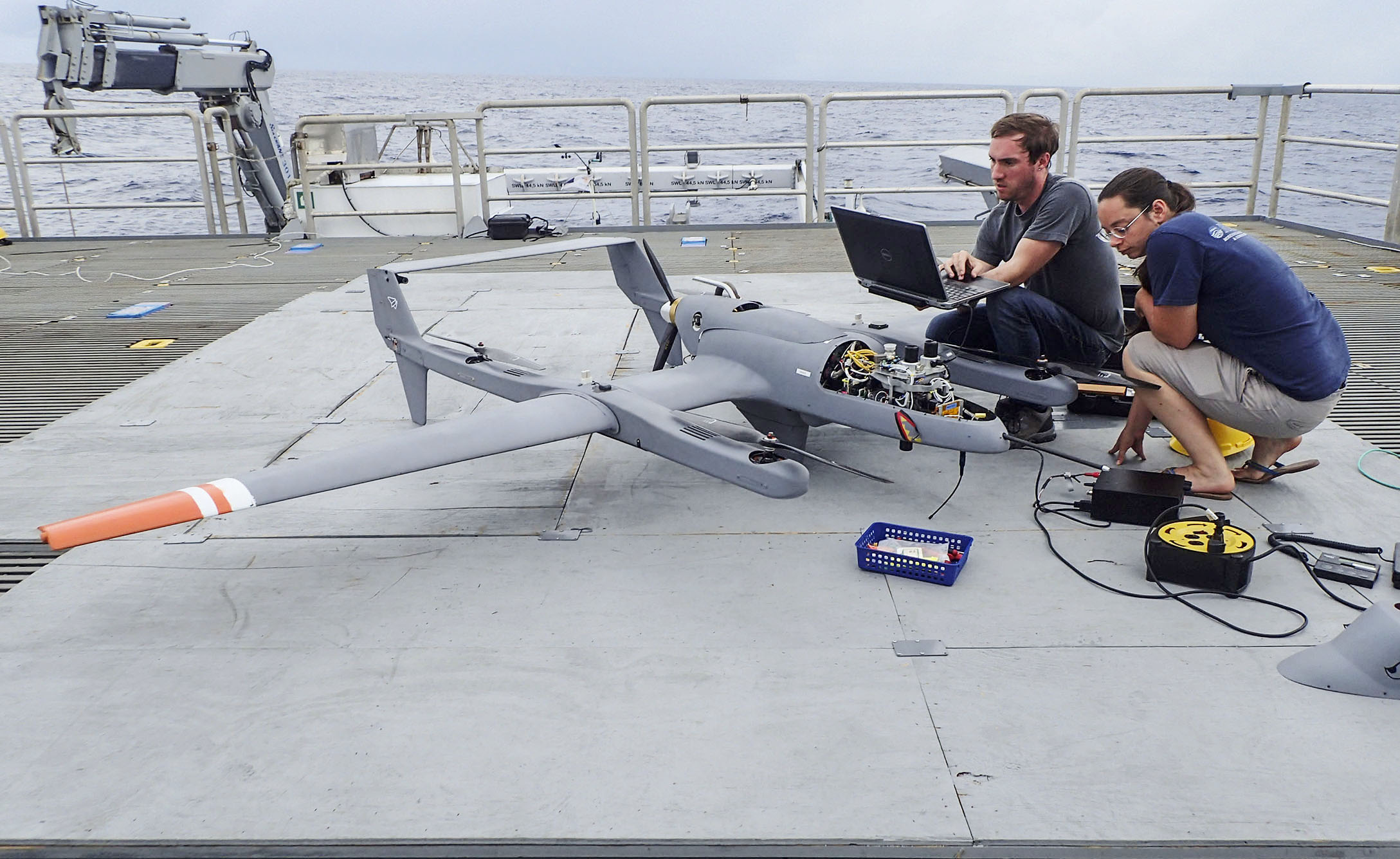
The engineering and science team that first conducted this work on Falkor in 2016 is back to continue their study with new and improved technology This time around, they won’t be just testing the Unmanned Aerial Vehicles (UAVs), but expanding their capabilities, utilizing a greater science payload. This will allow the team to launch the vehicles from Falkor while in transit to better investigate surface sea slicks in real time. The work will continue to examine slicks in the Southwest Pacific near Fiji, creating a study of fine scale, transient oceanographic features that are hard to see only using satellites. The team aims to make unprecedented sea surface maps both in spatial and spectral resolution to address important questions about the ability of the ocean surface to absorb heat. Multiple cutting-edge technological tools and vehicles will be implemented simultaneously to answer these questions.
Understanding the Secrets of Sea Slicks
A monomolecular surface film is an extremely thin (one molecule thick) layer of material that accumulates at the surface of the ocean, forming a membrane. These coatings of organic matter and microorganisms cause sea slicks, which effect transport processes at the air-sea interface. One key hypothesis is that these slicks influence the transfer of heat into the water column, and therefore alter the surface intake and output of heat through the ocean. The science team on Falkor plans to investigate the slicks influence on the surface ocean heat budget, and its effect on heat and salinity mixing. They hope that knowledge gained from this project will improve several global biogeochemical cycle and sea surface temperature models.
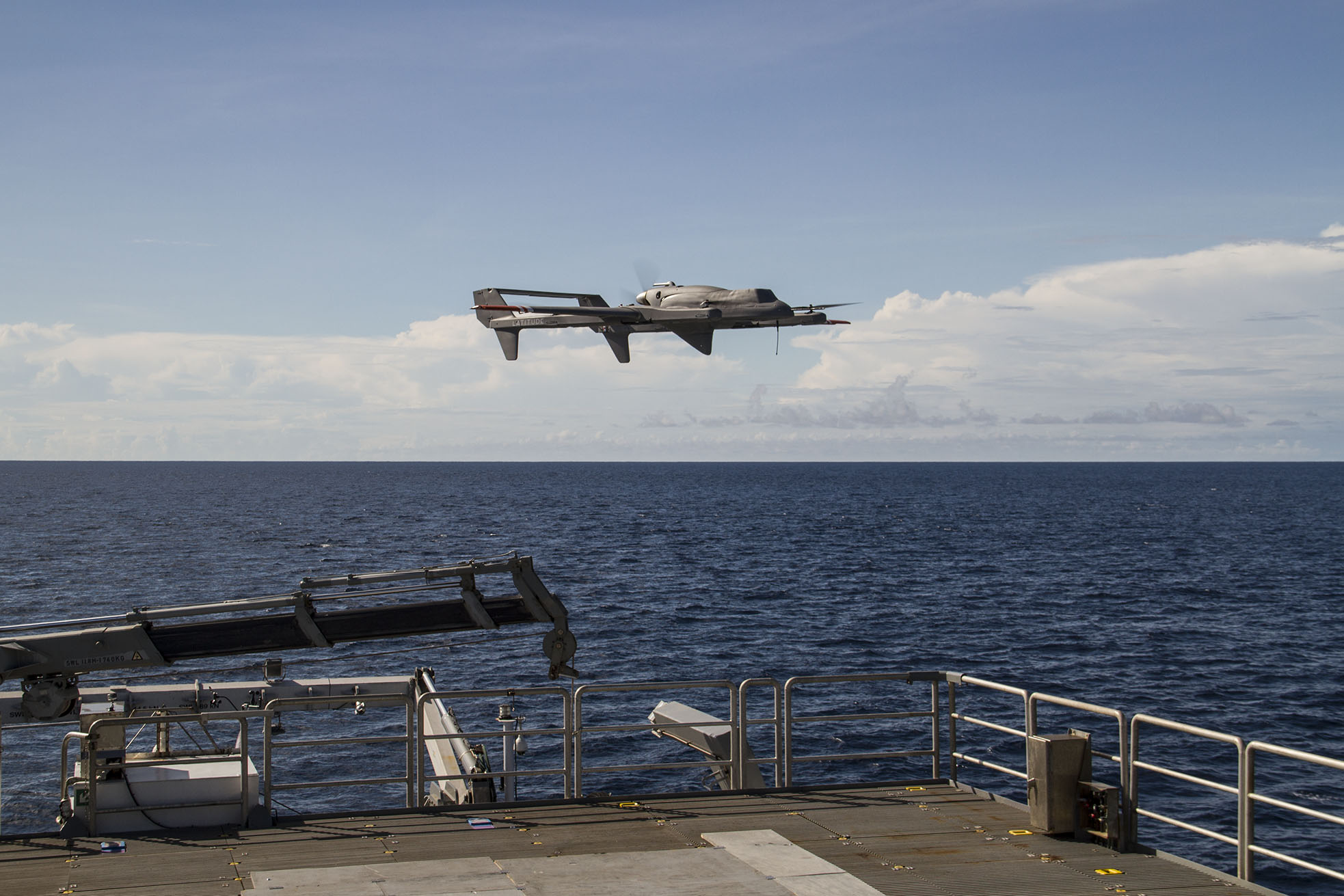
Aerial Tools
The ship-deployed UAVs will be equipped with sensors and imagers, as well as broadband thermal infrared cameras, to study the visible, near-infrared, and thermal reflection of slicks. They will be flown in a “lawn mower” pattern over the surface slicks gathering data, which will be compared to other input from satellite remote sensing. One advance with these platforms will be executing dual flight operations – allowing for more coverage in less time.
Additional samples of the surface microlayer will be collected using a glass disk mounted on a remote-controlled catamaran, similar to what was used in the 2016 #SeaSurface expedition. Other samples will be obtained from small boats and CTD rosettes. The UAV data set – combined with in situ samples of phytoplankton and marine optical properties – will be invaluable for the improvement of ocean color algorithms as implemented by NASA’s Ocean Ecology Laboratory.
Building on Past Successes
In many ways, this expedition will continue the 2016 “Study of the Sea-Surface Microlayer and Air-Sea Boundary” expedition, but with improved UAVs that will have automated takeoff and landing, and real-time telemetry, powered by a communication range up to 50 nautical miles. This improvements will allow researchers to see imagery and data in real time. Join us as we revisit the study of a small piece of ocean with tremendous influence over our planet.


