The WaterWord: Bathymetry
Definition:
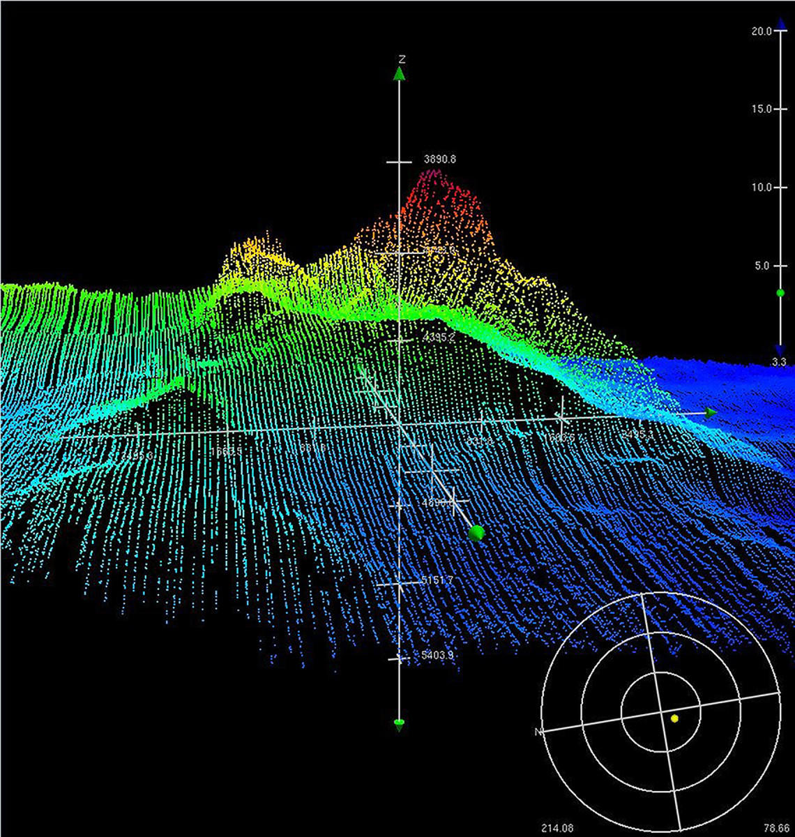
- Just as the land above the water has its highs and lows, so too does the land beneath the ocean’s surface. Those features are known as bathymetry.
Etymology:
Use/Significance in the Earth Science Community:
- Bathymetry is an important aspect of marine geology. Scientists seek to identify various types of features underwater, as well as to study how they formed.
- Researchers use tools like multibeam sonar to map the seafloor. By measuring how long an acoustic signal takes to bounce off the seafloor, scientists develop high-resolution maps of deep-sea features.
U.S. Geological Survey/Schmidt Ocean Institute Use:
- USGS and SOI are collaborating on a research cruise off the coast of Oregon and Washington that will study methane seeps in a region known as the continental margin. During this cruise, quite a bit of bathymetric data will be collected.
- SOI research cruises regularly collect bathymetric data, and its research vessel, the R/V Falkor, is equipped with advanced multibeam sonar systems to study the seafloor features.
- USGS has also collected significant amounts of bathymetric data, not just along the ocean floor but also for river and lake bottoms. That data can be found here.
Next WaterWord: Benthic