As the R/V Falkor transits from San Diego, California to Astoria, Oregon, Schmidt Ocean Institute will take advantage of this route, collecting valuable mapping data for unsurveyed areas over the active Cascadia Margin while hosting a unique group of Artist-at-Sea and Student Opportunities participants.
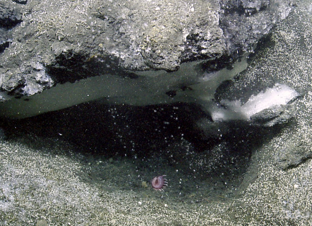
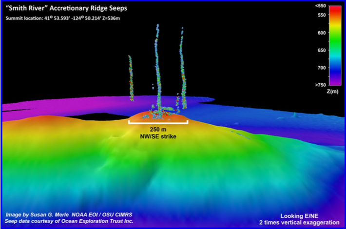
Over the past two years, researchers from Oregon State University have worked on projects over the Cascadia Margin, an area offshore of Washington, Oregon, and northern California. A coordinated water column mapping and data mining effort studying methane seeps has lead to the discovery of over 2,700 new bubble streams at more than 1,000 individual sites. However, the area is still poorly understood – the studies that led to these discoveries covered only approximately one-quarter of the Cascadia Margin area. The mapping effort continued on this expedition will be an important step towards understanding the recent changes in methane seep dynamics and documenting the distribution of these seep sites.

The Falkor will only need to deviate slightly from the most direct route from San Diego to Astoria, taking four days to expand the mapped area between Cape Blanco and Astoria. Marine technicians and scientists on board will use Falkor’s multibeam mapping capabilities to create detailed maps of the mid-water and seafloor throughout the transit, likely locating new methane seep sites. Identifying where these seeps are occurring and how active their flows are, will give scientists a greater understanding of the forces that act on this storage system. Researchers also seek data to ascertain if natural events such as earthquakes could result in sudden methane release and associated environmental impacts.
Capturing the Moment
The large number of seeps discovered during previous expeditions to the area are establishing a baseline inventory of methane bubble streams on the Cascadia margin. Only about 40% of the margin seafloor and water column has been mapped with the type of multibeam sonar on the Falkor. Researchers need to completely map the margin so that the results can be used to better quantify the current methane flux on the US west coast continental margin. A major concern is at seafloor sites where gas hydrates (methane in frozen form) are exposed to warming seawater. Heating up the ocean could cause the methane to change phase from solid to gas, adding more methane to the water column, and possibly the atmosphere as a potent greenhouse gas.
A Platform of Connection
Uniquely, this transruise is also Schmidt Ocean Institute’s first artist dedicated expedition. Six unique artists will come aboard the Falkor, using the mapping mission and life at sea as inspiration for their work. The participants’ creations span a wide-range of disciplines- from drawing, block prints, and sculpture, to performance art and jewelry design. Like scientists, artists conceptualize and put together ideas in new ways. By providing a time and space where experts from different disciplines can work together and share ideas, the experience aims to transform both the scientists’ and artists’ outcomes.
Two students from Duke University will also be joining the team as part of the Student Opportunities Program. They will immerse themselves in the working of the ship, perform mapping night watches, learn how to clean and interpret the data, and assist in science communication activities.
Time at sea is precious, and this journey promises to be a rich and productive experience for all involved.


In the News
Ghostfish Aboard the R/V Falkor
Justseeds Artists’ Cooperative • July 28th, 2018
Aboard Research Vessel Falkor, CHS Rotary Scholar D’amy Steward Fuses Art and Scientific Ocean Floor Mapping
Coronado Times • August 1st, 2018