Today, the Visioning the Coral Sea Marine Park seabed mapping data has been made publicly accessible through the AusSeabed portal.
The R/V Falkor arrived in Australia earlier this year, and despite COVID-19 restrictions, the Visioning the Coral Sea Marine Park survey took place from 29th April – 12th June with the scientists all working remotely. Pairing with the Falkor marine technician team and chief scientist Dr Robin Beaman of James Cook University, it was a wonderful opportunity for Geoscience Australia and AusSeabed to process and publish the seabed mapping data being collected.
Throughout the survey, the Falkor marine techn team provided us with processed data. We made little corrections other than shifting the elevation to the ellipsoid datum, in line with AusSeabed standards. The data was then put through a publishing pipeline to make it ready and accessible through the AusSeabed Marine Data Portal within hours. Before the improved AusSeabed tools, this process usually took weeks!
Fundamentally, this collaboration between the Schmidt Ocean Institute and Geoscience Australia demonstrates a rapid turnaround, from acquisition to publicly available data. Moving forward, these seabed mapping products will be used to plan future surveys in the area, particularly for a follow-up expedition by the R/V Falkor taking place in late July 2020.
The collection to publication process encouraged us to accelerate the progress of our own technologies and revealed an exciting insight into the future of seabed mapping in Australia.
AusSeabed Tools
AusSeabed is Australia’s seabed mapping coordination initiative, which brings together multiple sectors to improve the awareness, coverage, quality, and accessibility of seabed mapping data, through coordination and collaboration in the Australian region.
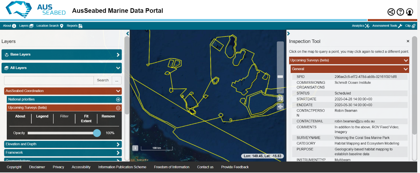
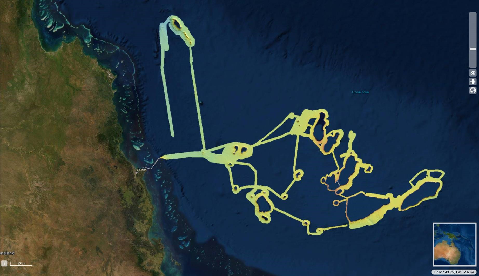
Before the R/V Falkor survey commenced in the Coral Sea, the shore-bound planning team used the AusSeabed Coordination Tool to inform the community of the upcoming plan for the expedition, by showing a planned track of the survey ahead of time (All layers > AusSeabed Coordination > Upcoming Surveys).
The AusSeabed Coordination Tool was developed in partnership with FrontierSI, and represents the first suite of technological solutions that are intended to support the marine community in developing a consistent and coordinated approach to the capture of seabed mapping data.
In terms of getting the data out, we established a publishing pipeline in Amazon Web Services (AWS) that uses a series of functions for taking the raw data all the way through to a published gridded product. The pipeline demonstrates the continuing integration of AusSeabed tools to provide standardised seabed mapping data and information efficiently to the national and global community.
Finally, when you visit the AusSeabed portal, you will find a suite of functionalities and analytical assessment tools to maximise the value of the data. This includes elevation profile creation, marine sediments analytics, and the ability to share maps with collaborators and add your own data to view within in the portal.
Want to keep up to date with the latest AusSeabed news? Join our community.
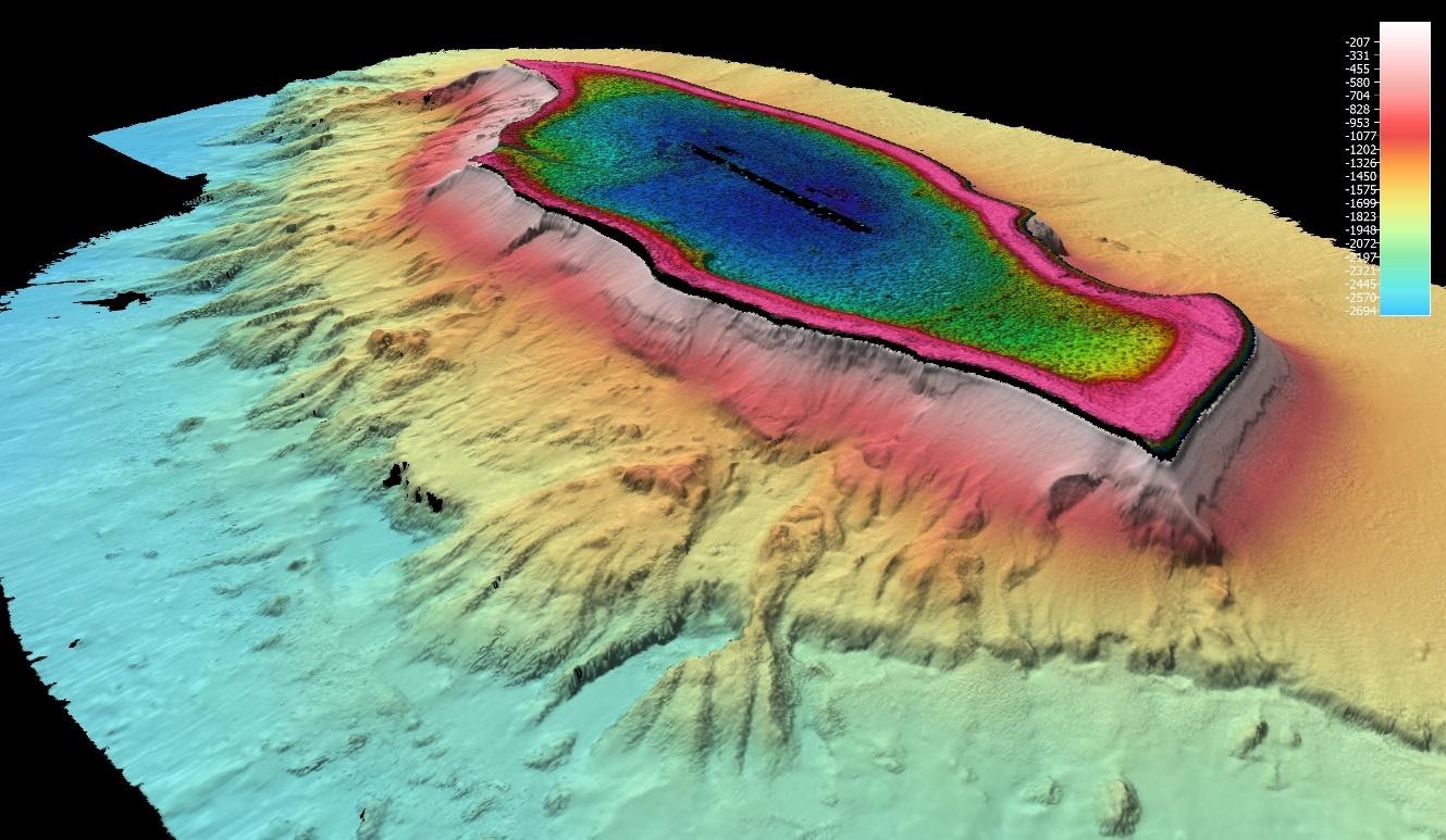
Before/After images of the data as it can be seen in the portal:
Instructions on how to find the dataset:
Click on Layers in top menu. Select All Layers > Elevation and Depth > Bathymetry – Survey (Clip enabled) > Visioning the Coral Sea Bathymetry 2020 64m, then expand. Click ‘Add to Map’. Adjust Opacity 0-100% to view change in coverage.