My name is Ben Houseman, and I am an Honours Student on the current Ice Age Geology of the Great Barrier Reef expedition of the Research Vessel Falkor. The Schmidt Ocean Institute offers students a chance to get their hands wet by participating in real oceanographic research work. When my supervisor explained that there was a position available on the R/V Falkor, I jumped at the opportunity.

Mid-last year, I completed a Bachelor of Science at the University of Queensland (UQ), with a major in Geographical Science. My coursework had a focus on geospatial technologies and paleoenvironmental studies. Currently, I am halfway through an Honours project under the supervision of Dr Helen Bostock. My project investigates the paleoceanography of the southwest Pacific over the past 1.5 million years. I am particularly interested in a distinct change in the frequency of glacial-interglacial cycles called “The Mid-Pleistocene Transition.” Being on the Falkor as we map ancient reef structures on the Australian continental shelf presents me with an opportunity to examine geological structures formed during the last glacial period.
Prior to this voyage, I had no experience working and living on a research vessel of this type. My role on the ship will be to aid the marine technicians as they perform systematic bathymetry mapping of the Australian continental shelf using multibeam sonar systems. I will spend time monitoring the sonar system in real-time, as well as aiding in data processing. My prior experience with mapping comes from geographical information systems and remote sensing courses that I took as an undergraduate at UQ. I am keen to get involved with and learn from the experienced marine technician team aboard the Falkor, as we uncover for the first time what lies on the seabed adjacent to the Southern Great Barrier reef.
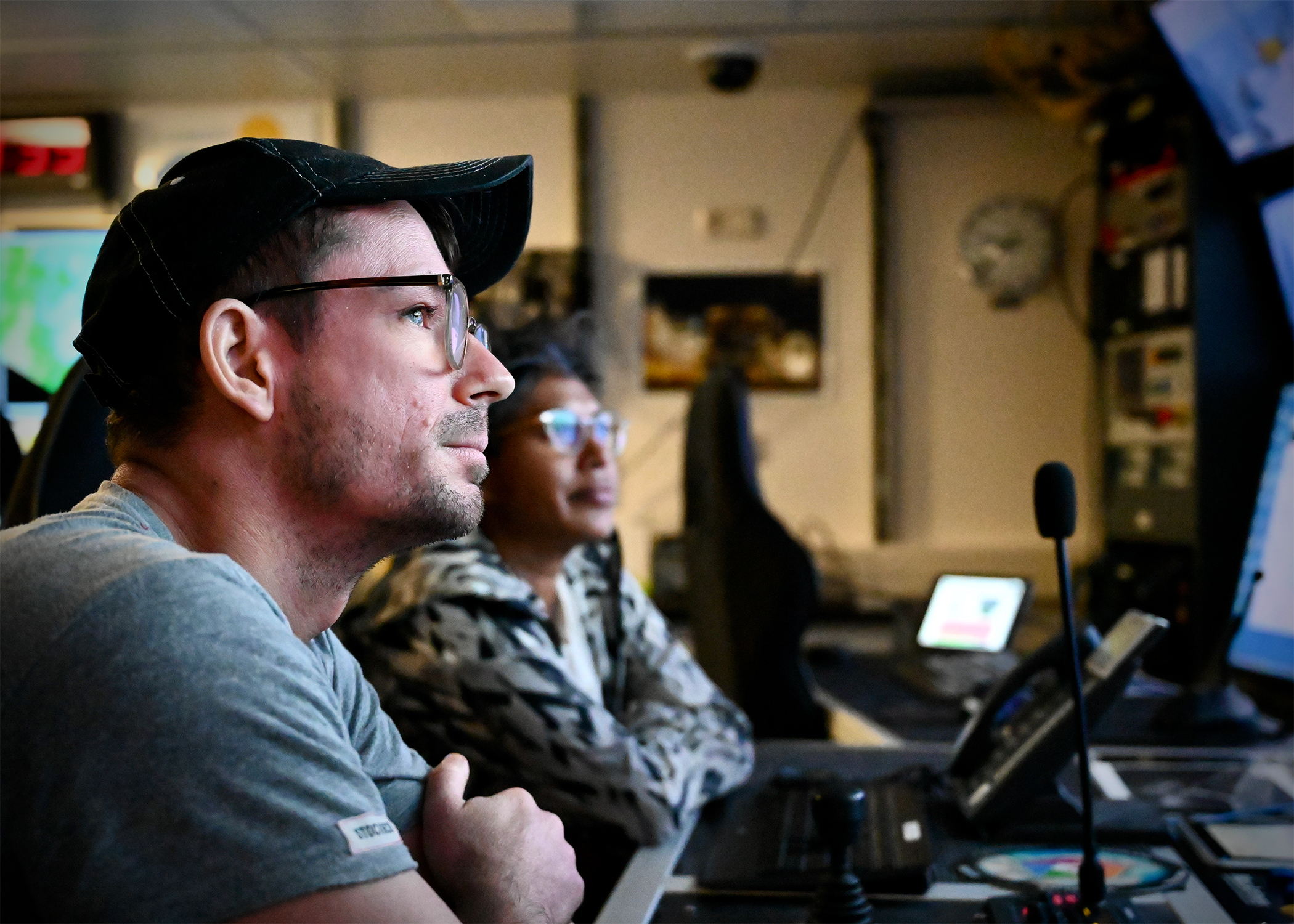
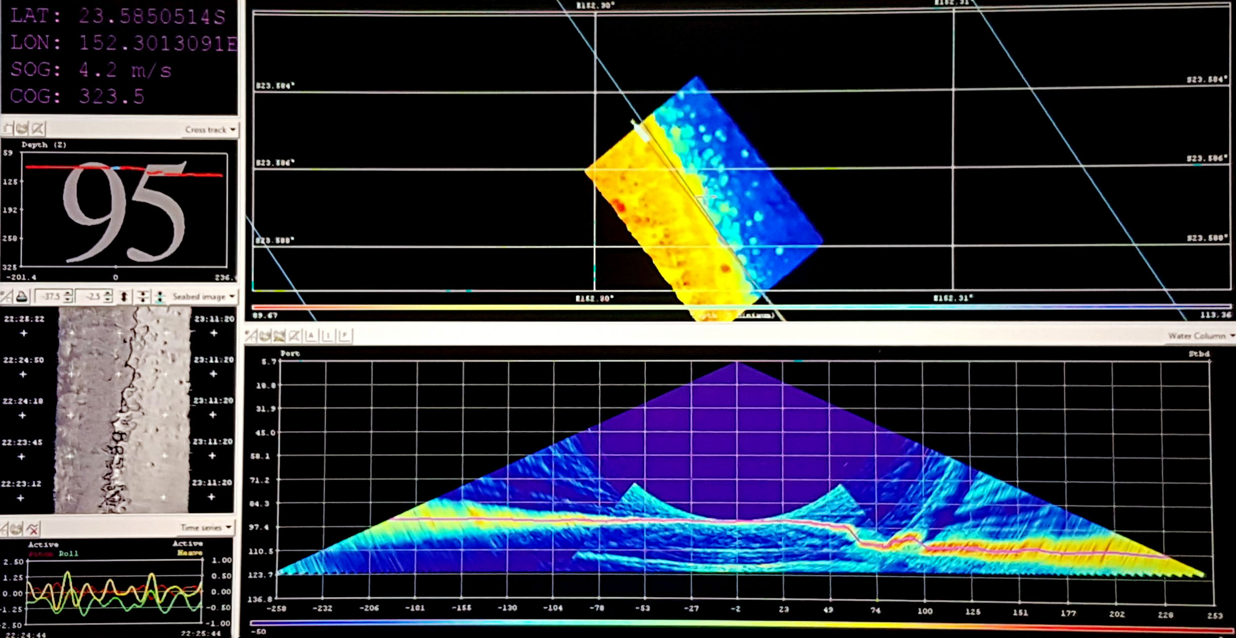
When I first entered the science control room with its ‘wall of screens,’ I felt a bit of sensory overload. However, as time has gone on, I feel more at ease and confident during my time on watch. During my watch, I ensure that systems are running as intended and notify the marine techs or bridge if anything seems out of sorts. We are currently running two multibeam systems, a Kongsberg EM710 and EM302. As the water depth is around 80m, each sonar captures bathymetric data at a width of around 400m. As we go forward and back at the survey locations, the undersea topography slowly reveals itself.
Periodically, the marine technicians aboard the Falkor need to take a sound velocity profile of the water column in the area we are mapping. Sound velocity is a parameter that changes with water temperature, salinity, and depth, so is crucial to know when mapping with sound.

I had the opportunity to aid the marine technicians as they released an Expendable bathymetry thermograph, or “XBT.” This is a device that is used to measure temperature and time through the water column. From this, the sound velocity can be determined, and the multibeam sonar data can be corrected adequately.
After a quick tutorial, I released the XBT off the aft deck. The XBT is held in a cartridge and loaded into a handheld launcher. When a steel pin is pulled, a lead weight attached to a fine copper signal cable falls through the water column. When the weight hits the seafloor, the copper wire is manually snapped off. The data captured by the XBT is relayed back to the Falkor’s computer in real-time and uploaded to the multibeam sonar.
I am excited to see the data we will gather during this expedition and continue learning about different methods for data collection.