After two weeks of surveying Tamu Massif, we are now halfway across the volcano and about to survey the highest point.

Just to give you a snapshot of what we have done so far, Leighton Rolley, Lead Marine Technician, has provided us with a summary of statistics. If you are an educator, this also gives you and your students the chance to do some Falkor math conversions. To date, research vessel Falkor has spent over 152 hours surveying and has travelled 2396.5 km (1294 Nautical Miles) at an average of 8.46 knots (4.35m/s). During this time, the ship’s multibeam has pinged 54,457 times collecting 23,525,424 soundings. We have surveyed 21654.9 square kilometers, an area the size of Belize, with the deepest depth recorded at 6944 meters and the shallowest at 2520 meters. This is quite an accomplishment.
The Story of Cooperation Seamount
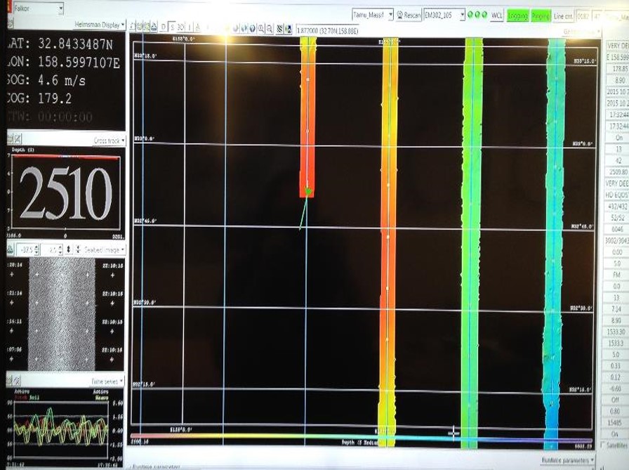

Throughout our survey, we have collected and processed a lot of data to produce some incredible 3D images of the seafloor. The latest map is of Cooperation Seamount that was studied back in the 1980’s. The image posted reveals details of the seamounts not seen before, with data indicating its highest peak at approximately 2000 meters and its deepest part is about 6000 meters. The other science story behind the seamount involved our Chief Scientist, Dr. Will Sager. In 1982, the Soviet Union was still in place and wanted to explore an area near Cooperation Seamount located between Ori Massif and Tamu Massif. They needed an American research partner to be able to come into the port in Honolulu and offered the University of Hawaii spots for observers on the R/V Pegas and the R/V Marskoy Geophysik as an incentive. Dr. Sager was one of the graduate students who was chosen to go on the month long expedition. He was able to observe the surveys and science aboard the ship and was given all the data that had been collected for Cooperation Seamount, which he was able to use for his project. Unfortunately, the month long expedition was extended to six weeks because the Soviet vessel was not allowed to come into the US port. Even though the ships were never allowed to port, they were given the supplies needed for their return trip home. In turn, Cooperation Seamount was named because of the “cooperation” between the Soviet Union and U.S. and Dr. Sager was able to return to home.
Safety First

Our first fire drill of the expedition took place this morning. In the event of fire emergency, all personnel are required to report to the designated area on the deck with their PFD (personal flotation device). As we go up the stairs we must call out our names loudly and Adriana, our Purser, checks us off the list. We are told by the crew that these drills are taken very seriously and it definitely showed as the crew dressed in their gear proceeded to finish the drill. The Captain then announced the drill was over and briefed us on the expedition plans for the next few days. We are currently finishing our last line and then headed west to avoid the effects of Typhoon Champi.
More to come as our survey line goes over some of the highest areas on Tamu Massif.