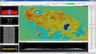
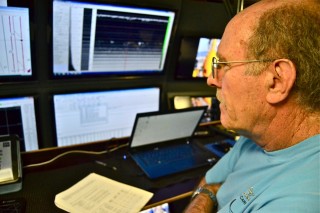
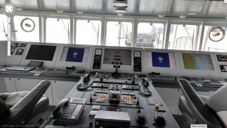
“Oh, wow, Nathan are you getting this?” marine tech Jimbo Duncan called across the room to his counterpart. On the screen, the sonar system was spitting out the first ever map of a large bank probably known before now only to a few fishermen. But it was the big, dark blue spot coming up that was the really intriguing part.
One of today’s main missions was to map a series of banks closer to shore and in shallower water than those we worked on earlier. Geologists’ best assessment is that this line of features more or less hugging the coast about 10 miles out is another ancient coastline, but one a few thousands years younger than the further banks.
The mapping is somewhat slow going as we move back and forth to “paint” the seafloor with sonar. But while most ships’ mapping capabilities top out around 6 M.P.H., Falkor can double that. The problem with most ships is that as they go faster, so many bubbles wash down the hull that they throw off the sonar, which sends out sound signals and then records their return after they bounce off the bottom.
Lightning Fast, Relatively Speaking…
To avoid the bubble issue, Falkor is fitted beneath the bow with a streamlined platform called the gondola. The bubbles pass between the hull and the gondola, so even at much higher speeds, the sonar system sends and receives without any bubble interference. It’s safe to say we’re all quite pleased that the process doesn’t take twice as long.
Mapping can be pretty mundane stuff but there are occasional bouts of excitement. Some of the spots we mapped today had little or no relief, but in between a couple of those targeted banks we came across an uncharted one.
Something New
As we passed back and forth through the area, we realized that what the team is tentatively calling Falkor Bank is more than two miles across. This may well have been an island a few thousand years back. What grabbed Duncan’s attention, and that of everyone else in the control room, was a large, dark blue crater appearing on one side of the bank’s plateau. It’s about 20 feet deeper than the rest of the bank and could have been a lake at some point.
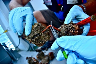
In previous work on banks closer to shore, some of those aboard have found amazing things at these kinds of sites, like mastodon bones and wooly mammoth teeth. So we’d all like to check out this big hole. But, alas, it’s too shallow to warrant an ROV dive—our goal for the shallower areas was purely mapping.
So, after fully documenting the site we headed further south. Tonight, after mapping a couple more areas, we’ll start making our way north again, hopefully for a first dive on Mysterious. But the weather is threatening to turn on us with high winds and seas predicted for tomorrow. So, we shall see.