Costa Rican Deep Sea Connections
Puntarenas, Costa Rica
January
Dr. Erik Cordes, Temple University
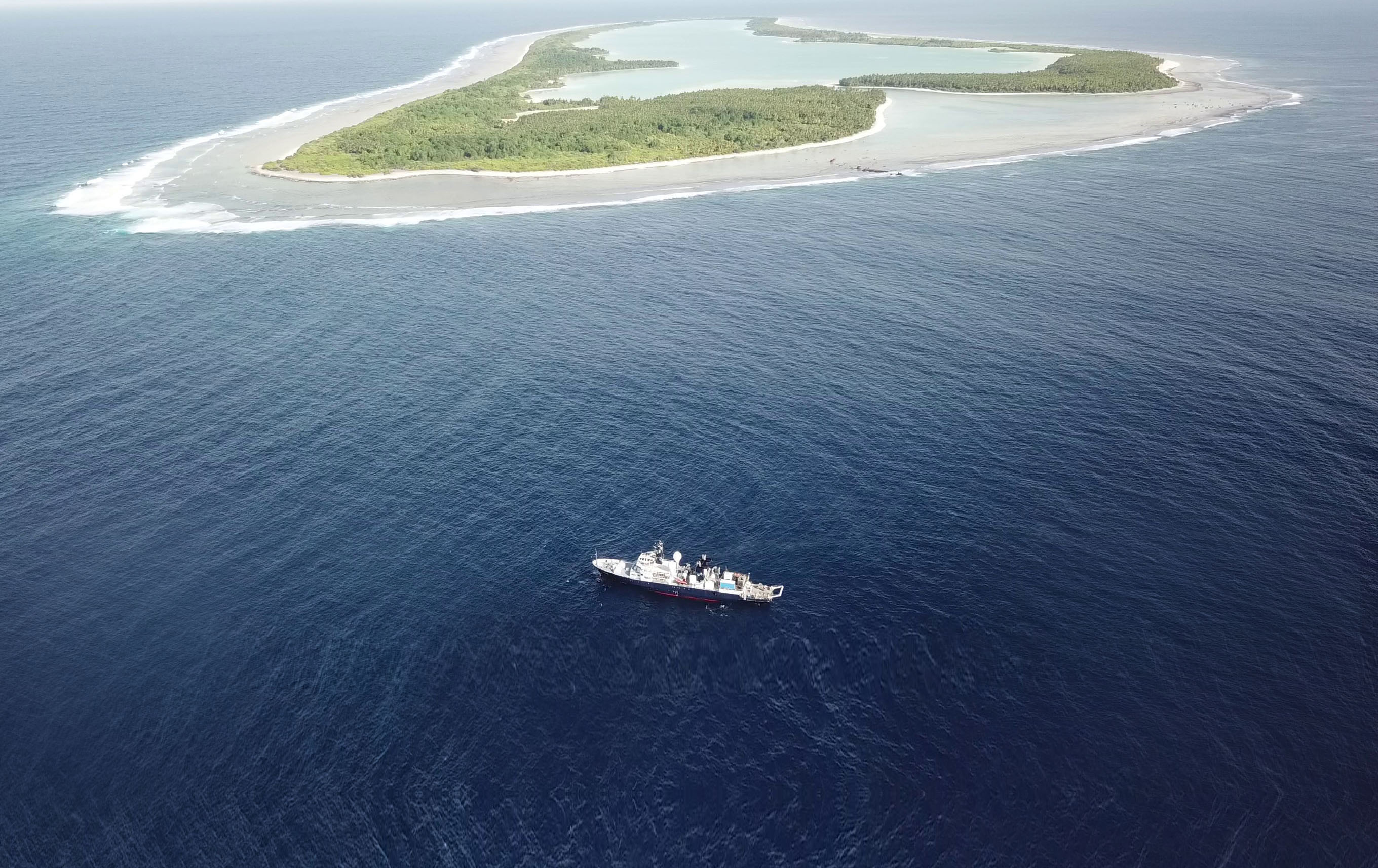
Dr. Erik Cordes and his interdisciplinary team will seek out deep sea communities to generate a three-dimensional profile of the methane seeps of Costa Rica. Diving off of the Isla del Cocos National Park, this research will help develop a proposal to expand the national park out to the connected seamount chain that runs from the island to mainland Costa Rica. Each seamount here has a unique habitat and is currently not under any protection. These environments are critically important supporting diverse faunal communities. The team will characterize seep community microbes and metabolic pathways by collecting samples with ROV SuBastian and comparing them to the seamounts further offshore. Oceanographic data will be collected with an in-water flying towed sensing system that quickly slides along a wire. Together, this information will allow researchers to explore the ways that seep communities are connected to the surrounding deep sea, and determine how far their influence can be felt. Exploration during this expedition will likely reveal new areas of active seepage and thermal anomalies, and describe the habitats on new seamounts that likely host a variety of new species. This expedition represents a rare holistic approach to describing methane seeps and exploring seamount communities and will contribute to a better understanding of potential effects of global ocean change in the equatorial Pacific (warming, acidification, and deoxygenation) to determine how the linkages with the surrounding deep sea will be altered.
Temperature Truths: Searching For Microbial Community Structure
Manzanillo, Mexico
February/March
Dr. Samantha Joye, University of Georgia
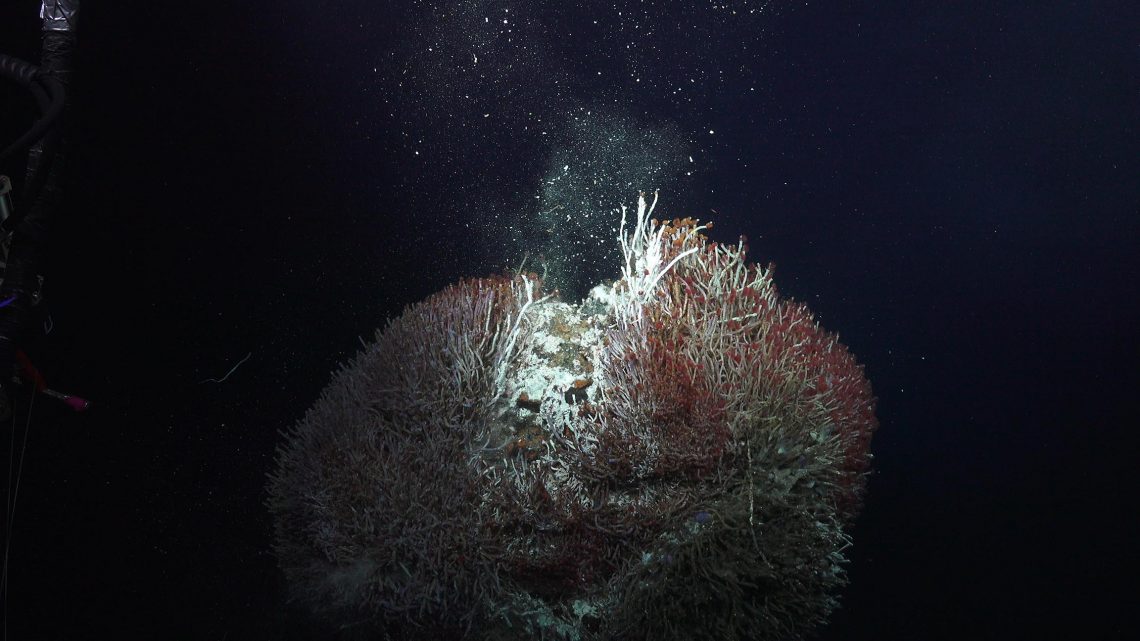
The Gulf of California is a young ocean undergoing changes such as active seafloor spreading, early rifting, and large-scale hydrothermal activity; making it an important site for advancing our understanding of deep ocean hydrothermal ecosystems. The region also provides an ideal natural laboratory to investigate changes over a gradient of hot hydrothermal vents to cold seeps with increasing sedimentation. Dr. Samantha Joye and her multi-national team will compare the biology, geology, chemistry, and microbiology of sites along a gradient from the Pescadero Basin to the northern gulf. The northern area of the gulf is largely unmapped and the hydrothermal characteristics, microbiology, and vent fauna are unknown, making a portion of the expedition exploratory in nature. The team will aim to identify and quantify habitat-specific microbial populations and assess how those microorganisms interact with the geologic structures and megafauna of vents, seeps, and hydrates. The scientists will visit eight sites in the gulf, revealing previously unknown areas with shipboard mapping, obtained water samples, and sediment, fluid, and microbiology samples collected with ROV SuBastian. In-situ tools including the ABISS autonomous lander and jumbo osmotic fluid samplers will be used to retrieve samples to study microbial diversity and geochemistry.
Seeking Space Rocks
Olympic Coast, Washington, USA
May/June
Dr. Marc Fries, Nasa
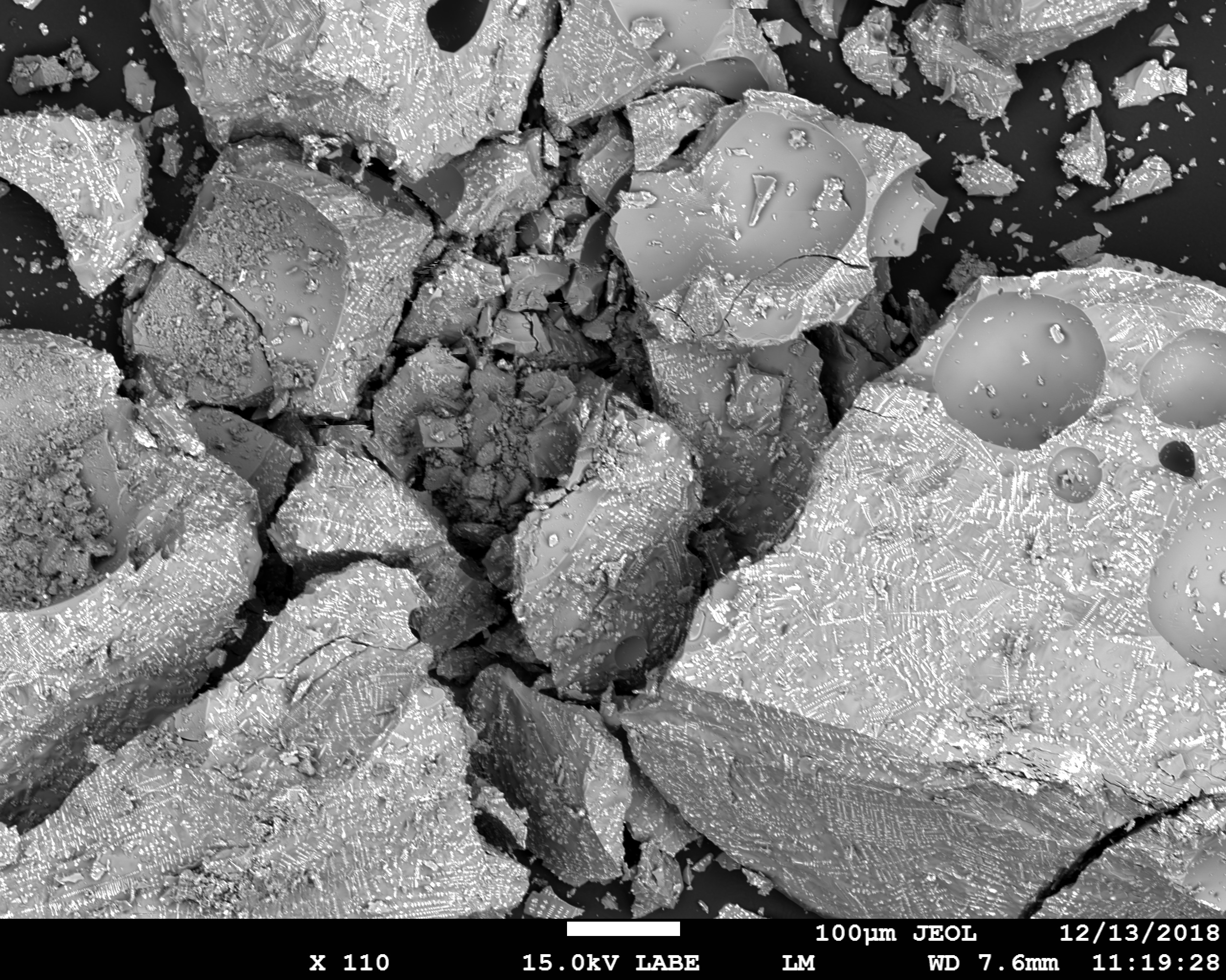
On March 7, 2018 at 8:05 PM local time, a meteorite broke up over the coast of Washington state, raining extraterrestrial rocks down into the ocean. This meteorite fall was detected by weather radars from the nationwide NEXRAD radar network, which recorded images of the falling rocks and data showing that they were composed of an unusually tough meteorite of unknown composition. The meteorite split into many different pieces, all hitting the ocean in a strewn field approximately 11km long. Eyewitnesses across western Washington reported the cloudy sky brightening significantly, and those near the coast reported sonic booms loud enough to shake their homes and cars. The massive size of the event caused impact signals to be recorded by ocean-floor seismometers, passive sonar, and even a weather buoy – this is the first time a meteorite fall has triggered and been recorded by these sensors. At present, the question remains unanswered – what kind of meteorite could cause a fall like this? Only by recovering at least one meteorite from the seafloor will we know.
Observing Seafloor Methane Seeps at the Edge of Hydrate Stability
Astoria, Portland, USA
June
Dr. Carolyn Ruppel, U.S. Geological Survey
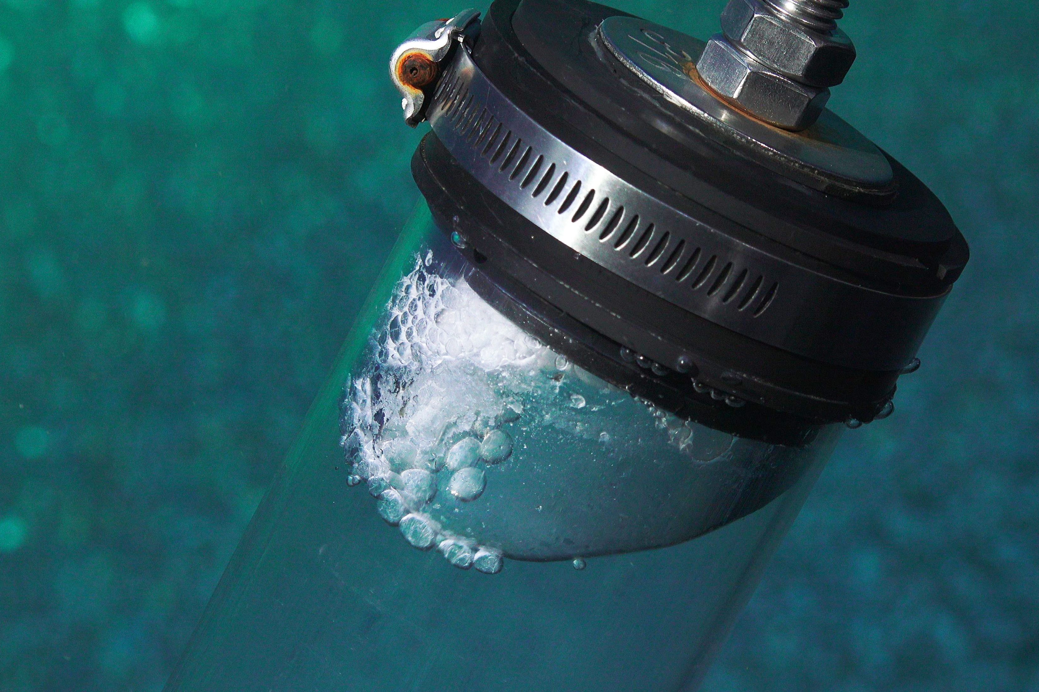
Methane is a more potent greenhouse gas than carbon dioxide but exists at lower concentrations in the atmosphere. An estimated 17% of global methane is trapped in gas hydrate, a naturally-occurring frozen form of methane and water that is stable at the pressures and temperatures common in marine sediments on continental margins. Continued warming of ocean waters could destabilize gas hydrate deposits and release methane to the water column and possibly the atmosphere. Dr. Carolyn Ruppel and a collaborating international team of geologists, biochemists, and benthic ecologists, will head to some of the hundreds of recently discovered methane seeps on the U.S. Pacific Northwest margin to conduct a comparative study along depth and latitudinal gradients of gas hydrate stability. This integrative expedition combines subseafloor imaging, seafloor sampling, analysis of water column processes, and measurements of methane release at the sea surface. ROV SuBastian will be used to sample sediments, carbonates, near-bottom waters, and benthic organisms, as well as deploy an oxidation rate laboratory. Scientist will examine bacterial oxidation of methane in seawater at full ocean pressure using incubation bags installed on a lander at a seep site. As methane is converted into carbon dioxide and other byproducts, sensitive sensors will monitor the chemical changes in the seawater contained in the incubation bags. An additional component of the observatory will be a sonar-equipped lander to monitor changes in methane seepage and instrumentation to track bubble emissions. Taken together, the seafloor laboratory measurements, sampling and mapping will advance understanding of methane seeps across the depth range where gas hydrates are most susceptible to breakdown as ocean waters warm.
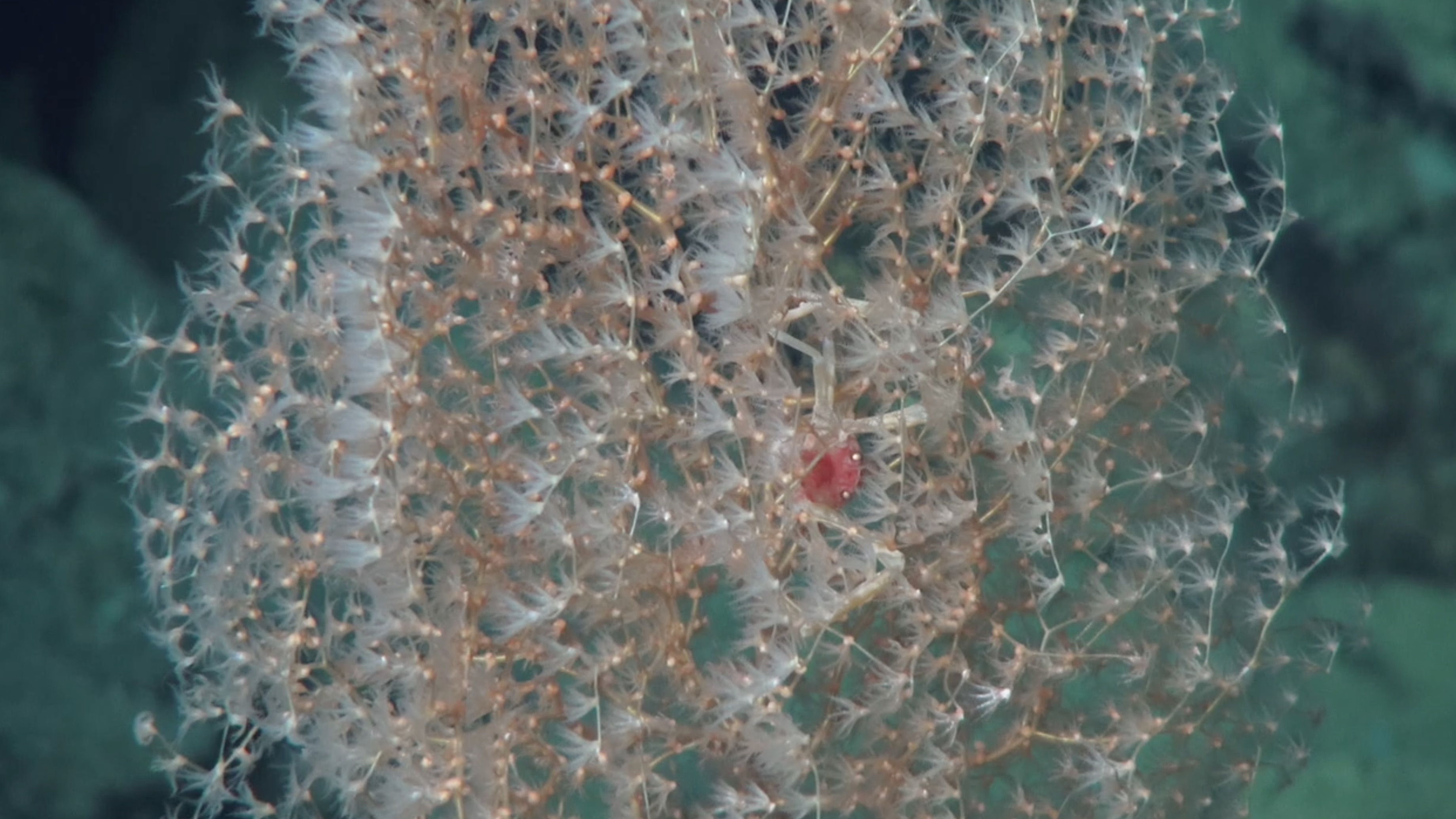
Deep Coral Diversity at Emperor Seamount
Honolulu, Hawaii, USA
August
Dr. Les Watling, University of Hawaii
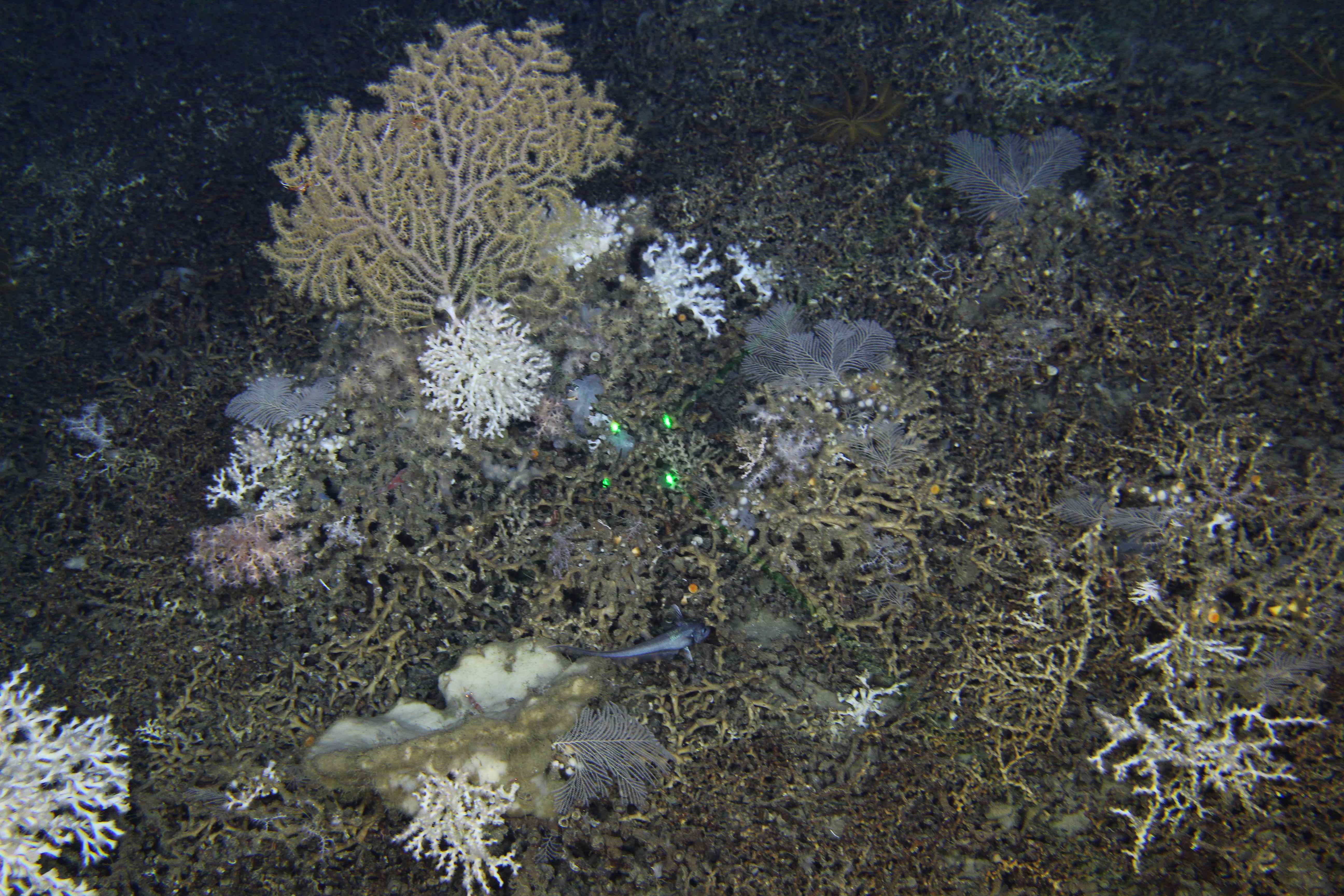
The bathyal zone (800-3500 m) is the least well-known depth zone in the ocean but contains much of the deep sea coral diversity. This species diversity is almost completely different between the Aleutians and Hawaii, with species transition occurring somewhere along the Emperor Seamount chain. Professor Les Watling and his team hypothesize that this boundary is determined by the flow of North Pacific Intermediate Water that comes from the Gulf of Alaska and the northwest coast of North America and crosses the Emperor Seamount chain at the Main Gap. This zonal water movement could function as a moderate to strong barrier to north-south species dispersal and may be responsible for the observed faunal differences. The team will sample seamounts on each side of the Emperor Seamount Chain Main Gap to differentiate the coral fauna and the water conditions where the corals live. Octocorals are widely distributed at deep depths throughout the world’s oceans, however no specimens have been collected from north of the Main Gap, even though there is evidence of their presence from images obtained during previous fisheries cruises. The team is hoping to better understand the distribution of octocoral species on each side of the Main Gap, as well as investigate the processes that influence these distributions. They will first produce detailed maps of the seamounts visited; these will be used to determine optimal dive locations for ROV SuBastian to collect octocoral samples for taxonomic and molecular analyses. Water samples will be collected to better understand the origin and characteristics of the environment in which the corals reside.
Genetic Connections at Necker Ridge
Honolulu, Hawaii, USA
September
Dr. Amy Baco-Taylor, Florida State University
Seamounts play key roles in the specialization and ecology of deep-sea fauna, acting as an oases of biodiversity and larval sources for non-seamount habitats. However, seamount fauna are threatened globally by a number of anthropogenic impacts such as trawling and possible mining for cobalt-rich manganese crust. This is concerning as the deep sea habitats are slow to recover and are still not fully understood. The Northwestern Hawaiian Islands (NWHI), also known as the Papahanaumokuakea Marine National Monument is one of the world’s largest marine protected areas and is dominated by deepsea octocorals. A preliminary survey of the region connecting this area to the largely unexplored central and western Pacific seamounts revealed patchy communities with crinoids (a type of invertebrate that include sea lilies and feather-stars) dominating the southern end and octocorals (a softer stony coral) the north. This difference may be due to environmental parameters or differences in larval supply. This fall, Dr. Amy Baco-Taylor and her team will sail aboard Falkor to this region surveying and sampling seamount fauna to explore the role of Necker Ridge in the Northwestern Hawaiian Islands as a stepping-stone for connectivity between Hawaii and the other Pacific islands. Using ROV SuBastian, the team will conduct quantitative image transects and sample benthic megafauna. This environmentally-focused research will help managers understand how mined seamounts will recover, and how the underwater features communities are connected.
Designing the Future
Honolulu, Hawaii, USA
October
Dr. Brennan Phillips, University of Rhode Island
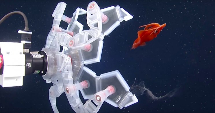
Species sampling is critical for ocean scientists to obtain all kinds of information; there are many criteria such as diet, life span, reproduction and growth that can only be determined by a live animal. Sampling in the ocean today is mostly performed the same way it was 30 years ago, and can sometimes be inefficient and destructive to fragile organisms. A significant amount of deep-sea species remain undescribed simply because they cannot be returned to the surface in good condition for taxonomic inspection. Co-Principal Investigators Brennan Phillips (University of Rhode Island), Kakani Katija (MBARI), Robert Wood (Harvard University), David Gruber (City University of New York/Baruch College), and their teams of interdisciplinary researchers have been working on new technology that allows them to study species in situ, something that has never been done before. They anticipate that their work will set a new benchmark for future midwater expeditions and pave the way for devices that revolutionize sampling, including some that would combine several their technologies into a singular solution for specimen characterization.
Listening for Cryptic Whale Species
Honolulu, Hawaii, USA
October
Dr. Ann Allen, National Oceanographic and Atmospheric Association
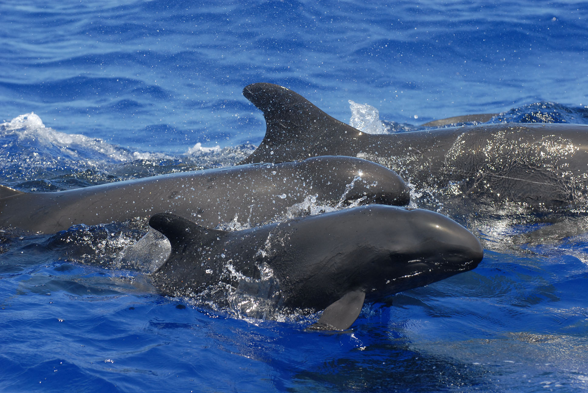
There are several species of whales that are particularly challenging to study, including four species of beaked whales and a population of endangered false killer whales around the Hawaiian Islands. Data on the population and behavior of these species is important in accurately assessing their status and the potential impacts of increasing human activity. However, study of both beaked whales and false killer whales is limited by their rare nature. To overcome these challenges, NOAA National Marine Fisheries Service, Pacific Islands Fisheries Science Center (PIFSC), and the Cetacean Research Program (CRP) have been pioneering new techniques to better estimate their species abundances. By using cutting-edge technology (including Drifting vertical acoustic recording arrays and eDNA analysis) to listen for and gather traces of these mysterious giants, researchers hope to drastically increase the small amount known about these enigmatic creatures.
Mapping the Gaps
Honolulu, Hawaii, USA-Suva, Fiji
October/November
Dr. Sam Wilson, University of Hawaii
 Crossing the Pacific from Honolulu, Hawaii to Suva, Fiji, Research Vessel Falkor will stop to conduct several days of mapping in the Phoenix Islands Protected Area, one of the largest yet least studied Large Scale Marine Protected Areas. With over 25 submerged volcanoes, pristine coral archipelago systems, and astonishing biological diversity, these unknown waters critically need bathymetric mapping for researchers to understanding what lies beneath the surface. Falkor has visited the area before, during a month-long expedition characterizing the region in 2017. The mapping will help to fill in gaps in mapping data and help to prepare for an ROV expedition in 2021. In addition to the mapping, we will welcome several scientists who will be working on technology development of a new Biological Nitrogen Fixation device and deployment of eight NOAA Argo Float systems.
Aerial Investigation of Sea Surface Dynamics
Suva, Fiji
November – December
Dr. Christopher Zappa, Columbia University
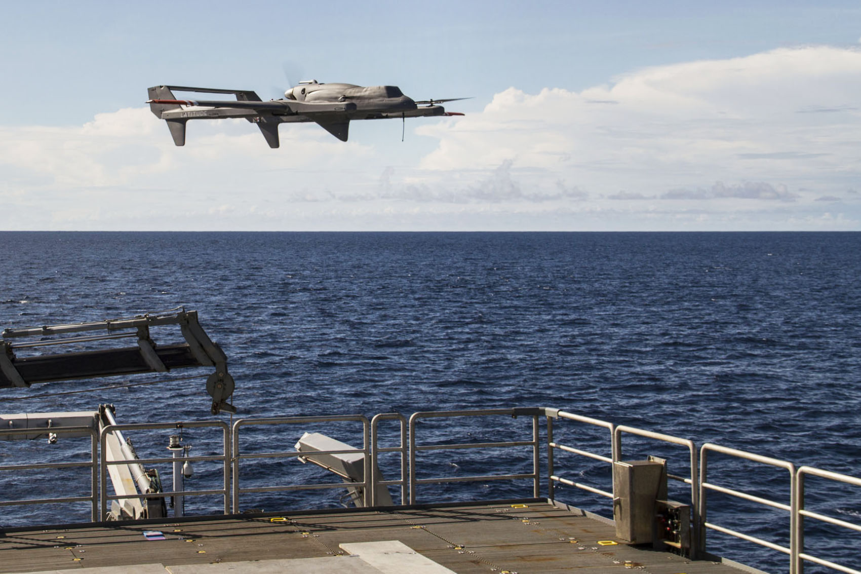
The surface microlayer (SML) is the upper 40-100 micrometers of the ocean surface, and forms a boundary layer between the atmosphere and the ocean through which any gas or matter exchanges must occur. The SML is known to be influential in global air-sea interactions and weather forecasting, but is notoriously difficult to study and has been largely neglected. Dr. Zappa and his team of scientists and engineers aim to advance our ability to study this layer of the ocean by focusing in on the effects of common cyanobacteria surface slicks in Fiji. Clusters of many thin, filamentous algae called Trichodesmium (also known as sea sawdust) commonly occur on the ocean surface around Fiji, and likely have impacts on near-surface ocean heating by changing local sea surface temperature. This expedition will utilize unmanned aerial systems with hyperspectral, near-infrared, and broadband thermal infrared cameras along with an autonomous catamaran, ocean drifters, CTD casts, and satellite imagery to test and develop ways of studying the SML both through autonomous sampling and data collection on site as well as remotely by increasing our ability to detect and interpret data about cyanobacteria surface slicks. This dataset will provide invaluable data to improve models of sea surface heat budgets and global biogeochemical cycling, as well as advance science by providing new sampling methods to study the sea surface microlayer and improving our use and understanding of satellite imagery.