Cruise: The Secret Lives of Whales
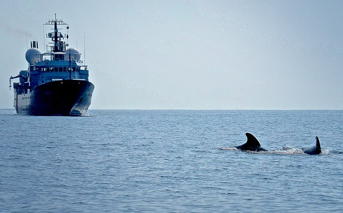
On the first of three student cruises, the team aboard Falkor answered questions about whales’ decision-making process about how and where whales feed in the deep sea.
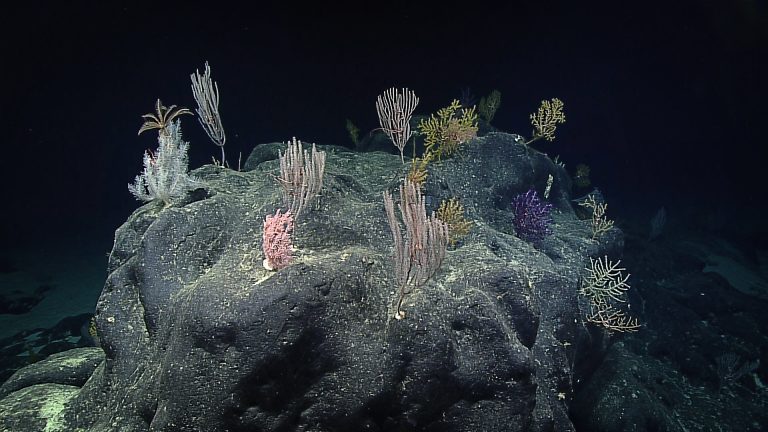
Search Results for CTD
On the first of three student cruises, the team aboard Falkor answered questions about whales’ decision-making process about how and where whales feed in the deep sea.
When you build a house, you do not use only a hammer, but a variety of specialized tools in an organized and collaborative manner to construct a complex structure.
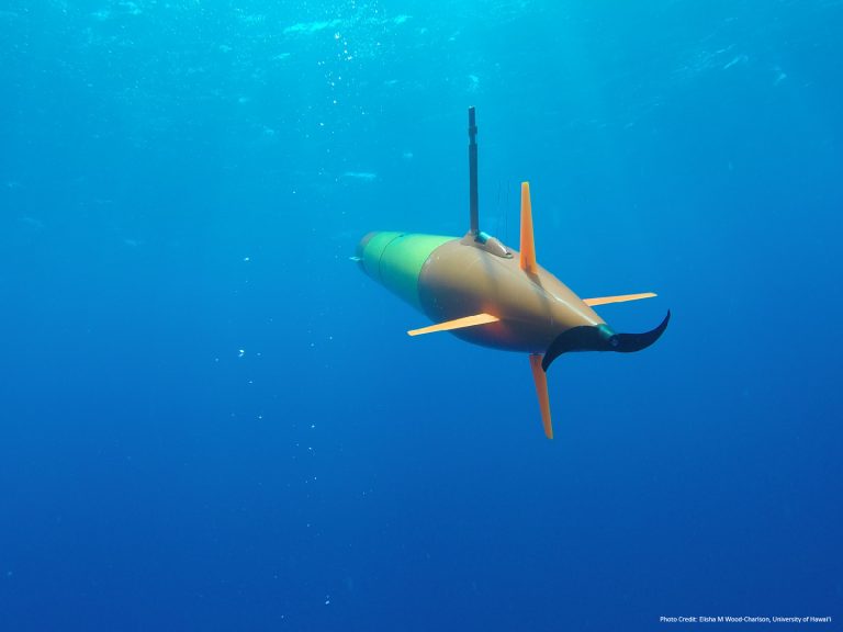
AUV Sentry will be used at Hawaii’s underwater volcano, Loihi Seamount, whose base remains largely unexplored. The team will survey and sample the seamount to better understand the dispersion of hydrothermal fluids from Loihi to the Pacific Ocean.
Expedition dates: Feb. 24 - Apr. 4, 2024 The Salas y Gómez Ridge extends off the coast of Chile to Rapa Nui, also known as Easter Island, in the Central Pacific. Created by volcanism, these underwater mountains provide essential habitats for deep-sea organisms, supporting some of the highest marine endemism globally. Many of the species … Continued
If you have ever flown over the Pacific and looked down from the window seat, the water seems still. Viewed from this distance, the water appears stagnant with unmoving dashes of waves.
Expedition dates: Jan. 8 - Feb. 11, 2024 Underwater mountains, or seamounts, are remarkable features on the seafloor, playing an integral role in oceanic processes and connectivity. Rising up from the depths, seamounts create complex current patterns that influence what lives on and above them. They are an oasis for deep-sea communities, providing food, shelter, … Continued
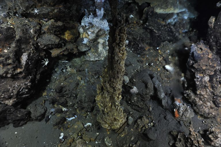
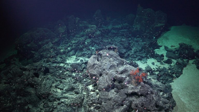
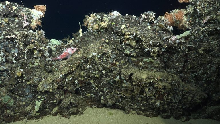
Aboard R/V Falkor, Dr. Ken Rubin and his research team will visit one of the most active underwater volcano sites in the world, the Meta Volcano group. There they will work to obtain a detailed geological understanding of up to 12 different submarine volcanoes, attempting to do this across a suite of volcanos for the very first time.
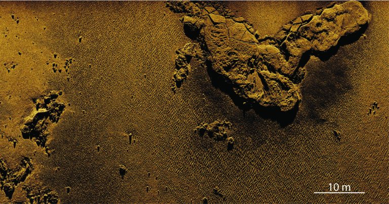
Expedition dates: October 25 - November 23, 2023 Seafloor mapping is integral to oceanographic research. Bathymetric data illustrate the seafloor’s depth, contours, and physical features, and it is often the first essential step in planning a successful submersible operation. The typical tool for seafloor mapping, multibeam sonar, creates three-dimensional topographical outlines—rather than visual images. Physical … Continued
The Phoenix Islands Protected Area (PIPA) is the largest and deepest UNESCO World Heritage Site on Earth. Approximately the size of California, PIPA was the first Marine Protected Area (MPA) of its kind. In October, Dr. Erik Cordes (Temple University) and his team will explore never seen before seamounts and atolls within PIPA with R/V Falkor and ROV SuBastian.