2024 – The Southeast Pacific
The Southeast Pacific Basin, off South America, is one of the most tectonically active areas in the Pacific Ocean. The Peru-Chile Subduction Zone stirs off the continental shelf, where the Nazca tectonic plate dives under the South America plate, forming volcanoes and the 8000-meter-deep Peru-Chile trench. Wind patterns along the South American coastline push surface waters away, which are then replaced by deep, cold, nutrient-rich waters in a process known as upwelling. This upwelling sustains one of the most bountiful areas in the global ocean, facilitating two of the largest fishing industries in the world and providing habitats for blue whales, leatherback sea turtles, and more. The eastern tropical Pacific Oxygen Minimum Zone lies further off the coast; it is an oxygen-starved environment inhospitable to many large marine animals, and it is likely growing due to climate change.
In 2024, R/V Falkor (too) will venture to the depths off the west coast of South America, creating vital seafloor maps, gathering data to improve climate models, and searching for ecosystems on seamounts, seeps, canyons, and vents. The data collected will contribute to Chile and Peru’s stewardship of their Ocean environments and illuminate unknown marine realms.
Seamounts of the Southeast Pacific
January – February
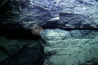
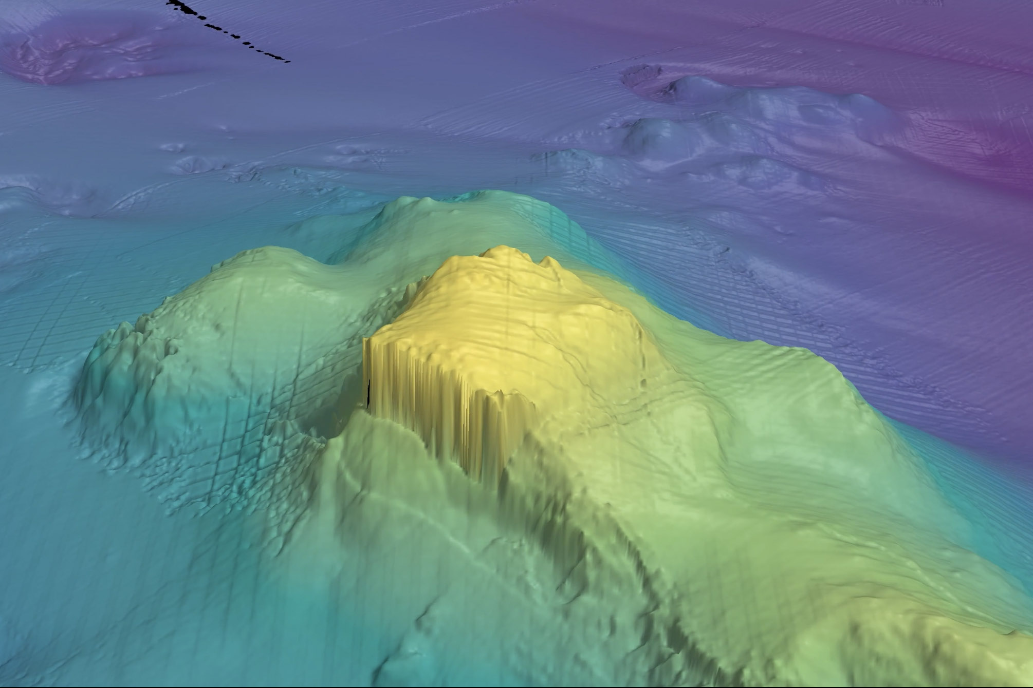 Seamounts are essential structures within the global Ocean. These underwater mountains shelter numerous animals and influence undersea processes like the movement of currents and chemical cycling. Less than 1% of the Earth’s seamounts have been thoroughly mapped and sampled, and the seamounts of the Southeast Pacific remain some of the least explored.
Dr. Javier Sellanes of the Universidad Católica del Norte, Chile, and an international team will characterize ten seamounts along three different ridges off Chile’s coast: The Nazca, Salas y Gómez, and Juan Fernández. A primary focus of the team will be to survey the animal communities living on seamounts within the Nazca-Desventuradas Marine Park, the third-largest marine park in the world. Their comprehensive study has four objectives: (1) To create a complete picture of seamount biodiversity from the bottom of the mountain to the top; (2) to examine ecosystem recovery following the closure of fisheries on several seamounts; and; (3) to assess if there is a biogeographic border between the Indo-West Pacific and East Pacific. To do this they will use R/V Falkor (too)’s multibeam, CTD, and other sensors, ROV SuBastian, and baited camera traps attached to SOI’s lander. This research will support the design of strategic marine management plans for the Southeast Pacific.
Unexplored Seamounts of the Salas y Gomez Ridge
February – April
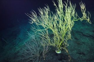
The Salas y Gomez Ridge, an underwater mountain range, extends from off the coast of Chile, to Rapa Nui (Easter Island) in the Central Pacific. The ridge consists of numerous seamounts, creating precious animal habitats in one of the most remote parts of the Ocean. Scientists hypothesize the biodiversity here is so rich, that the region should be designated as an international marine protected area. The connections between the seamounts extending from mainland Chile to Rapa Nui Island have not been characterized, though likely the Salas y Gomez Ridge serves as a protective corridor for many marine species and may harbor species new to science.
To better understand connectivity in the deep sea along the Salas y Gomez Ridge, Dr. Erin Easton of the University of Texas, Rio Grande Valley, US, has assembled an international and multidisciplinary team to examine seamounts in the Central Pacific on a forty-day expedition. By the end of the study, they will have assembled enough data to potentially support the designation of a marine protected area in the High Seas along the Salas y Gomez Ridge.
Microbes in Oxygen Minimum Zones
April – May
Oxygen Minimum Zones (OMZs) are areas in the water column with naturally less oxygen due to physical and biological processes within the Ocean. Many organisms have adapted to live in this oxygen-starved environment, particularly microbes. Microscopic ecosystems living in OMZs are immense, yet the data on their life cycles and the role they play is scarce. Understanding these microbial communities is critical, as OMZs are thought to be growing due to climate change.
To characterize microbe communities living in OMZs, Dr. Maria Pachiadaki of the Woods Hole Oceanographic Institution, US, and an international team will test two new instruments in the eastern tropical Pacific Oxygen Minimum Zone. The team will use the Submersible Incubation Device to accurately measure oxygen in the water and the Microbial Sampler to examine microbe community structures and life cycles. These two devices will be used to fully comprehend microbial communities in situ within OMZs instead of back in the lab. The data collected will help create better regional models to predict what will happen to OMZs as the climate changes.
Living Fossils of the Atacama Trench
May – June
 In Northern Chile lies the Atacama Desert, the oldest and driest desert on Earth. For the past 150 million years, as tectonic activity has moved the plates around it, the Atacama Desert has remained at the same latitude. While land masses changed and continents were re-configured, the Atacama remained the same. Some of its geological and climate conditions have not changed since the Jurassic period. And, just as the desert remained in place, so has the Atacama Trench, the continental shelf just offshore where the desert meets the sea.
When scientists began investigating the Ocean microbes living in the Atacama trench, they noticed they were the same as those found in the fossil record from 150 million years ago. Later investigations into the catches of local fishermen revealed living fossil invertebrates, like chitons and brachiopods, once thought to have only been alive during the Jurassic period.
Drs. Armando Azua-Bustos of the Centro de Astrobiologíca, Spain, and Lauren Seylor of Stockton University, US, hypothesize that because of the unchanged position of the Atacama region, there are entire living fossil ecosystems in the Atacama Trench. The science team will utilize R/V Falkor (too)’s sensors and ROV SuBastian to reveal if the trench is teeming with prehistoric life. Should they be successful, the discovery of living Jurassic marine ecosystems will unlock insights into the development of life in the deep sea.
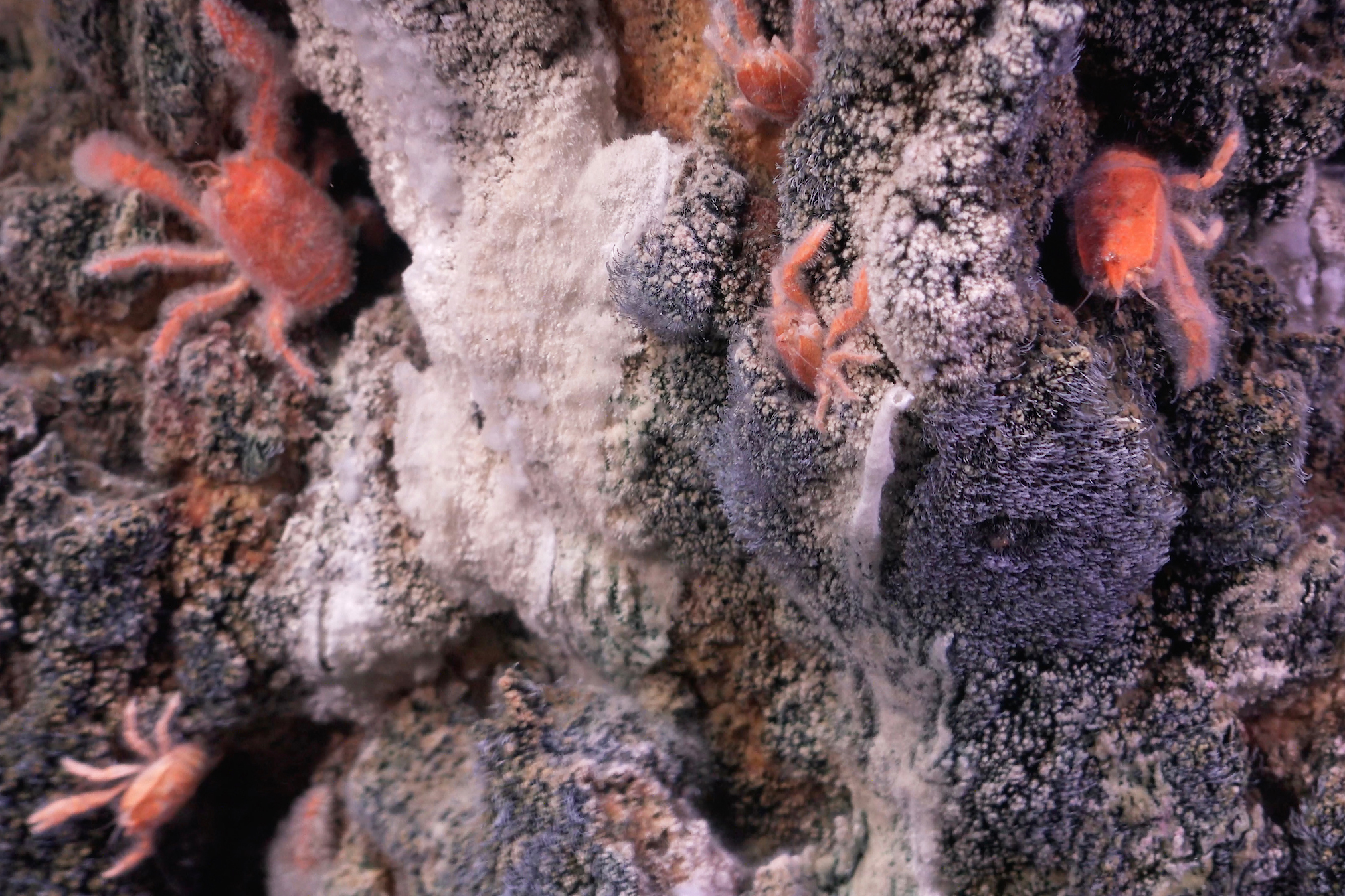
High Seas and Seamounts of the Nazca Ridge
July – August
From toadfish and amphipods to a Bathyphysa siphonophore, the underwater mountains comprising the Nazca and Salas y Gómez Ridges make this a region unlike any other place on Earth. Most of both ridges lie outside of any country’s jurisdiction — in the high seas — leaving these diverse and understudied ecosystems vulnerable to human exploitation from climate change, plastic pollution, overfishing, and potential deep-sea mining. Many experts in marine protection and policy believe that the Nazca and Salas y Gómez Ridges are a top priority for designation as one of the world’s first high-seas marine protected areas. Recent Schmidt Ocean Institute-supported expeditions to the region discovered over 150 suspected new species and several new seamounts. In the bordering oxygen minimum zone, scientists also found trace amounts of oxygen in an area where oxygen has historically been below the limit of detection; this discovery revised the understanding of microbes and nutrient cycling in OMZs.
To expand on these expeditions’ success and contribute vital data to inform future protections of these high seas areas, we will conduct an expedition co-led by Schmidt Ocean Institute Marine Technician Tomer Ketter and Executive Director Dr. Jyotika Virmani. The expedition will be a collaborative effort between Schmidt Ocean Institute, the University of New Hampshire Center for Coastal and Ocean Mapping Alumni, the Ocean Census, and an international contingent of scientists. The crew of Falkor (too) and the international science team will collect comprehensive seafloor mapping data and, using ROV SuBastian, characterize the biodiversity of life along several seamounts at the Nazca and Salas y Gómez junction. The team will also integrate and test several new pieces of equipment on the ROV, including a state-of-the-art channel oxygen logger called a mini Trace analyzer in situ logger, or mTail, a new camera with a 3rd-person view of SuBastian, and new specialized sampling jars.
Fire and Ice: Volcanic and Glacial Interactions
September
In 2008, the Chaitén Volcano erupted, spewing ash 30 kilometers into the air while lava flowed down the mountainside and into the fjords below. The nearby town of Chaitén evacuated as the volcano completely transformed the surrounding landscape. While the destruction was easy to observe on land, scientists have not yet closely examined the impacts the eruption had on the surrounding Ocean environments. Dr. Sebastian Watt of the University of Birmingham, UK, and an international team will travel to southern Chile to study the underwater effects of the Chaitén eruption.
The research will provide information on how active volcanism impacts the Ocean and marine ecosystem recovery following a major disturbance. Additionally, the team will examine the region’s geologic record of eruptions and how glacier formation and recession over time may contribute to eruption events. Their research will expand our knowledge of how volcanic activity affects marine ecosystems and the impact of large, explosive eruptions.
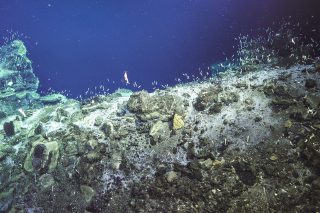
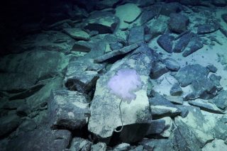
Canyons, Vents, and Seeps of the Chile Margin
October – December
 The region off the coast of Chile is a geologically dynamic environment. Under the Pacific Ocean, the Nazca plate dives under the South American plate, creating the Peru-Chile subduction zone. The interaction between these two plates creates numerous deep-sea environments like hydrothermal vents, methane seeps, and submarine canyons along an area known as the Chile margin.
While the presence of these deep-sea environments on the Chile Margin is known, they have been minimally explored and sampled due to limited access to advanced ocean technologies. Drs. Jeffrey Marlow (Boston University, US), Patricia Esquete (University of Aveiro, Portugal), and Eulogio Soto (University of Valparaiso, Chile) have combined their scientific strengths to assemble a truly interdisciplinary and international team to map, sample, and characterize the deep-sea ecosystems along the coast of Chile. Through this work, they hope to locate new methane seeps and hydrothermal vents and almost certainly discover new species. Their characterization will aid in better understanding and management of Chile’s deep-sea ecosystems.
Climate Connections at the Ice-Sea Interface
January 2025
In austral summer, the Antarctic ice sheet recedes, allowing scientists to map and study parts of the seafloor typically covered in ice. One region in Antarctica that has been minimally mapped and studied is the waters surrounding the Antarctic Peninsula in the Bellingshausen Sea. Drs. Patricia Esquete (University of Aveiro, Spain), Alexsandr Montelli (University of Cambridge, UK), and Eulogio Soto (University of Valparaiso, Chile) will travel to this poorly charted region to obtain the area’s first high-resolution maps. These maps and R/V Falkor (too)’s high-performance computing system will aid in studying ice-sheet melt dynamics and their impact on the Earth’s climate.
The science team will additionally examine seafloor features carved into the continental shelf by glaciers over time while studying the intricate ecosystems living at the interface between ice and sea. Their research will provide critical insight into the stability of the Antarctic ice sheet, affiliated deep-sea ecosystems, and how these systems will be impacted by climate change.