Benthic landers, shipboard mapping, and ROVs give underwater views of the seafloor, but aerial remote sensing platforms provide another vantage point for finding evidence of seafloor processes like seeps.
Dr. Ian MacDonald and the ECOGIG team have collected and analyzed imagery from satellites and airplanes to document the oil spill and natural seep oil slicks in the Gulf of Mexico. Ian has been collaborating with the environmental non-profit On Wings of Care to conduct aerial surveys of the region. Founder Bonny Schumaker, a retired physicist from NASA, lends her experience as a pilot and her interest in helping scientists have ready access to customized planes for this type of research.
Dr. MacDonald had planned an aerial overflight with On Wings of Care to overlap when R/V Falkor would be working in the region of the Macondo wellhead blowout. Favorable weather conditions continued while we worked in this area, allowing the plane to fly over R/V Falkor as scheduled after the ROV dive yesterday at the site of benthic lander.
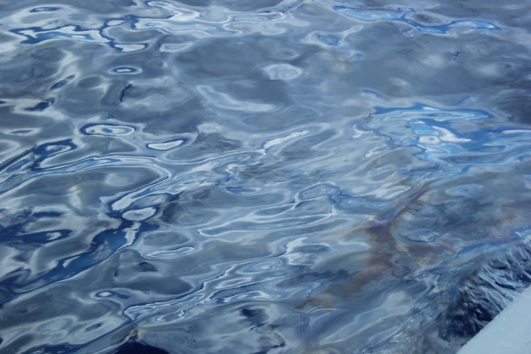
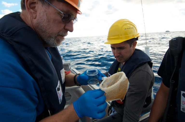
It was a fortuitous plan. Bonny called the ship right away to report that she could see surface oil slicks from the plane that we could not see from the ship. Dr. Ian MacDonald quickly mobilized sampling gear and graduate student Mauricio Silva to load the workboat which was launched for action. It was not easy to see the oil without the help of Bonny guiding us to the slick via communications from her plane to our boat over marine radio. When we reached the patch, Ian and Mauricio skimmed the water with special collection nets that quickly turned brown with the oily residue. I could see a rainbow sheen on the water with some effort between breaking waves and rising winds. I worked to photograph the oil, the samples, and the GPS readings on the boat as the sampling continued. Bonny made several more passes overhead and guided us towards another slick. We filled several sample containers and returned to the ship.
The science team was keen to dive the ROV this morning to investigate. The mapping efforts of the past several nights revealed evidence of possible seafloor seeps that might be the sources of the slicks seen on the surface. The hope was to find the gas seep, collect push core sediment samples with the ROV, and compare the samples with the material collected at the surface yesterday. This is easier said than done. The ROV flew transects across the bottom in search of the plumes but none were found.
The team also spent some time using the ROV to determine an exact location for the next benthic lander deployment. This also proved challenging as numerous pieces of debris and cables on the seafloor made it a precarious location to operate the ROV. But this didn’t deter the team from making sample collections where possible and continuing their studies.
After sunset the ship sailed southwest for a 12-hour transit to the natural seep site where a second benthic lander has been collecting data since April. The weather deteriorated along our journey, bringing strong winds and swells against the ship. Everyone had to ensure that loose items were secured as the ship began to rock and roll.