Underwater mapping leads to discovery of seamount two times taller than Burj Khalifa
Images available here
Los Angeles, CA – Seafloor mapping during a Schmidt Ocean Institute expedition has revealed an underwater mountain twice as high as the Burj Khalifa, the world’s tallest building, in international waters off Guatemala.
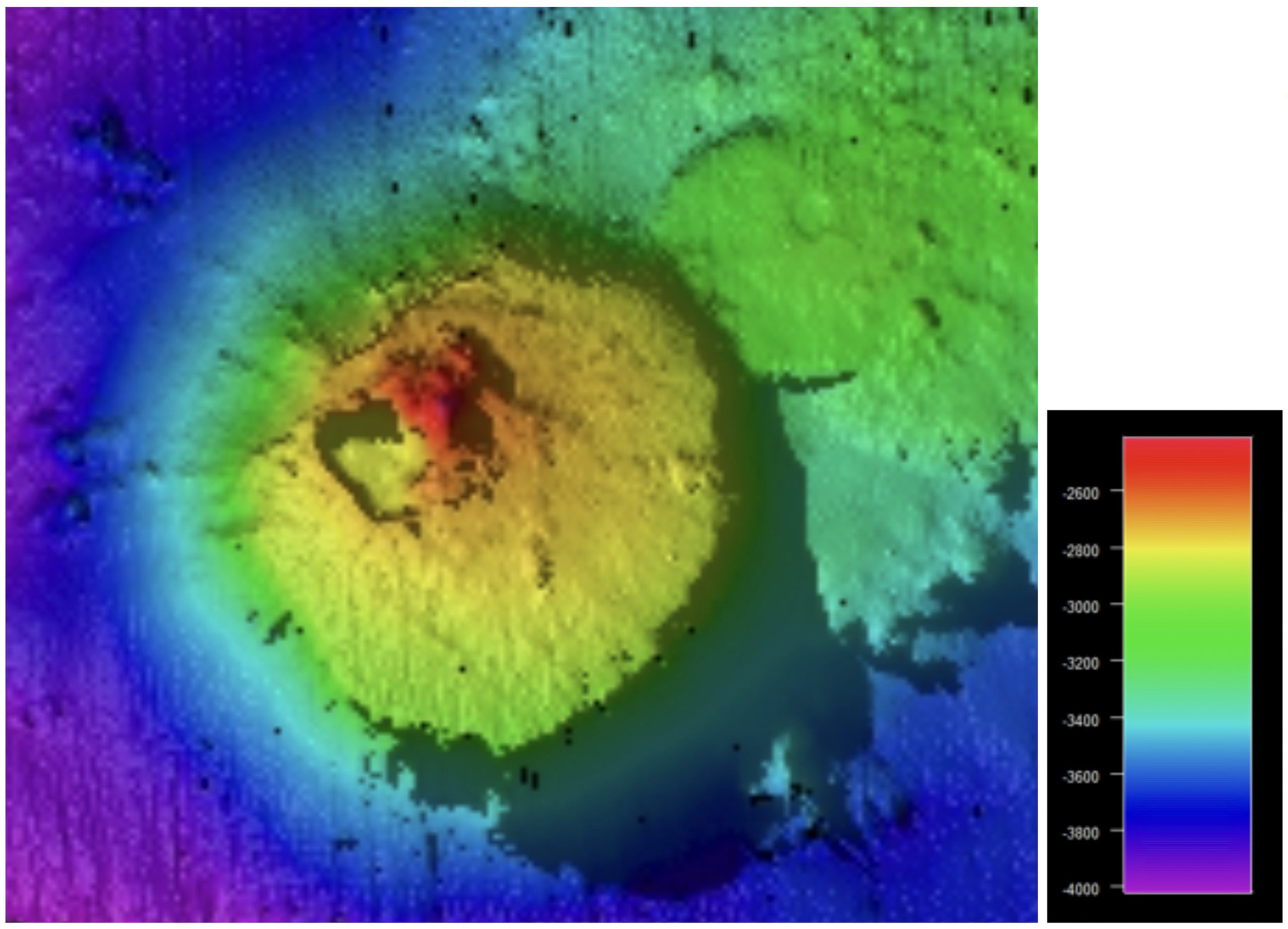
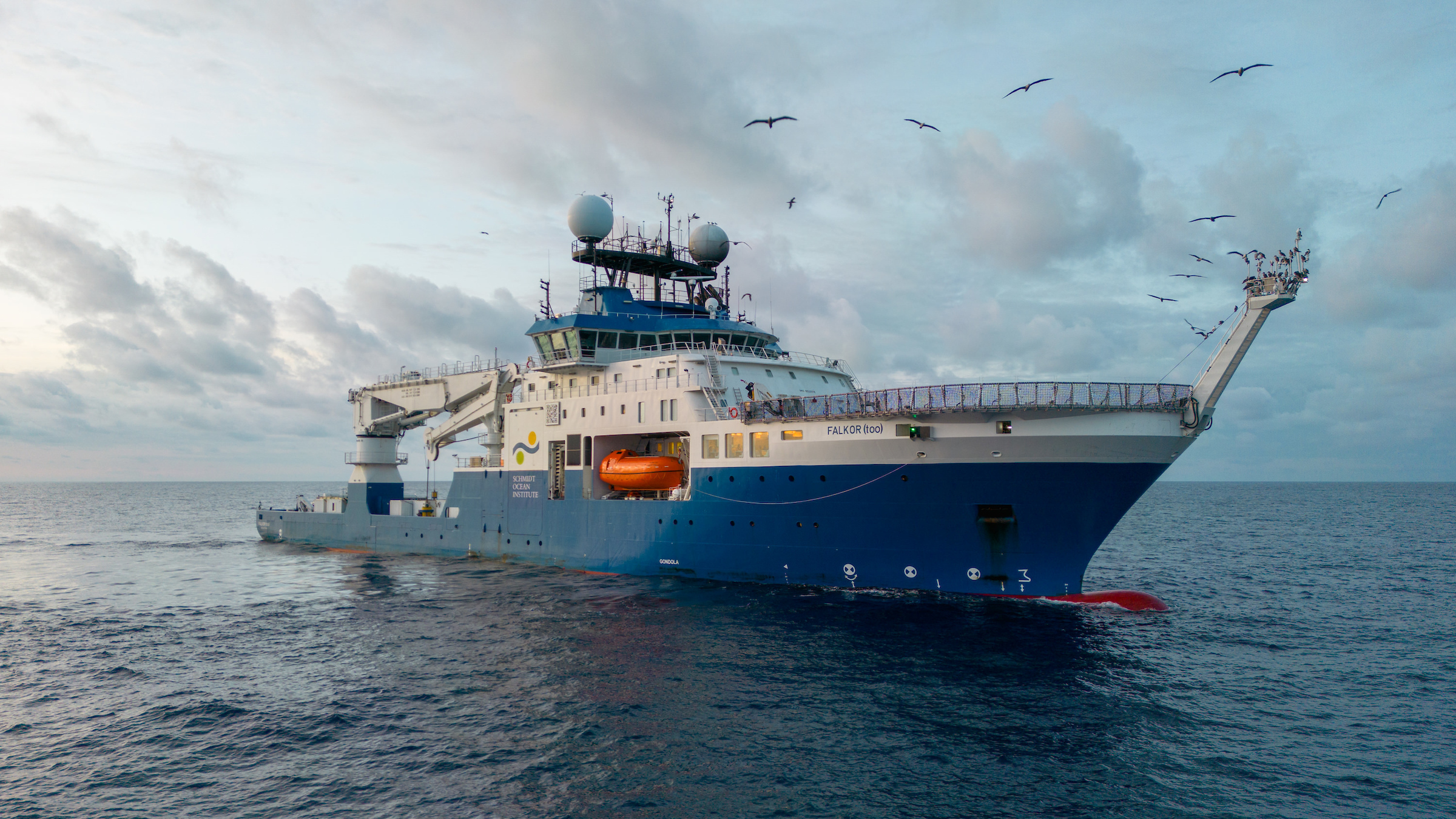
The 1,600-meter (5,249-foot) seamount covers 14 square kilometers and sits 2,400 meters below sea level. Using the EM124 multibeam echosounder on Schmidt Ocean Institute’s exploration and research vessel Falkor (too), the seafloor feature was discovered 84 nautical miles outside the Guatemalan Exclusive Economic Zone during a six-day crossing this summer from Puntarenas, Costa Rica, towards the East Pacific Rise. The Schmidt Ocean Institute on-board crew included a GEBCO-trained hydrographic expert, who confirmed that the seamount is not in any seafloor bathymetric database.
This marks the ninth seafloor discovery since the research vessel Falkor (too), was launched in March. Discoveries have included two additional uncharted seamounts in the Galápagos Islands Marine Reserve, three new hydrothermal vent fields, a new ecosystem underneath hydrothermal vents, and two pristine cold-water coral reefs.
“On every expedition, those aboard Falkor (too) have found the unexpected, the awe-inspiring, the new,” said Wendy Schmidt, co-founder and president of Schmidt Ocean Institute. “While there is so much we’ve come to understand as discoveries tumble ever faster into view, so much remains unknown in our Ocean–and we are thrilled to continue exploring.”
Seamounts are biodiversity hotspots, providing surfaces for deep-sea corals, sponges, and a host of invertebrates. According to NOAA Ocean Exploration, recent satellite-based estimates indicate there are more than 100,000 unexplored seamounts taller than 1,000 meters. With continued exploration and mapping of the deep sea, more accurate and higher-resolution maps will guide scientific research and future discoveries, while offering an improved understanding of geological processes.
“A seamount over 1.5 kilometers tall which has, until now, been hidden under the waves really highlights how much we have yet to discover,” said Dr. Jyotika Virmani, executive director of SOI.“ A complete seafloor map is a fundamental element of understanding our Ocean so it’s exciting to be living in an era where technology allows us to map and see these amazing parts of our planet for the first time!”
Mapping and exploring unknown areas of the seafloor is an essential element of understanding our planet. Since 2013, Schmidt Ocean Institute has mapped 1.44 million square kilometers of seafloor, discovering more than 20 underwater features. As of 2023, a map of almost 25% of the seafloor at a 100-meter or higher resolution is available.
“Yet another breathtaking discovery by the team onboard Falkor (too),” said Jamie McMichael-Phillips, director of the Seabed 2030 Project. “We are hugely grateful to all at SOI for sharing essential information that will move us further towards our goal of delivering 100% seafloor mapping by the end of the Decade.”
Schmidt Ocean Institute is a partner in the Seabed 2030 initiative led by the Nippon Foundation and the General Bathymetric Chart of the Ocean (GEBCO). Seabed 2030 and partners are accelerating ocean mapping efforts and working towards the ambitious goal of mapping the entire seafloor by 2030. The absence of detailed underwater topography, or bathymetric data, hinders the ability to safely navigate vessels at sea, manage marine resources sustainably, and safeguard coastal communities.
About the Organization
Schmidt Ocean Institute was established in 2009 by Eric and Wendy Schmidt to catalyze the discoveries needed to understand our ocean, sustain life, and ensure the health of our planet through the pursuit of impactful scientific research and intelligent observation, technological advancement, open sharing of information, and public engagement, all at the highest levels of international excellence. For more information, visit www.schmidtocean.org.
The Nippon Foundation-GEBCO Seabed 2030 Project (Seabed 2030) is a pioneering initiative accelerating ocean mapping efforts. We are a global community working with partners across industry, governments, research, philanthropy, NGOs, and civil society to achieve a complete map of the entire seabed by 2030. For more information, visit seabed2030.org.
# # # #