A conversation with Schmidt Ocean Institute 2024 Artist-at-Sea Jill Pelto

Artists enable people to see the Ocean in new ways, illuminating the beauty and complexities inherent in our planet’s life support system. Schmidt Ocean Institute’s Artist-at-Sea program, established in 2015, explores the intersection of science and art by embedding artists in deep-sea expeditions. One artist is selected to work across disciplines and practices by joining the crew and science teams to explore, research, create, and discover using the Institute’s state-of-the-art Research Vessel Falkor (too) as a platform for discovery.
In September, 2024 Artist-at-Sea Jill Pelto joined the Fire & Ice: Volcanic & Glacial Interaction expedition led by Dr. Sebastian Watt, University of Birmingham, UK. Pelto is an artist and science communicator based in Washington. She was intrigued by the opportunity to study the underwater effects of a 2008 volcanic eruption that dramatically transformed the landscape and lives of the people of Chaitén, Chile.
She was eager to create art inspired by regional history and explore the science team’s research, tracing volcanic impacts from land to sea. For Pelto, research that reaches distant communities recovering from catastrophic disasters can serve as a symbol of renewal and ecological connectedness. We sat down with her to discuss how joining the expedition has influenced her creative practice and unearthed new perspectives. The following conversation has been edited for brevity.
Tell us a little bit about your time at sea.
The experience of getting to be immersed in an environment full-time like this is so rare and special. Being on the ship for a few weeks, surrounded by the science team and the Falkor (too) crew, was an amazing experience. Stepping out of daily life for a chunk of time shapes you moving forward, and I feel connected with the Ocean. My science experiences have been land-based. Since the expedition, my path has taken me to projects involving topics about marine life and changes in ocean dynamics. This opportunity just opened a new window for me on another part of the world I hadn’t experienced, and that’s what I’m taking forward into ocean-inspired art pieces.
What drew you to creative storytelling and data visualization?
When I was still a student, I was constantly around data: creating graphs and learning about existing ones. I have always had one foot in the art world and one in the science world. And although I put it that way, I don’t see them as separate fields, but as overlapping ones. I have a Master’s degree in climate science and have done science fieldwork worldwide. Now, I do art and science communication work full time.
To me, data tell a story, often about a change over time. Graphs can communicate a great deal, but many people don’t see that. Many don’t see the data in their daily lives. I am interested in incorporating data to tell stories because I can see and feel what they share about the world. To me, this information contains emotion. In my art, I try to translate that through visuals, through colors and patterns. I hope to make complex topics more accessible, such as the seafloor mapping and sampling during my time on the Falkor (too). I wanted to show people the research — what the mapping results looked like, how the sediment cores looked. Lastly, I wanted them to see the place and its overlapping scientific and cultural stories.
You incorporate the environment from local to global, from the landscape to the Ocean. Can you elaborate on how the weather and the environment play into your work?
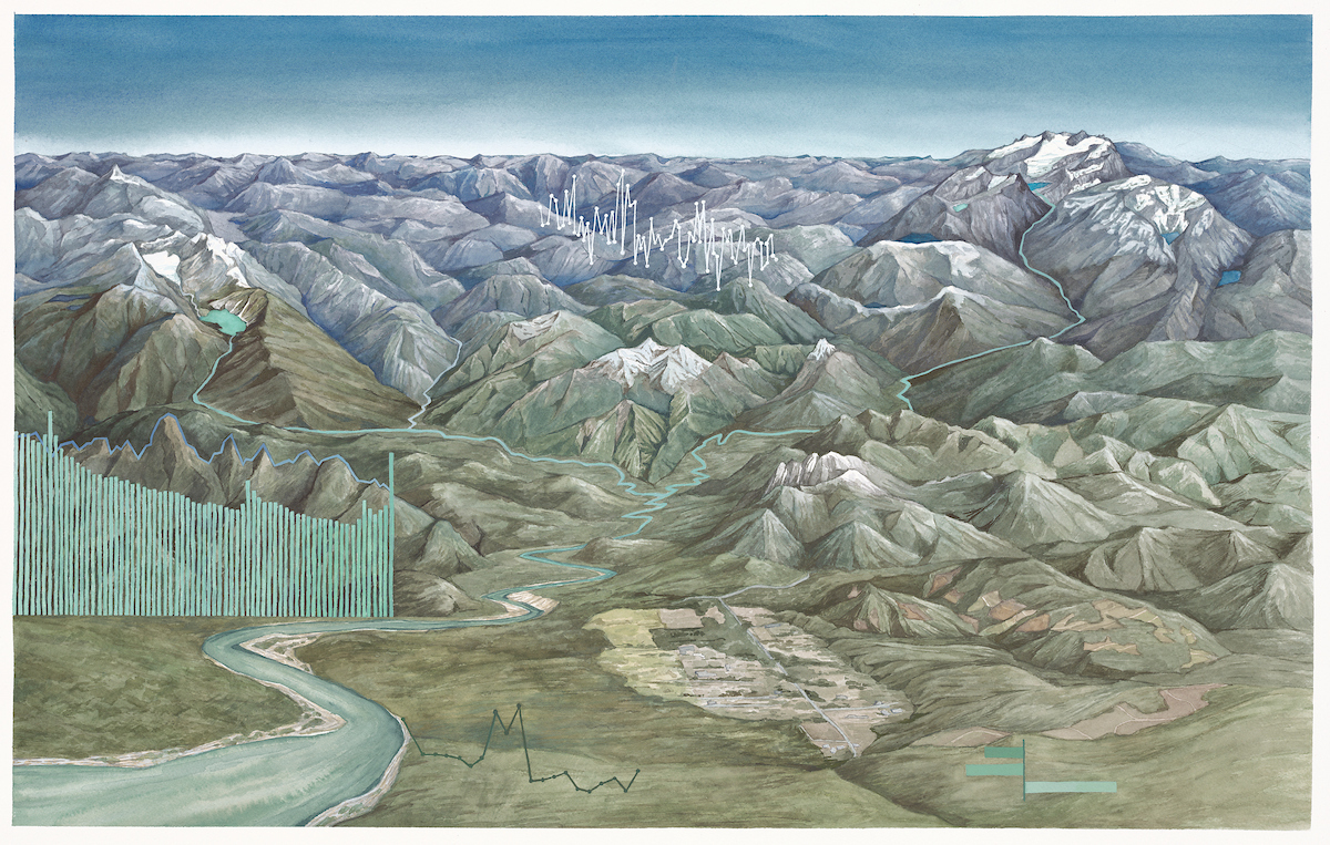
My goal is to help people connect to the landscapes I’m communicating about, whether it’s a place I have spent time in or not. As an artist-at-sea, I can physically be in the space I’m creating work about; it is so much more inspiring for me. I only occasionally create landscape paintings. Instead, I include landscape elements that someone might not always see, such as views of the seafloor from different perspectives. I want to highlight something about the environment that might be around us, but that we can forget, or that I want people to learn more about, or to see in a different light. For example, I am working on two paintings right now that are about mountain glaciers in Washington and how the glacier meltwater feeds into large river systems that eventually flow into the Ocean. My art can give people in this community a new perspective. That is my goal: to use art to make people feel things about these environments, whatever they may be.
What was the most memorable experience as an artist-at-sea?
To be present and take everything in, I balanced learning about the research, connecting with all the new people, creating art, and exploring the ship. It’s full on, and I love focusing on the expedition and how I could use my paintings to tell stories about it. My most memorable experience was painting in the lab where the science team processed all their samples. I had a little space on a table set up for the whole expedition. They looked for volcanic deposits in sediment cores, foraminifera under the microscope, and marine life in sample bags from the ship’s remotely operated vehicle, SuBastian. It was incredible to make art in the space, soaking everything in and putting that into my art, and being able to ask questions to folks with such a wide range of expertise.
Could you tell us about the pieces and how they developed from your time on the Falkor (too)?
I created four pieces about the Falkor (too), three of which are now part of the Schmidt Ocean Institute Artist-at-Sea collection. For the first piece, I wanted to capture how the science team worked. “Beneath the Falkor (too)” shows how water and sediment samples are collected from the ship, and some of the data measured throughout the water column: temperature, salinity, and fluorescence, which correlate to where phytoplankton is within the water column. The yellow device near the seafloor is the ship’s remotely operated vehicle, or ROV. From the safety of the ship, experienced pilots fly the car-sized robot, which is tethered to Falkor (too) and capable of diving to 4500 meters deep.
My next two paintings were meant to capture some of what the science team was finding with sampling and mapping. “Seafloor Sediment” shows some of the actual sediment cores taken, highlighting the variety of sediment types, things like volcanic ash, mud, sand, and gravel. These are needed to begin to understand past processes and climate in a region. The team was most interested in finding ash to learn about volcanic history in this region, in particular the eruption of Chaitén Volcano in 2008. The blue lines next to them are scaled according to the water depth at which they are taken.
The third piece, “Landforms and Layers,” shows the beautiful results of the mapping, which is constantly being done aboard the Falkor (too), and in a myriad of ways. The colorful image at the top of this piece represents a bathymetric map, which shows seafloor features from above; cooler tones represent a greater depth. This map is an area near Chaitén, Chile, where most of the research for this expedition was based. The marks approximately represent the five locations of the mapping shown below. These are sub-bottom profiles; in other words, they offer a side view of the layers beneath the seafloor, going down about 40 meters below. The layers are indicated by the lines and help determine features such as deltas, landslides, dunes, and moraines. The combination of bathymetric mapping and sub-bottom profiles is crucial for understanding the history of this region and helping the research team determine where to take sediment cores. There are so many stories I could still tell about the expedition work, but I wanted to highlight some unique and technical things that people may not see or know about this type of research.
You gave one of your works to the Chaitén Museum. A massive 2008 volcanic eruption devastated Chaitén, Patagonia, profoundly influencing your work and creative process. Can you tell us more about this?
One of my primary research focuses was on the 2008 volcanic eruption that nearly destroyed the entire remote town of Chaitén. It changed the whole river system and coastline. Over 15 years later, the damage is still evident. I wanted to create one painting where the expedition science could be viewed as part of the story of this place and its people. I combined this into a story about the town, the spirits of the volcano, and the Ocean — which many Mapuche people believe in — and the stories of change and restoration that have occurred since the eruption.
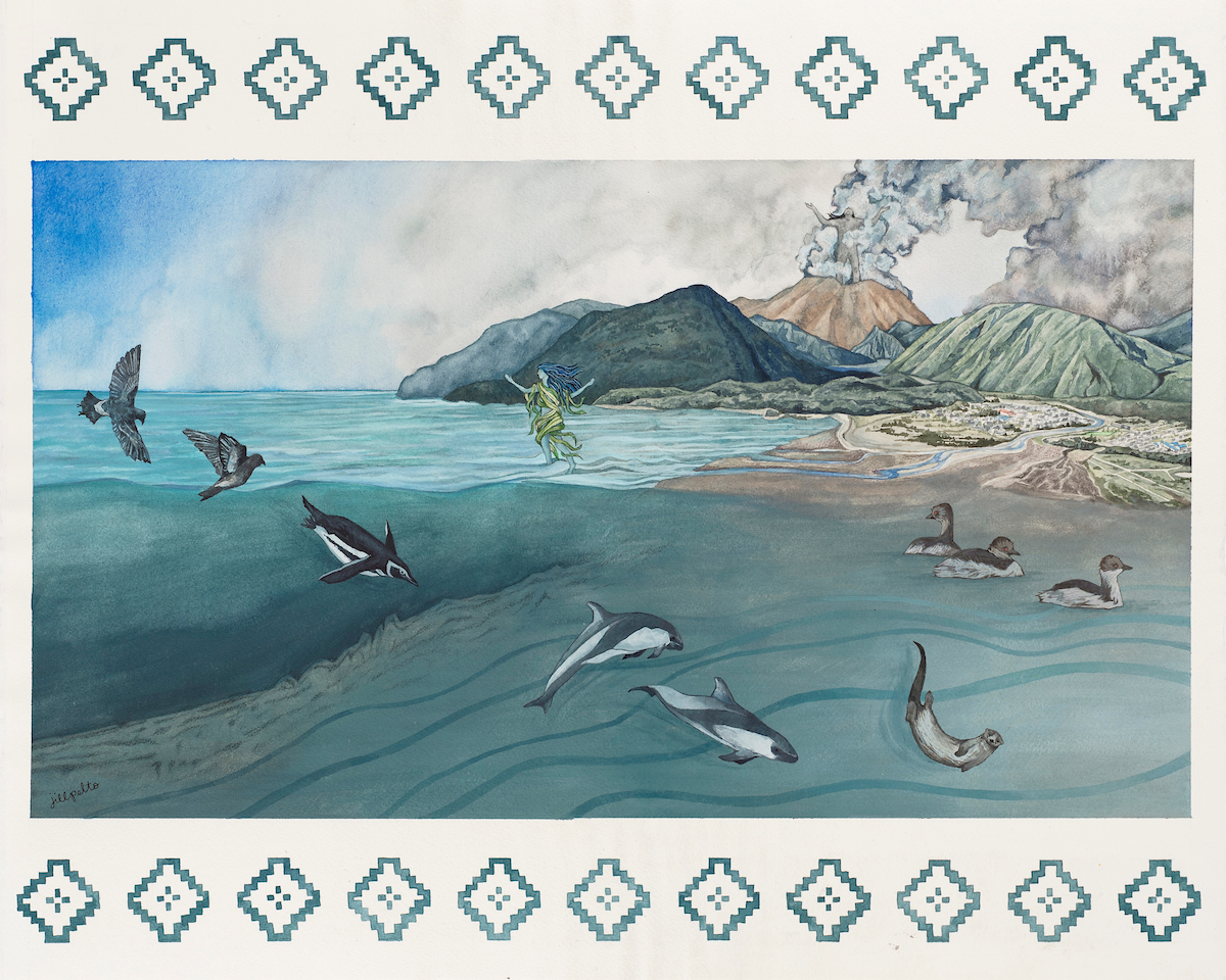
While on board, I collaborated with Rodrigo Fernandez, a Chilean geologist, and Danny Leviñanco, a local teacher. They coordinated to bring students and teachers from six remote island schools on board to learn about the work. This was so impactful for these communities. It led me to create a plan for a piece that includes cultural aspects and stories, which I donated. Contributing my work is a small way I can give back to the region, which inspired the whole concept of this science cruise. I also made prints of the piece, so I can donate a copy to each of the schools in the region.