Schmidt Ocean Institute reconstructs the bow of R/V Falkor (too), adds a high-performance Autonomous Underwater Vehicle (AUV) to its advanced technology suite, and reaches a major milestone: 2 million square kilometers of seafloor mapped to date.
Video and photos available here.
Palo Alto, California, USA — Schmidt Ocean Institute announces it has mapped 2 million square kilometers of seafloor — about the size of Greenland — and this year, has made two significant changes to advance the seafloor mapping capabilities of R/V Falkor (too): it radically changed the shape of the ship’s bow and added the gold standard of Autonomous Underwater Vehicles (AUV) to its technology suite.
“There has always been a commitment from our organization to continuously improve what we can provide to the scientific community,” said Schmidt Ocean Institute’s Senior Director of Maritime Infrastructure, Eric King. “We moved quickly to make these latest changes in response to lessons learned in our first two years of expeditions aboard R/V Falkor (too), and we have never been better positioned to provide the best quality data to scientists around the world.”
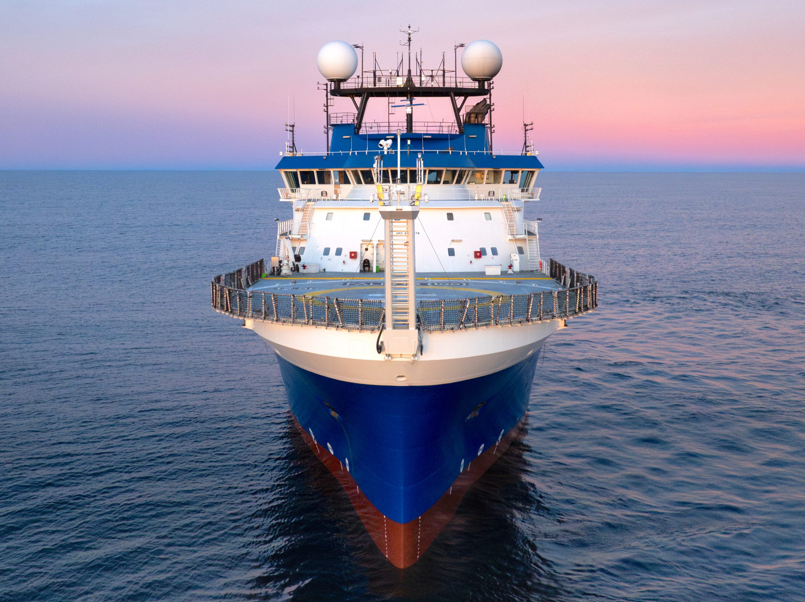
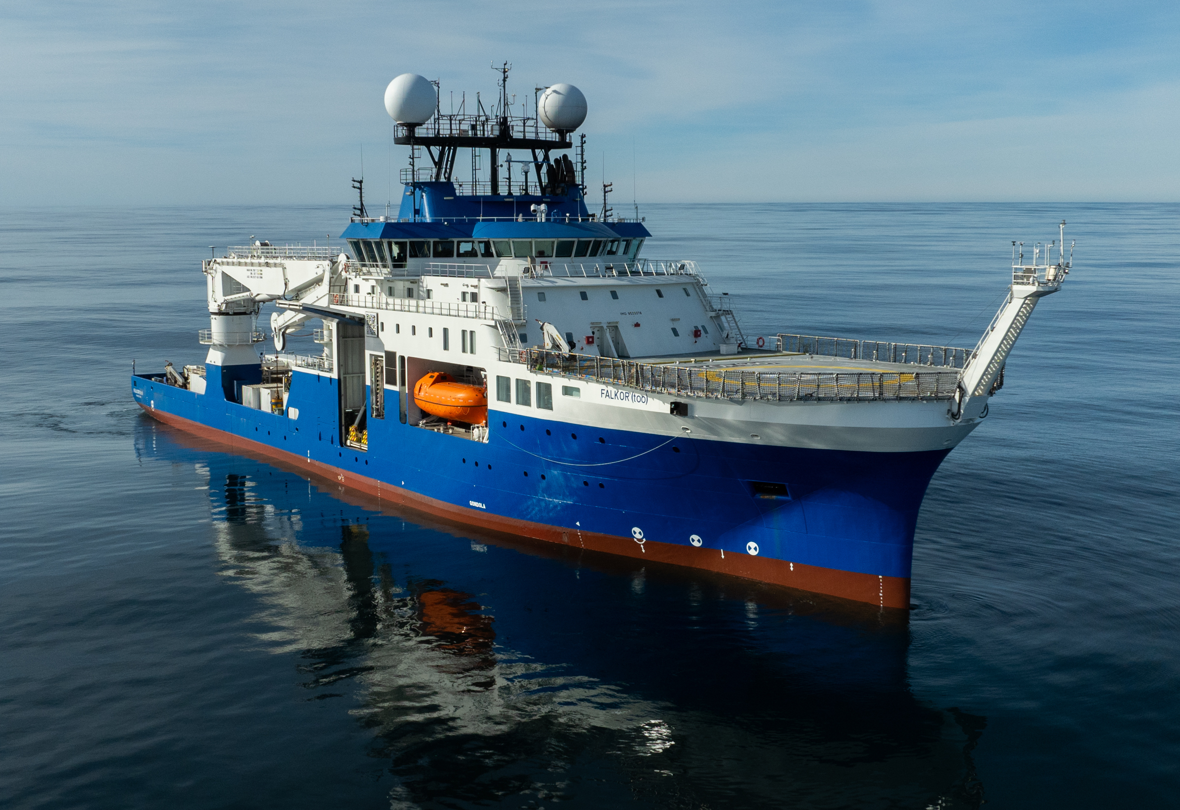
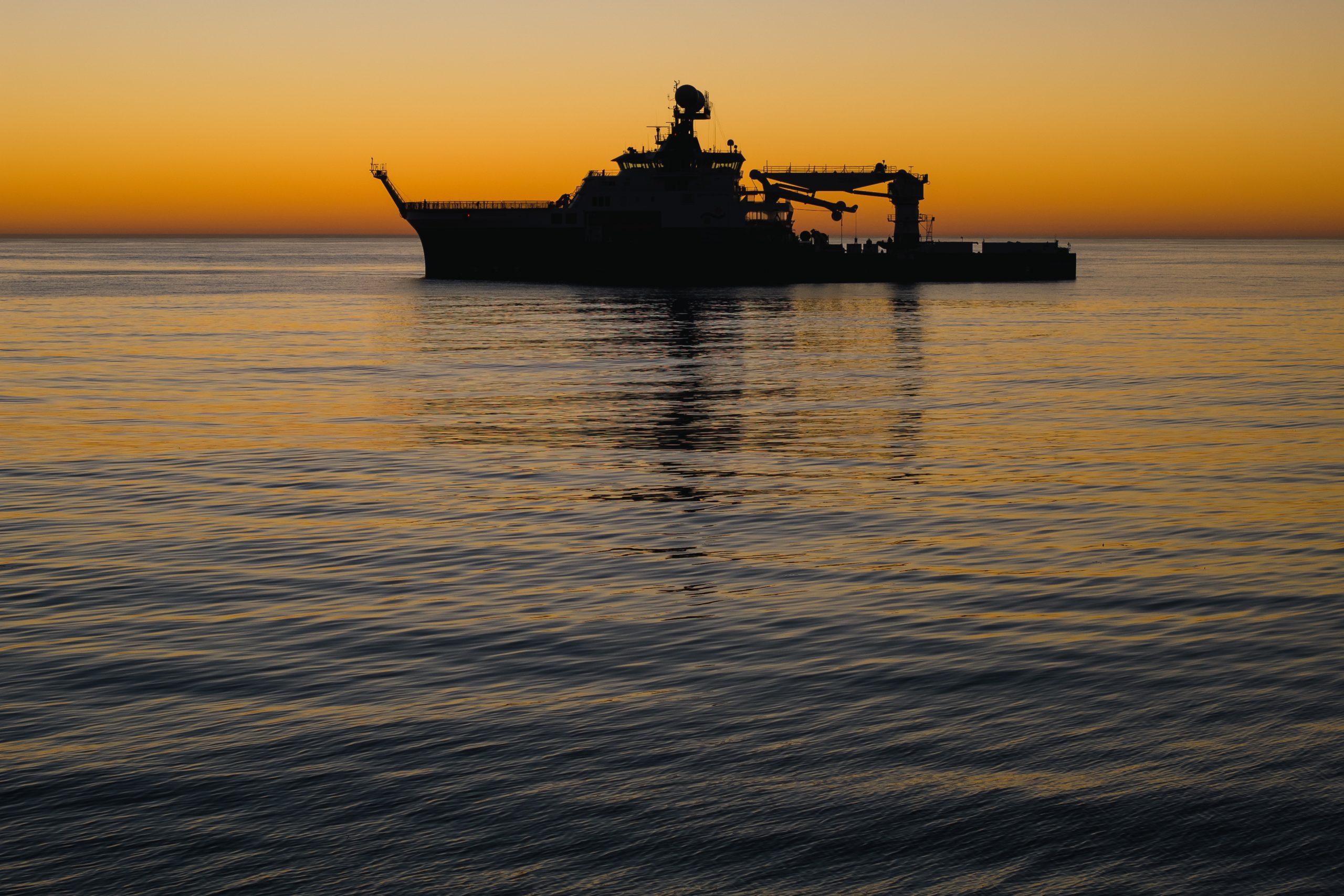
Over a two-month dry dock period (28 April – 28 June) in Talcahuano, Chile, the team reconstructed the bow of R/V Falkor (too), transforming it from a bulbous bow more common on offshore commercial vessels into a streamlined, V-shaped bow optimized for science missions. The new bow significantly improves the precision and reliability of the ship’s sonar systems in capturing high-quality mapping data, even in challenging weather conditions. It can now capture high-resolution data in 6-11 knots (~7-13 mph) and in swells exceeding three meters.
R/V Falkor (too)’s new bow helps to eliminate bubbles from interfering with the ship’s sonars and sensors, which proved challenging with the previous bulbous bow— an aspect of the original MV Polar Queen vessel design that assisted in faster transits across the ocean. Seafloor maps are created using multibeam sonar technology, which sends sound from the vessel to the seafloor. Scientists, especially hydrographers, use the time it takes for the sound to travel between the ship and the seafloor to calculate the depth, creating a bathymetric map and revealing seafloor features like underwater mountains and canyons.
“Reconstructing the bow was a massive undertaking and a clear demonstration of Schmidt Ocean Institute’s commitment to advancing oceanography. The shipyard period required dedication and hard work from teams across the entire organisation, including our fantastic crew,” said Captain Peter Reynolds of R/V Falkor (too). “The result is the ability to collect higher-quality sonar data at greater speeds. Combined with our new AUV, this significantly enhances our scientific capability during our expeditions.”
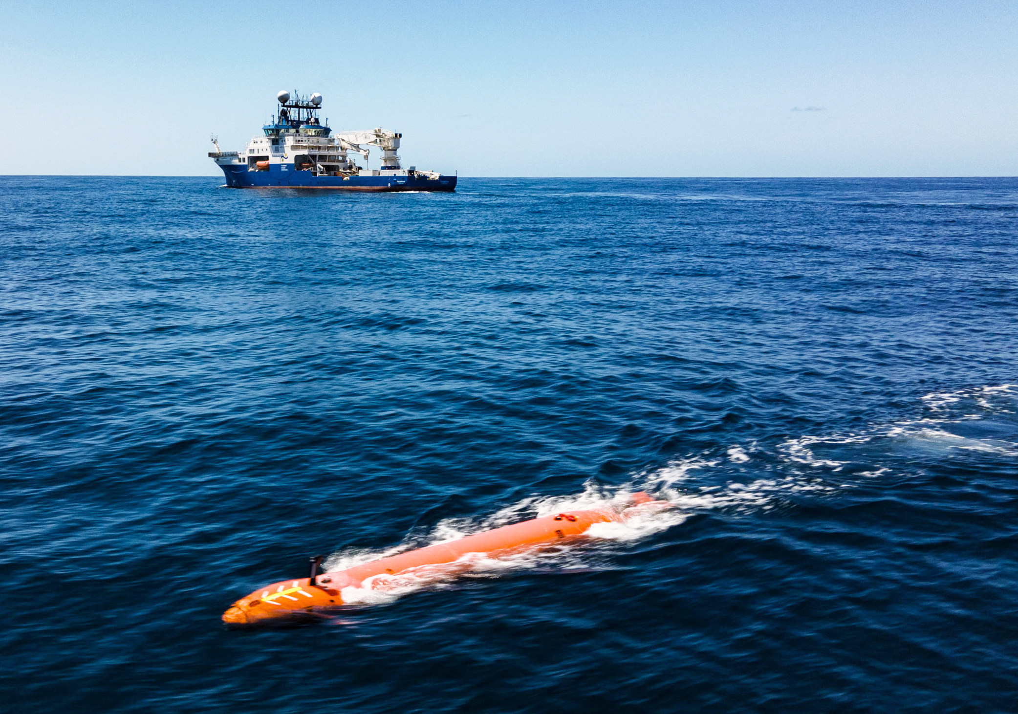
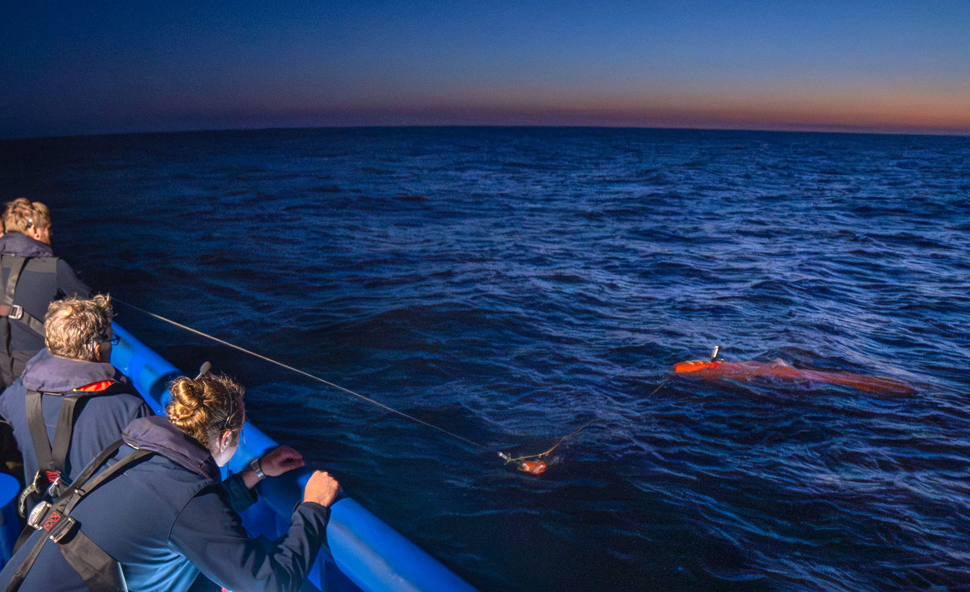
The state-of-the-art Kongsberg Hugin Superior AUV, called The Childlike Empress, can operate to depths of up to 6000 meters and stay in the water for up to 72 hours — offering access to 98% of the ocean floor, with the exception of the deepest trenches. The organization’s ROV SuBastian can operate in waters up to 4500 meters. The AUV, the most adaptable and advanced commercially available vehicle, will be mission-ready by mid-2026 after additional training and field tests.
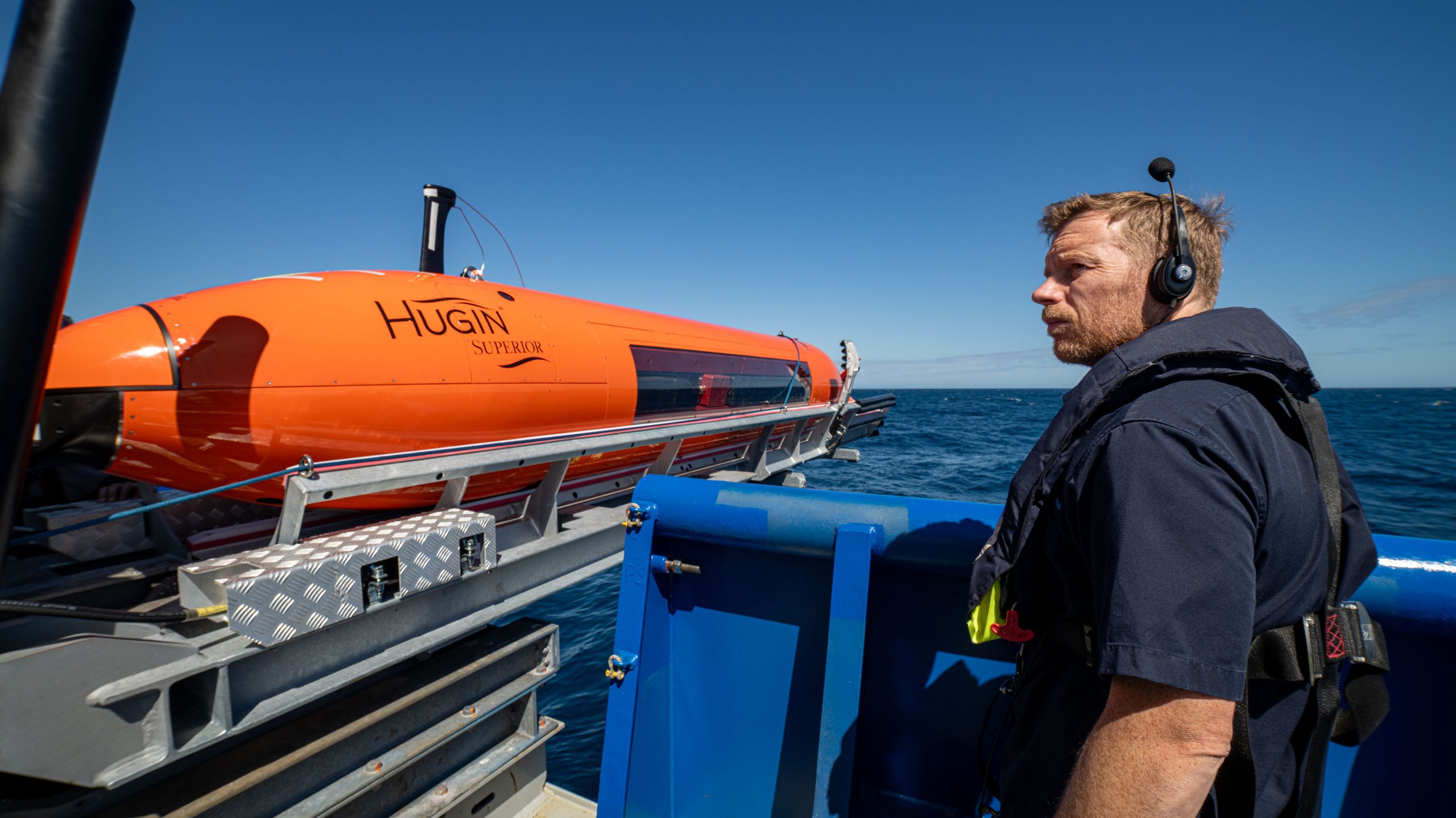
“The Childlike Empress is a game-changer for scientific mission planning,” said Schmidt Ocean Institute’s Engineering Senior Manager, Jason Williams. “Where once it could take weeks to locate intriguing seafloor features like hydrothermal vents, we can now identify areas of interest within a day, accelerating our knowledge of the global ocean.”
The AUV has many sonars and sensors, including a traditional multibeam system, sub-bottom profiler, a magnetometer; oxygen, methane, and dissolved carbon dioxide sensors; a conductivity, temperature, depth (CTD) sensor; imaging system; and Synthetic Aperture Sonar (SAS). Where multibeam systems collect data at resolutions of 1-50 meters (depending on the depth and type of sonar), SAS can collect data every 25 centimeters (2 feet), achieving much higher resolution, producing some of the clearest seafloor images. These maps help pinpoint the exact locations of hydrothermal vents, shipwrecks, and other interesting seafloor features.
The AUV can house additional sensors and imaging equipment and is adaptable to the scientists’ needs, Williams said.
Seafloor mapping is critical for improving our understanding of ocean ecosystems, resource management, safe navigation, and more. Just over 70% of the ocean floor remains unmapped.
“Schmidt Ocean Institute is committed to several global initiatives, and is a partner of the Nippon Foundation – GEBCO Seabed 2030,” said Schmidt Ocean Institute’s Executive Director, Dr. Jyotika Virmani. “We have contributed 2 million square kilometers to the global seafloor map, and with The Childlike Empress AUV and our new bow, we are better equipped to contribute to the global effort to map the seafloor and speed up the pace of ocean discovery.”
About the Organization
Schmidt Ocean Institute was established in 2009 by Eric and Wendy Schmidt to catalyze the discoveries needed to understand our ocean, sustain life, and ensure the health of our planet through the pursuit of impactful scientific research and intelligent observation, technological advancement, open sharing of information, and public engagement, all at the highest levels of international excellence. For more information, visit www.schmidtocean.org.