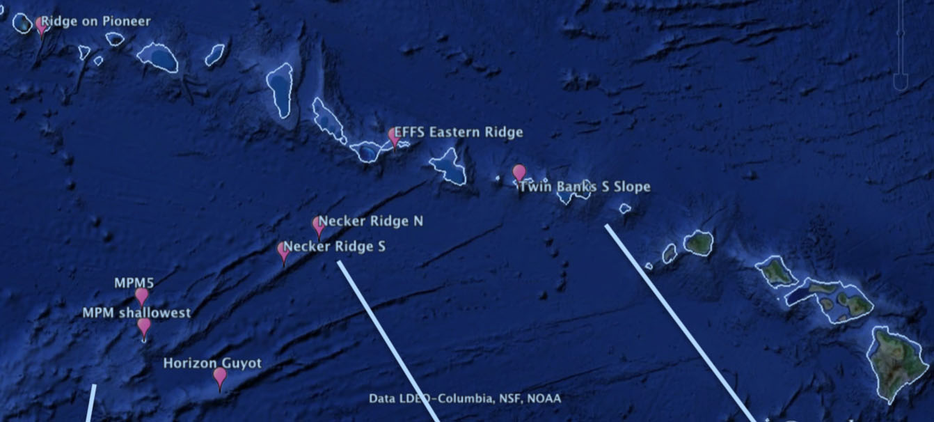
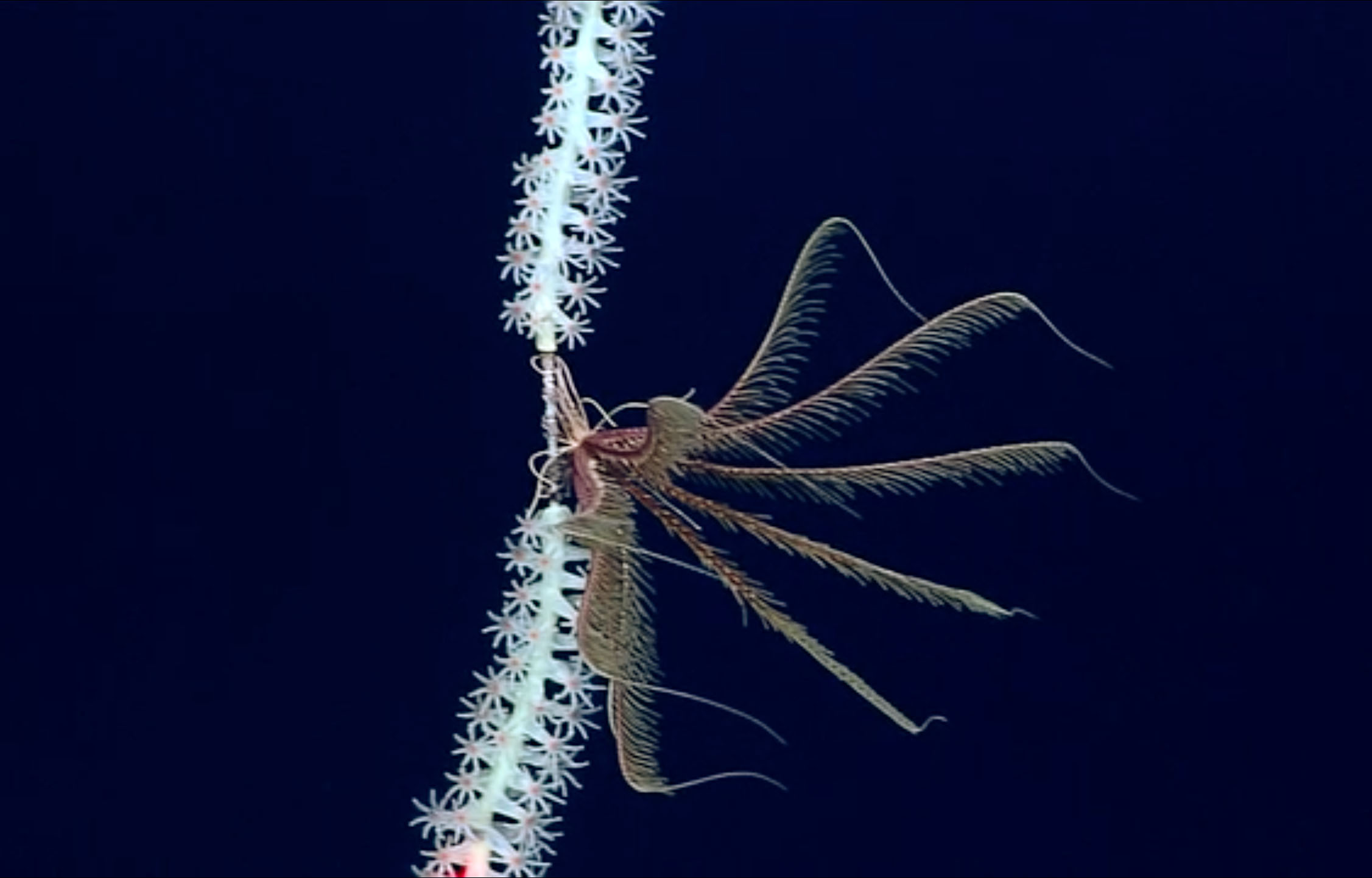
A largely unexplored area containing the central and western Pacific (CWP) seamounts is targeted for deep-sea, cobalt-rich, manganese crust mining. The nearest marine reserve to these seamounts, Papahanaumokuakea Marine National Monument, is also the world’s most isolated chain of islands, and a main feature of the Hawaiian Ridge. Consisting of seamounts, atolls, islands and reefs on the northern Pacific Ocean’s seafloor, the Hawaiian Ridge is dominated by deep-sea octocorals. Necker Ridge is a 600 km-long feature constructed of a series of stacked, thick (200–400 m) volcanic flows, and is the primary feature connecting the Hawaiian Ridge to the CWP. A preliminary survey of Necker Ridge revealed that undersea life is not consistent along this line: crinoids dominate areas in the southern end, but octocorals are more common across the north. Researchers guess that the cause could be due to environmental parameters or differences in larval supply, but they are not sure why the difference is occurring.
Bridge or Barrier?
Led by Dr. Amy Baco-Taylor from Florida State University, the science team will aim to gain insight into CWP seamount lifeforms and distribution, while examining the role of Necker Ridge as a stepping-stone (or blockade) to other parts of the Pacific. They will gather imagery and samples of the seafloor biology while exploring Necker Ridge and nearby structures of the Northwestern Hawaiian Islands and the CWP.
The scientists have been to Necker Ridge before. Their previous survey gave them an idea of the life on and around the feature, but this first study did not allow them to fully test whether Necker is a gateway or impediment: they were only able to survey a small depth range and do not have samples from the seamounts. This time, the science team will test the role of Necker Ridge as a stepping-stone and begin to gain a picture of the CWP seamount fauna.
Planned Approach
Surveys will be used to assess the fauna of three sets of features: the seamounts in the Northwestern Hawaiian Islands, the Necker Ridge, and seamounts of the Mid-Pacific Mountains. The surveys will be done at the same depths on each feature, and target similar geological areas. Using the ROV, the team will gather biological samples from each feature, as well as other environmental data such as CTD measurements, water samples, current information, substrate facts (such as substrate type, slope and rugosity) and video.
Imminent Human Influence
The recent onset of active CWP leasing makes it is imperative to gain baseline knowledge of the fauna of the seamounts. This environmentally-focused research is relevant as it will test for connectivity to the protected Papahanaumokuakea Marine National Monument. Besides trawling and mining, broad-scale anthropogenic impacts such as ocean acidification will affect even remote areas of the world’s oceans. This examination will contribute to the understanding of the potential impact of ocean acidification on corals and other ecosystems.
Activity conducted under Permit #: PMNM-2019-016
Credit to: Papahanaumokuakea Marine National Monument, US Fish & Wildlife Service, Department of Interior
Header image caption: Cobalt-rich Ferro-Manganese crust with batraoidal (bubbly) appearance characteristic of older, thicker deposits. More information here.


