Scattered along the barren ocean floor lie uncounted hydrothermal vent sites—oases of hot, chemical-rich, life-nurturing fluids. These oases are a submarine version of Yellowstone National Park.
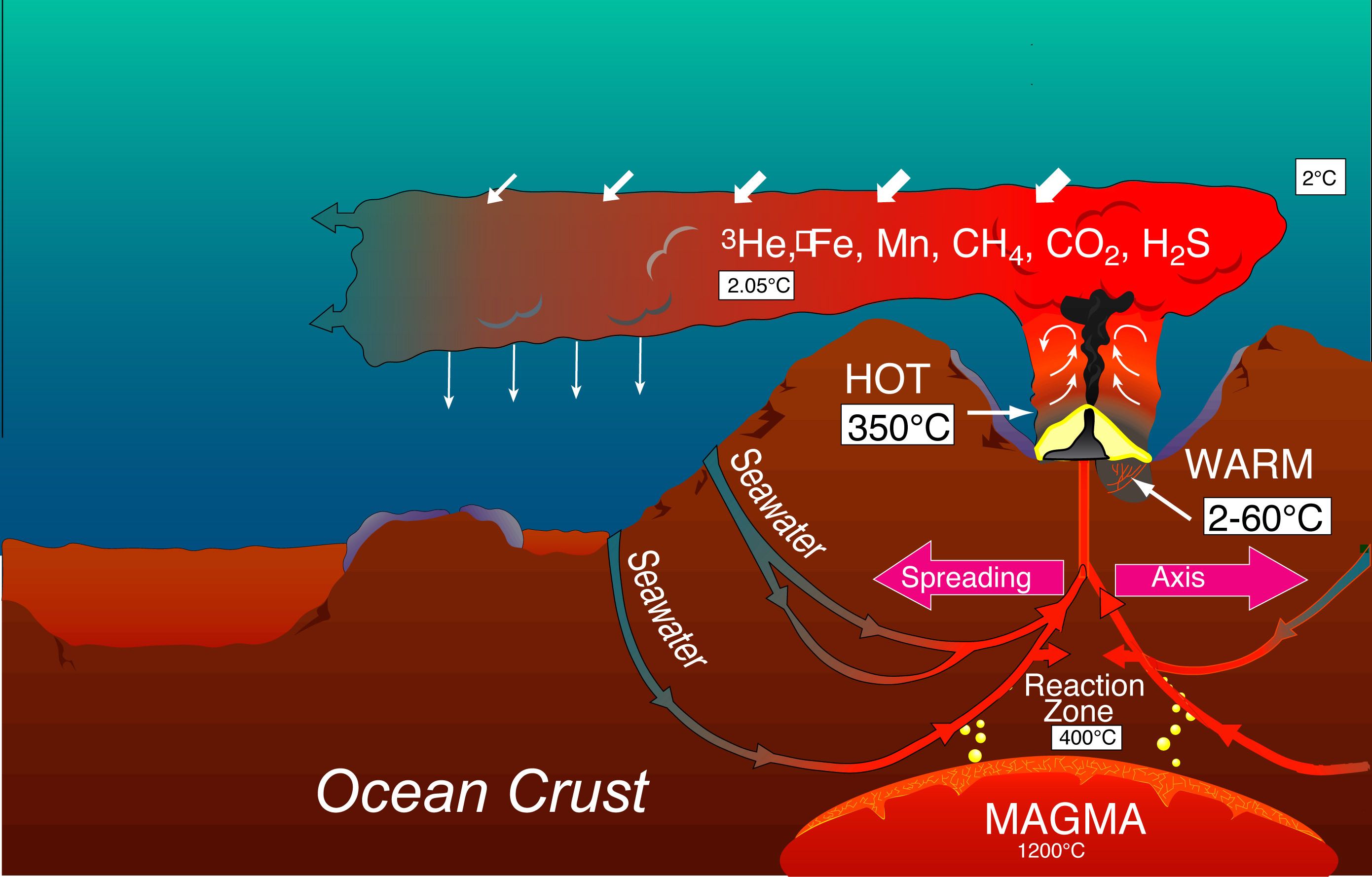
Cold seawater in deep cracks is heated by cooling magma, becomes buoyant, and rises to the seafloor. Instead of forming a warm pond, as at Yellowstone, the hot fluid rises like a hot-air balloon into the cold ocean, cooling as it mixes with the frigid seawater. Mixing continuously dilutes the hot discharge and increases its volume as it rises, until the hydrothermal plume achieves neutral buoyancy and is dispersed by the local currents. This hydrothermal circulation pattern occurs wherever seafloor cracks can channel seawater to layers of hot rock.
First You Need a Good Map
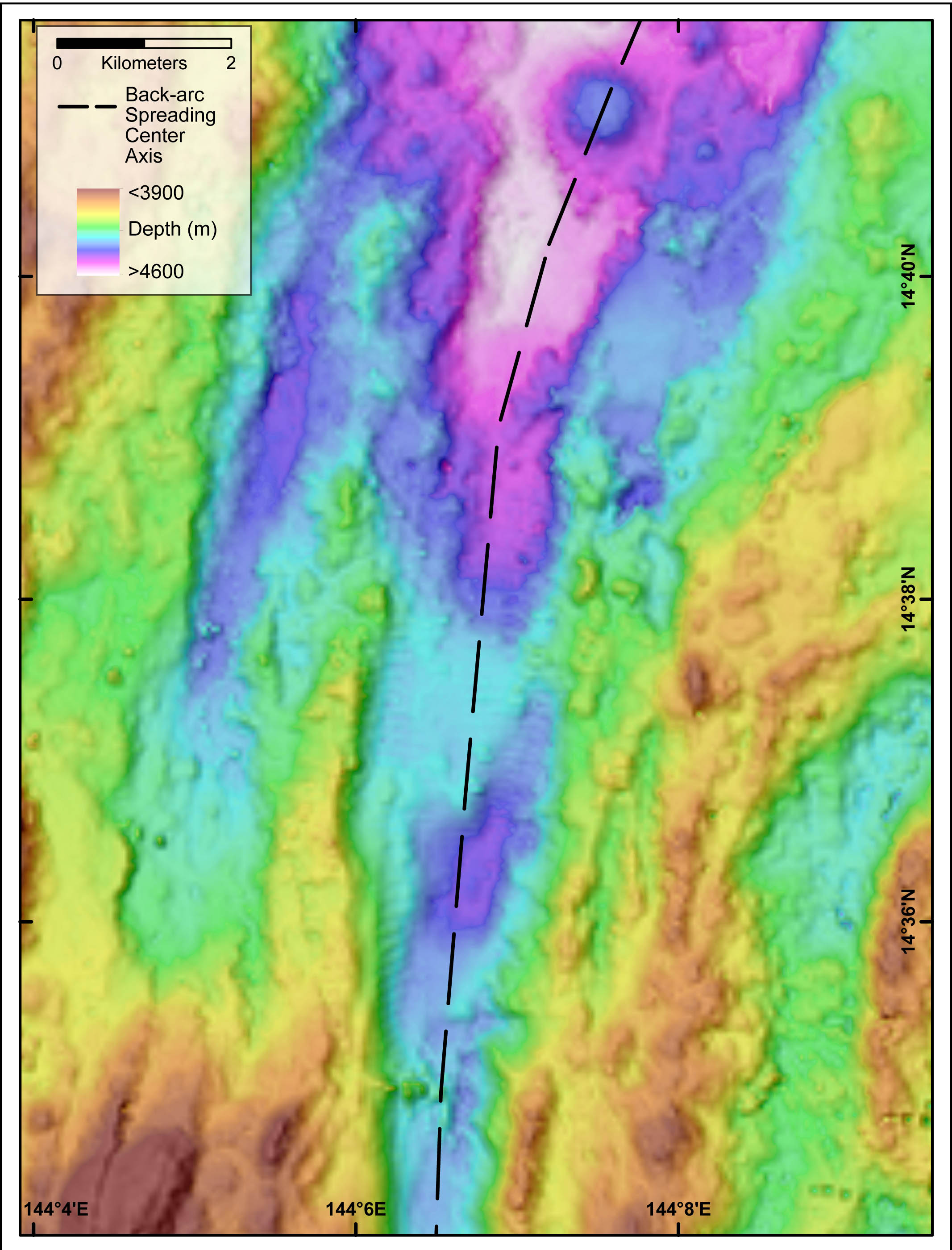
Our task on the R/V Falkor is to hunt down where these sites lie along the Mariana Back-arc (see previous blog). No search can begin without detailed bathymetric maps that precisely define the shape of the seafloor. Seafloor bathymetry provides a roadmap that greatly narrows our search by identifying the path along the seafloor where the most recent seafloor spreading is occurring. On the Mariana Back-arc, seafloor spreading has created a broad valley whose size rivals the Grand Canyon. It is here where deep, still-molten magma may be powering active vents.
Hunting for Plumes
Our search is challenging because the active discharge orifices themselves are small, scattered, and difficult to find. We greatly enhance the chance of success by searching first for the telltale plumes the vents emit, and not the vents themselves. As a trail of wind-blown smoke draws the eye to a smokestack, oceanographers use maps of hydrothermal plume tracers that lead back towards a field of vents. The tracers can be physical measurements such as changes in temperature, salinity, and turbidity of the water. Chemical characteristics of the plume are also used, including various trace metals and gases common in a hydrothermal discharge.
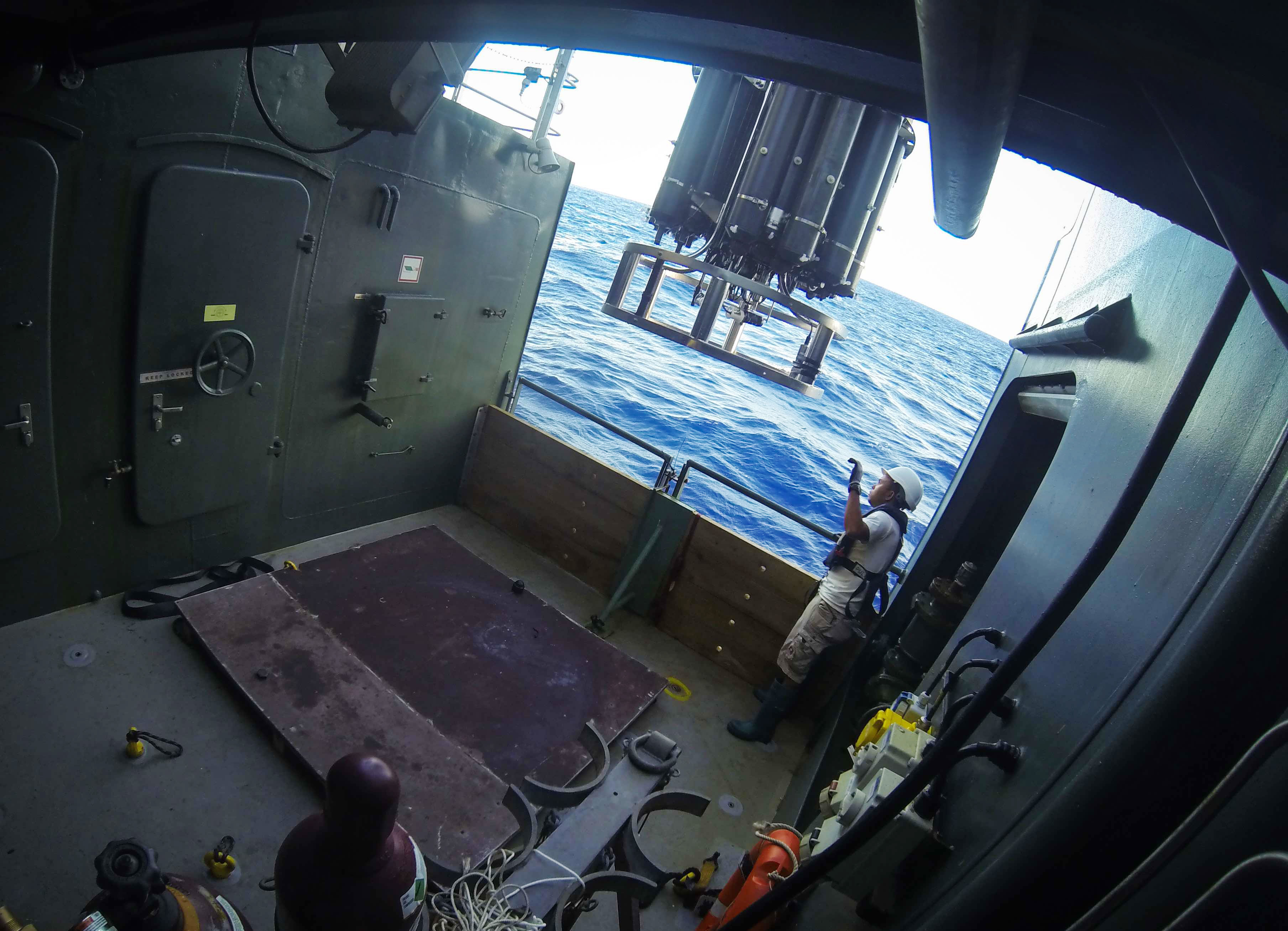
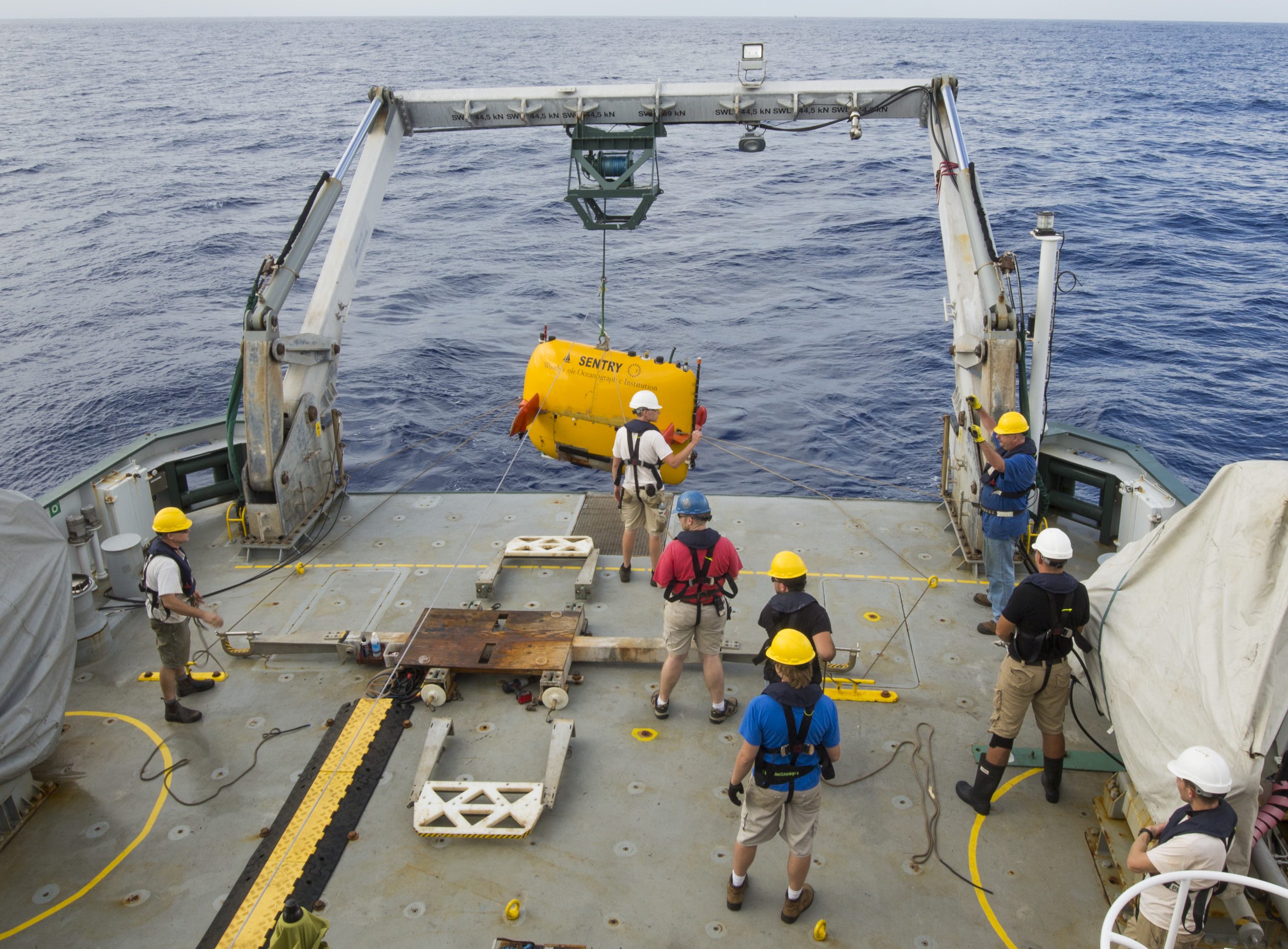
To map these plumes we have two powerful tools. A basic instrument, used by oceanographers around the world, consists of a Conductivity-Temperature-Depth (CTD) package with specialized sensors to detect specific tracers, and bottles to collect samples. We tow the CTD behind the ship, a few hundred meters above the seafloor, as we slowly steam along the spreading center path, creating a map of likely vent locations. To precisely locate the vents themselves, we next deploy a better bloodhound. Sentry is a robot submarine, or Autonomous Underwater Vehicle (AUV), that can navigate precise grids over the seafloor, sniffing out the source of a hydrothermal plume. Ultimately, Sentry flies closer to the seafloor, making high-resolution sonar maps or capturing images of animal life and the hot springs themselves.
 A year from now, when we return on the R/V Falkor with a seafloor-sampling vehicle, we will have detailed information on the location and characteristics of a suite of vent sites. Explorers now, we will next year spend our time on diligent investigations of the chemical, biological, and geological marvels of hydrothermal oases along the Mariana Back-arc.