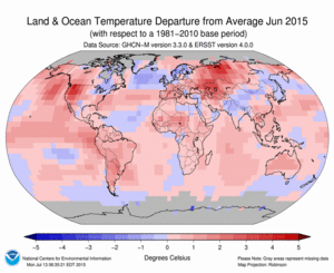
2015 has been a record breaker. Global average land and ocean surface temperatures for June were the highest in the 136-year instrumental record (NOAA National Center for Data Info). At 0.88°C (1.58°F) above the 20th century average, the Earth is surpassing previous records set just one year ago (NOAA National Center for Data Info). A primary reason for these record-breaking temperatures is the El Niño event currently developing in the tropical Pacific. These events can lead to massive shifts in the circulation of our atmosphere and oceans that affect temperature and precipitation patterns across the globe. With preliminary observations of El Niño conditions already underway, headlines such as “How much worse” and “Biggest El Niño Yet” are surfacing all over the web. But what goes into these predictions, and what do they all really mean?
False start
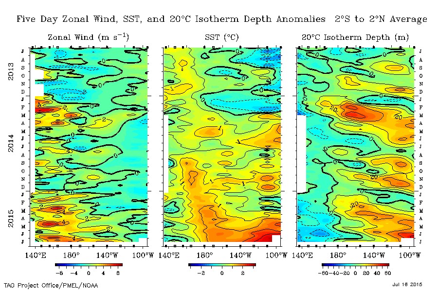
This time last year, nearly everyone was predicting fully developed El Niño conditions by the end of winter. To the surprise of many, that event appeared to fizzle out. Data recently released by the International Research Institute for Climate and Society, however, show that the El Nino did not die, but may have merely been in hibernation. Sea surface temperatures in the central and eastern tropical Pacific have already risen well above normal.
El Niño is a natural phenomenon that is generated by an interaction between the atmosphere and ocean in the tropical Pacific. Warm ocean waters in the tropical Western Pacific spread into the central Pacific taking atmospheric convection (and associated rain) with them. The easterly trade winds slacken and sometimes reverse reducing the amount of nutrient rich water that is brought to the surface in the east.
Warm water is an important ingredient, but what really ignites an El Niño event – and what was missing from last year’s conditions? One difference from last year is the occurrence of a series of strong westerly wind events in the first half of the year over the western equatorial Pacific. These wind events may well have been the trigger that started this year’s El Niño.
The last large El Niño event occurred during 1997-1998, and caused massive drought conditions in places like Indonesia and floods in California. Current conditions show a warming Pacific Ocean, and the NOAA Climate Prediction Center expects a greater than 90% chance that El Niño will continue through the winter. It is important to remember though, that these models are just a prediction, and are susceptible to change. In March forecasters were unsure about El Niño this year, but as characteristic features of an event get stronger, prediction becomes a lot easier. The other important factor to remember is that not all El Niño’s are created the same, and can easily be influenced by other climatic states.
As luck would have it
Dr. Kelvin Richards from the University of Hawaii, had no idea two years ago when he submitted a research proposal to Schmidt Ocean Institute that he would be sailing during one of the most anticipated El Niño events. Dr. Richards is looking at small scale mixing with the goal of better understanding how this activity effects larger ocean processes like El Niño.
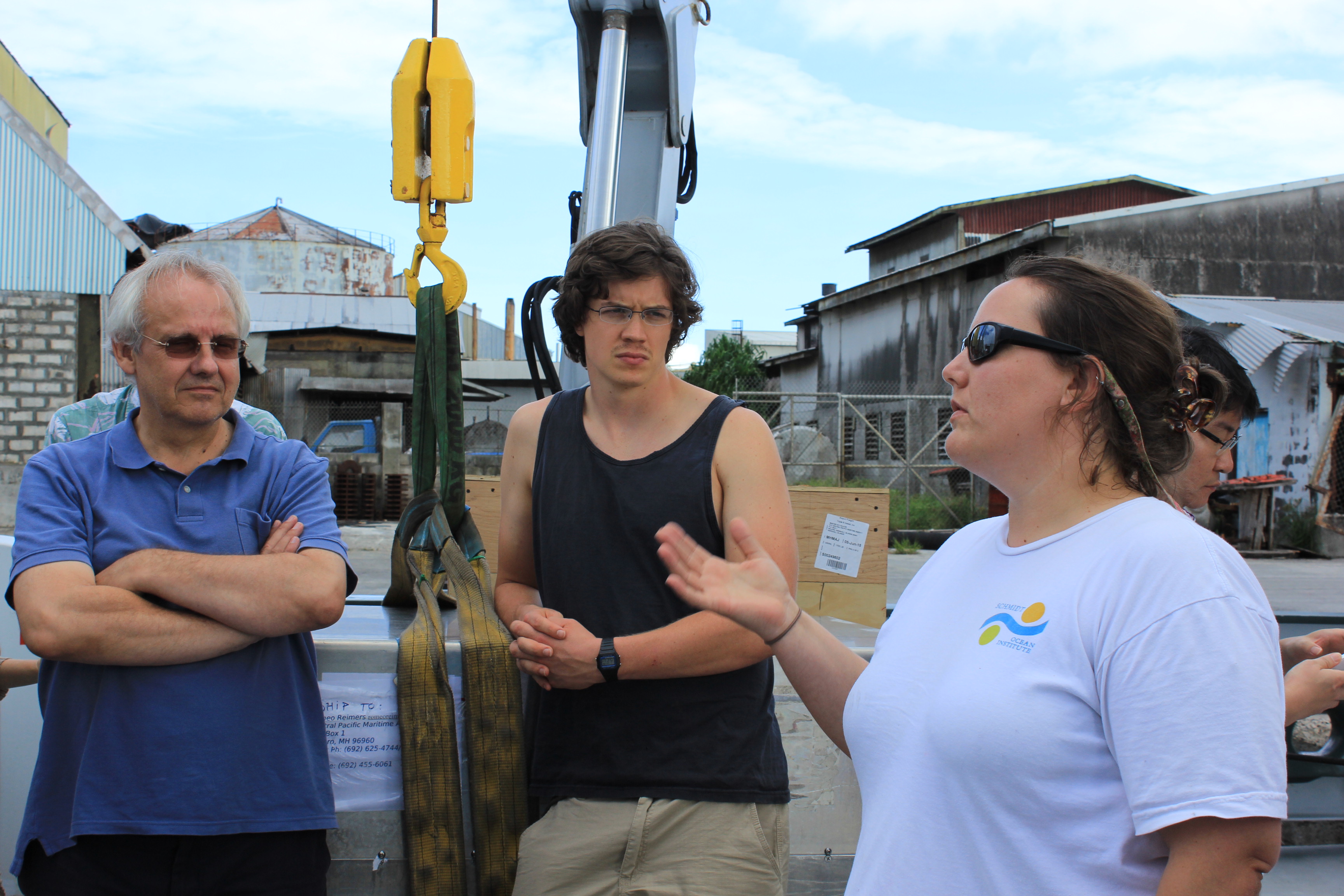
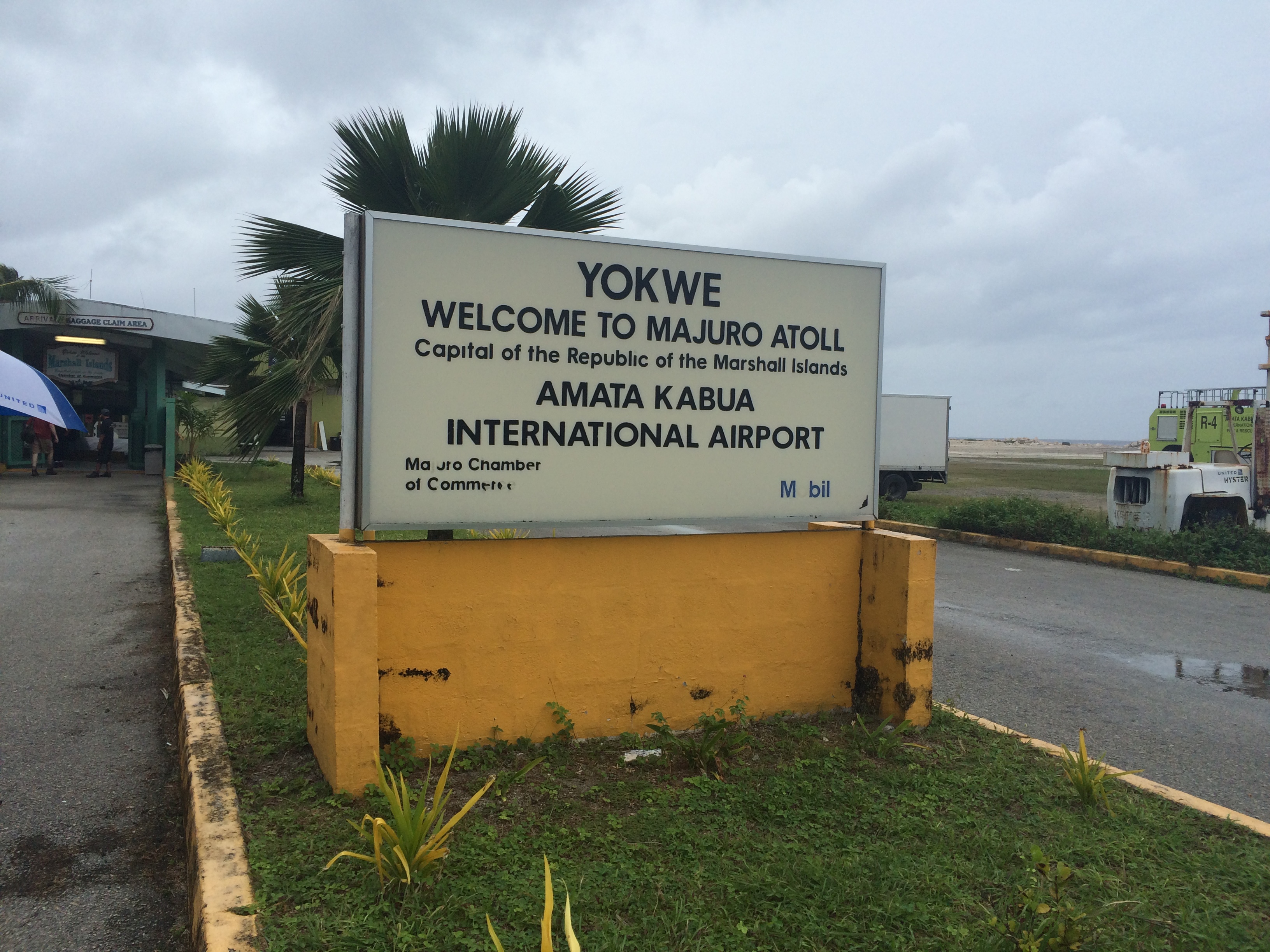
The science team is currently trickling onto research vessel Falkor this week, and after mobilization in Majuro, Marshall Islands, the ship will begin to transit to the equator where the real science will begin. Richards will measure small scale currents and the associated mixing with an Acoustic Doppler Current Profiler (ADCP) and Vertical Microstructure Profiler (VMP). The ADCP will be used to measure the vertical sheer in the upper ocean currents while the VMP will record ocean turbulence. “Water and air are amazing.” said chief scientist Kelvin Richards. “Under the right conditions their flow goes unstable and this instability causes turbulent mixing of properties such as ocean heat and salt.”
Dr. Richards and his team have conducted this work before further in the western Pacific. They hope that by repeating their observations further to the east they will see similar small-scale mixing trends related to the developing El Nino-like conditions. Ideally, these observations will improve how these processes are represented in climate models, which will increase the accuracy of predictions. Until then, it is an exciting and fortunate time to be out collecting data.