The time has finally come to start our exploration of Perth Canyon and so we left dock early this morning to get a first glimpse of what lies ahead. However, as mentioned in a previous post, not everything always goes according to plan – and in our case we are still missing one part for the ROV. This means that we are not able to do our first ROV dive today, but instead, complete some high-resolution mapping of the Canyon, and test the other equipment essential to our mission.
Deep CTD Cast
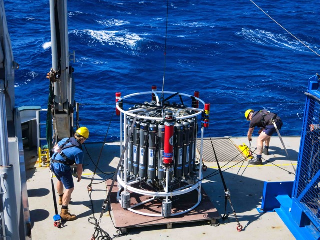
In order to understand which animals can live in the Perth Canyon, it is critical to measure the physical and chemical properties of the water column, such as temperature, salinity, oxygen and carbonate chemistry. The latter is particularly important for calcifying marine organisms such as corals and clams because it determines how easily these organisms can build their calcium carbonate skeletons and shells. One of the most important instruments for obtaining these data is the CTD. CTD stands for Conductivity (which allows us to calculate salinity), Temperature, and Depth (of the ocean). In addition to the CTD, an oxygen sensor, a fluorometer, and an array of 24 niskin seawater sampling bottles are mounted onto a metal frame, called a rosette, which we lower down to measure seawater parameters and collect water samples at different depths. Each CTD drop and retrieval is called a cast and takes ~one hour. These are scheduled twice per day – once in the morning and once in the late afternoon. This afternoon, we completed our first successful test cast of the CTD down to 1000 metres in the Perth Canyon.
Multi-beam Sonar
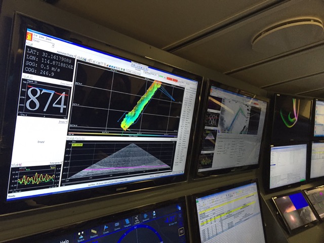
Another important goal of our Perth Canyon exploration is to provide high-resolution bathymetric maps of the canyon. For this purpose,Falkor is equipped with two multi-beam sonars. Since the sonars require Falkor to steam around the areas to be mapped, the mapping cannot be done while the ROV is out for a dive and therefore has to be conducted at night. Both science and crew team members will take turns throughout the night to do ‘shifts’ watching the sonar scans, keeping them operational, and making sure everything stays on track. The bathymetric map of the canyon will be used for selecting precise locations for the ROV dives to collect the deep-sea corals and other specimens. So far, we have mapped a good section of the lower shoreward section of the Perth Canyon, as shown in the image.
Early tomorrow morning, we will head back to Rottnest Island to retrieve the missing ROV part and then hopefully nothing will stand in our way for a successful first dive. Fingers crossed!